The Han River
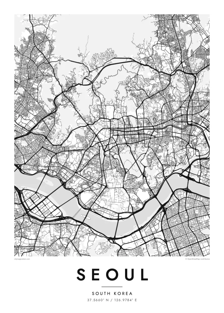
A wide river running across the full width of the city, crossed by a long sequence of bridges. It divides the map into two clear halves and gives the poster its main horizontal line.
Posta faʻafanua faigofie · South Korea
37.5660° N / 126.9784° E
A mountain-ringed capital divided by the broad Han River, crossed by dozens of bridges from north to south



Tasi le aai, lagona e lima
Tapi se sitaili e vaai ai i luga o le puipui. E tutusa uma le tau o sitaili — pe lolomiina, faapipiiina, pe avea ma faila HD.
 Pika Moni · Faila Lolomi 24 × 36″
Manino mo le lolomi
O se vaega atoa (100%) lenei mai le faila lolomi moni. O posita uma — pe lolomiina, faapipiiina pe download mai — e faia i luga o a matou server i le 300 DPI, e oo atu i le 7,200 × 10,800 pika, ina ia manino pea auala laiti i luga o se lolomiga 24 × 36″.
I luga o le puipui


Le faʻafanua
Seoul is organised by mountains and a river. The Han River crosses the city from east to west in a wide, gentle curve, dividing it into a northern and a southern half connected by more than two dozen bridges. Around the edges, ridges such as Bukhansan in the north and Gwanaksan in the south enclose the basin, and Namsan rises in the middle of the city.
North of the river, the old walled capital lies between Bugaksan and Namsan, with the palaces of Gyeongbokgung and Changdeokgung and the restored Cheonggyecheon stream running east through the centre. South of the river, Gangnam and its neighbours were developed from the 1970s on a far more regular grid of wide avenues and large blocks. Yeouido, an island in the Han, holds the National Assembly and a cluster of towers.
Sections of the Joseon-era city wall still run along the ridges around the old centre, and Changdeokgung Palace is a UNESCO World Heritage Site. Seoul hosted the Summer Olympics in 1988. A Seoul map poster shows how the city has fitted itself between mountains and river, with palace quarters and newer grids on either side of the Han.
A wide river running across the full width of the city, crossed by a long sequence of bridges. It divides the map into two clear halves and gives the poster its main horizontal line.
A flat island in the Han, home to the National Assembly, financial towers and riverside parks. Its compact, elongated shape stands out clearly in the middle of the river.
Namsan, topped by N Seoul Tower, rises as an open wooded mass south of the palace district, while the old walled city fills the valley between it and the northern ridges.
Fai mo oe
Faʻaopoopo se aso, se igoa po o sau lava upu, sui le sitaili, lapoʻa po o le itu.
O le preview e leai se totogi e maualalo le resolution ma iai se watermark. O lolomi ma faila HD e faia i le 300 DPI, e oo atu i le 7,200 × 10,800 px, e aunoa ma se watermark.
Aisea Seoul
Seoul suits people who have lived on one side of the Han and crossed it every day, as well as travellers who remember the view from Namsan. The river and mountains give the map a balanced, spacious composition that sits comfortably in almost any room.
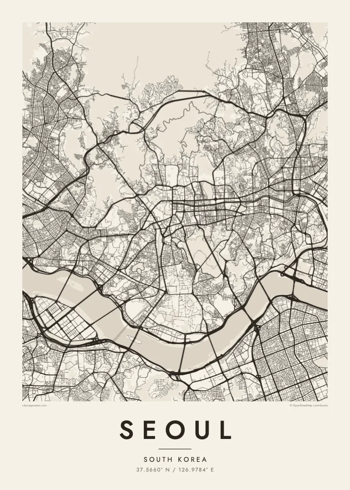
Personalise the title and subtitle with a district, a name or a date, and edit the coordinates line to mark a precise place. The poster is available in Classic black & white, Noir, Paper, Blueprint and Sand, as digital files or printed and framed.
Faatau le posita Seoul| Lapoʻa lolomi | Manino | Faila |
|---|---|---|
| 30 × 40 cm11.8 × 15.7″ | 3,543 × 4,724 px | PNG · PDF |
| 29.7 × 42 cm (A3)11.7 × 16.5″ | 3,508 × 4,961 px | PNG · PDF |
| 42 × 59.4 cm (A2)16.5 × 23.4″ | 4,961 × 7,016 px | PNG · PDF |
| 45.7 × 61 cm18 × 24″ | 5,400 × 7,200 px | PNG · PDF |
| 50 × 70 cm19.7 × 27.6″ | 5,906 × 8,268 px | PNG · PDF |
| 61 × 91.4 cm24 × 36″ | 7,200 × 10,800 px | PNG · PDF |
Ae faʻatusatusa, o le faʻataʻitaʻiga e leai se totogi e 900 px le lautele, e iai le faʻailoga vai ma e mo mata. O faila HD e oʻo atu i le 8× le manino i itu taʻitasi ma e lolomi manino i le lapoʻa atoa o le posta.
Filifili se sitaili i le pito i luga o le itulau, ona filifili lea o le Posita Lolomi — se lapopoa ma, afai e te fiafia, se faavaa — po o Faila HD Numera. E na o le tasi laasaga o le Checkout, ma o le a fesuia'i lou itulau o oka i le taimi lava e mae'a ai le totogi.
E lolomiina i luga o pepa matte maualuga le tulaga e 200 gsm, i se tasi o lapopoa e ono, mai le 30 × 40 cm i le 24 × 36″. E amata le tau o posita lolomi mai le $39, aofia ai le auina atu.
Ioe. Filifili se faavaa laau malosi i le lanu uliuli, sina, oak masani, po o le laau pogisa. E aofia ai se tioata e le gau ma ua saunia e tautau i luga. E amata le tau o posita faavaa mai le $99, aofia ai le auina atu.
E leai se totogi o le auina atu i atunuu e 60+. O pepa ata taʻitasi e lolomiina e le tasi o matou paaga lolomi e latalata mai i atunuu e 30+, ma e masani ona taunuu i le 3–7 aso faigaluega. E mafai ona e mulimulitaia le tulaga ma le sailiga i lalo o My Orders. O nisi atunuu e 2–5 vaiaso, ma i nofoaga e lei matou auina atu iai, e taʻu atu e le saite ia te oe a o lei totogi.
Auina mai se ata i totonu o le 14 aso talu ona taunuu, ma o le a matou toe lolomiina e leai se totogi po o le toe faafoi atu lau tupe.
Ioe. I totonu o le editor i lenei itulau, suia le ulutala, le ulutala laititi ma le laina o coordinates i soo se mea e te fiafia i ai, ma filifili se sitaili ma le lapopoa. O oka lolomi, faavaa ma numera e faaaoga uma lava lau mamanu.
Mo le $9 e te maua ai faila PNG 300 DPI ma PDF ua saunia mo le lolomi i lapopoa uma e ono, e aunoa ma se watermark, e mafai ona lolomi i soo se mea. Le mautinoa lava? Download muamua se preview e leai se totogi ma le watermark.
