Kansas River bend
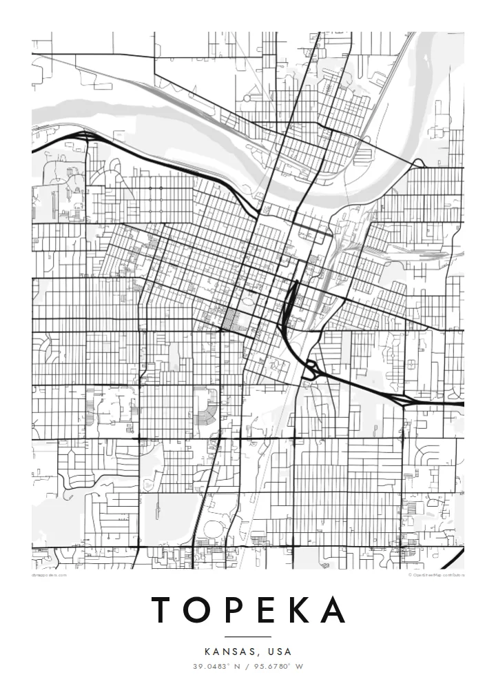
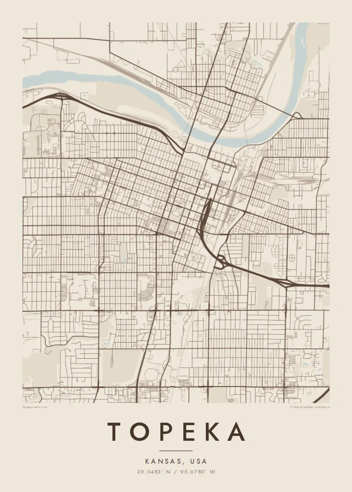
The river forms the northern boundary of the older city. Its wide, slow curves are the only real break in the otherwise regular street pattern, and it frames the downtown blocks on the map.
Posta faʻafanua faigofie · United States
39.0483° N / 95.6780° W
A prairie capital laid out on a tidy grid, with the Kansas River curving along its northern edge


Tasi le aai, lagona e lima
Tapi se sitaili e vaai ai i luga o le puipui. E tutusa uma le tau o sitaili — pe lolomiina, faapipiiina, pe avea ma faila HD.
 Pika Moni · Faila Lolomi 24 × 36″
Manino mo le lolomi
O se vaega atoa (100%) lenei mai le faila lolomi moni. O posita uma — pe lolomiina, faapipiiina pe download mai — e faia i luga o a matou server i le 300 DPI, e oo atu i le 7,200 × 10,800 pika, ina ia manino pea auala laiti i luga o se lolomiga 24 × 36″.
I luga o le puipui


Le faʻafanua
Seen from above, Topeka is a city of right angles. Numbered and named streets run in a steady grid south of the Kansas River, which bends lazily along the top of the map. Downtown sits close to the water, and the blocks spread out south and west into quieter residential streets. Interstate 70 cuts across the whole pattern and loops around the centre before heading out across the plains.
Topeka is the capital of Kansas, and the domed State Capitol stands at the heart of the downtown grid. The city is also known for Brown v. Board of Education, the 1954 Supreme Court case that began with local families. The former Monroe Elementary School is now a national historical park, marked on the map as a small block among ordinary streets.
A Topeka map poster shows how a planned Midwestern capital meets its river. The north bank looks looser and more rural, and the south side is denser and more regular. Washburn University's campus makes a clear rectangle to the southwest. To the southeast, Lake Shawnee shows up as an irregular shape of open water, a contrast to the straight lines around it.
The river forms the northern boundary of the older city. Its wide, slow curves are the only real break in the otherwise regular street pattern, and it frames the downtown blocks on the map.
The State Capitol occupies its own green square in the middle of downtown. Streets on all four sides line up with it, so the building works as a quiet anchor for the grid.
In the southeast, a reservoir surrounded by parkland adds a patch of irregular shoreline. It is the largest body of open water inside the city's footprint and is easy to pick out in any style.
Fai mo oe
Faʻaopoopo se aso, se igoa po o sau lava upu, sui le sitaili, lapoʻa po o le itu.
O le preview e leai se totogi e maualalo le resolution ma iai se watermark. O lolomi ma faila HD e faia i le 300 DPI, e oo atu i le 7,200 × 10,800 px, e aunoa ma se watermark.
Aisea Topeka
People who grew up in Topeka, studied at Washburn or worked in state government often want the city's plain, orderly grid on the wall. It is an understated print that still shows the river, the Capitol and the neighbourhoods clearly.
You can personalise the title, subtitle and coordinates line, for example with a family name or a year you moved. Choose from five styles: Classic black & white, Noir, Paper, Blueprint and Sand. The HD file costs $9, or you can order a matte print, framed if you like.
Faatau le posita Topeka| Lapoʻa lolomi | Manino | Faila |
|---|---|---|
| 30 × 40 cm (11.8 × 15.7″) | 3,543 × 4,724 px | PNG · PDF |
| 29.7 × 42 cm (A3, 11.7 × 16.5″) | 3,508 × 4,961 px | PNG · PDF |
| 42 × 59.4 cm (A2, 16.5 × 23.4″) | 4,961 × 7,016 px | PNG · PDF |
| 45.7 × 61 cm (18 × 24″) | 5,400 × 7,200 px | PNG · PDF |
| 50 × 70 cm (19.7 × 27.6″) | 5,906 × 8,268 px | PNG · PDF |
| 61 × 91.4 cm (24 × 36″) | 7,200 × 10,800 px | PNG · PDF |
Ae faʻatusatusa, o le faʻataʻitaʻiga e leai se totogi e 900 px le lautele, e iai le faʻailoga vai ma e mo mata. O faila HD e oʻo atu i le 8× le manino i itu taʻitasi ma e lolomi manino i le lapoʻa atoa o le posta.
Filifili se sitaili i le pito i luga o le itulau, ona filifili lea o le Posita Lolomi — se lapopoa ma, afai e te fiafia, se faavaa — po o Faila HD Numera. E na o le tasi laasaga o le Checkout, ma o le a fesuia'i lou itulau o oka i le taimi lava e mae'a ai le totogi.
E lolomiina i luga o pepa matte maualuga le tulaga e 200 gsm, i se tasi o lapopoa e ono, mai le 30 × 40 cm i le 24 × 36″. E amata le tau o posita lolomi mai le $39, aofia ai le auina atu.
Ioe. Filifili se faavaa laau malosi i le lanu uliuli, sina, oak masani, po o le laau pogisa. E aofia ai se tioata e le gau ma ua saunia e tautau i luga. E amata le tau o posita faavaa mai le $99, aofia ai le auina atu.
E leai se totogi mo le uta i le lalolagi atoa. O poster ta'itasi e lolomi e le paaga lolomi e latalata mai i matou i atunuu e 30+, ma e masani ona taunuu i aso faigaluega e 3–7. E mafai ona e mulimuli i le tulaga ma le tracking i le "Aʻu Oka". O nisi atunuu e 2–5 vaiaso, ma i atunuu matou te lei tuuina atu ai, e taʻu atu e le saite iā te oe ae e te leʻi totogiina.
Auina mai se ata i totonu o le 14 aso talu ona taunuu, ma o le a matou toe lolomiina e leai se totogi po o le toe faafoi atu lau tupe.
Ioe. I totonu o le editor i lenei itulau, suia le ulutala, le ulutala laititi ma le laina o coordinates i soo se mea e te fiafia i ai, ma filifili se sitaili ma le lapopoa. O oka lolomi, faavaa ma numera e faaaoga uma lava lau mamanu.
Mo le $9 e te maua ai faila PNG 300 DPI ma PDF ua saunia mo le lolomi i lapopoa uma e ono, e aunoa ma se watermark, e mafai ona lolomi i soo se mea. Le mautinoa lava? Download muamua se preview e leai se totogi ma le watermark.
