Okozu diversion channel
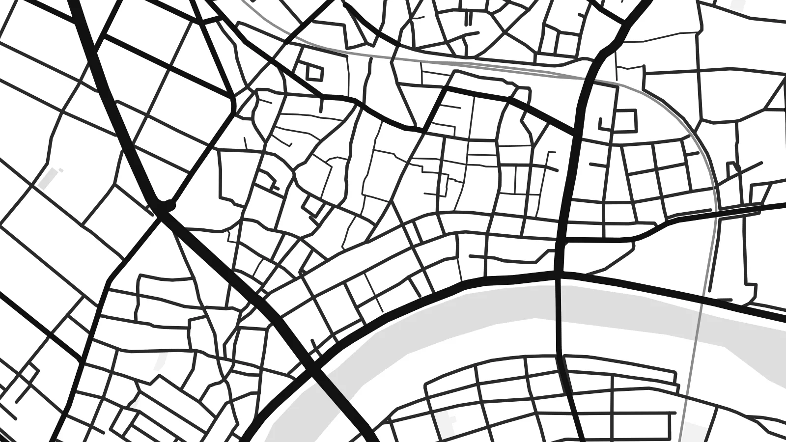
In the Bunsui district a large channel leaves the Shinano River and heads towards the Sea of Japan. It was built in the early twentieth century to control flooding on the plain, and it cuts a bold diagonal across the map.
Posta faʻafanua faigofie · Japan
37.6645° N / 138.9252° E
A flat grid of streets and paddies on the Echigo Plain, bounded by the Shinano River and cut through by a great diversion channel


Tasi le aai, lagona e lima
Tapi se sitaili e vaai ai i luga o le puipui. E tutusa uma le tau o sitaili — pe lolomiina, faapipiiina, pe avea ma faila HD.
 Pika Moni · Faila Lolomi 24 × 36″
Manino mo le lolomi
O se vaega atoa (100%) lenei mai le faila lolomi moni. O posita uma — pe lolomiina, faapipiiina pe download mai — e faia i luga o a matou server i le 300 DPI, e oo atu i le 7,200 × 10,800 pika, ina ia manino pea auala laiti i luga o se lolomiga 24 × 36″.
I luga o le puipui


Le faʻafanua
Seen from above, Tsubame sits on the wide, level ground of the Echigo Plain in Niigata Prefecture. The Shinano River, Japan's longest, runs along its edge, and smaller waterways cross the plain beside it. The built-up centre has a fairly tight grain of streets. Beyond it the pattern opens into long rectangular rice fields, so the map moves from dense linework to a quieter geometry of field boundaries and farm roads.
The city in its current form dates from 2006, when Tsubame merged with the neighbouring towns of Yoshida and Bunsui. On the map this shows as more than one cluster of streets, joined by roads and railway lines across open farmland. The Joetsu Shinkansen passes nearby, with Tsubame-Sanjo Station close to the boundary with Sanjo. A Tsubame map poster shows how these separate settlements fit together on the plain.
Tsubame is best known for metalworking. Nail-making began here centuries ago and later gave way to copperware. Today the city is one of Japan's main centres for stainless-steel cutlery and tableware. Workshops and small factories sit among the houses, though the map shows none of that directly. It records the setting instead: flat ground, reliable water and routes to the rest of the country, which helped a local craft grow into an industry.
In the Bunsui district a large channel leaves the Shinano River and heads towards the Sea of Japan. It was built in the early twentieth century to control flooding on the plain, and it cuts a bold diagonal across the map.
The broad river curves along the city's edge, with embankments and wide floodplain on either side. In black and white it forms the main natural line on the poster, and the street pattern is set against it.
Around the urban areas, rice fields divide the land into long regular plots with straight farm roads between them. The result is a calm, almost woven texture that sets off the denser streets of the town centres.
Fai mo oe
Faʻaopoopo se aso, se igoa po o sau lava upu, sui le sitaili, lapoʻa po o le itu.
O le preview e leai se totogi e maualalo le resolution ma iai se watermark. O lolomi ma faila HD e faia i le 300 DPI, e oo atu i le 7,200 × 10,800 px, e aunoa ma se watermark.
Aisea Tsubame
For people from Tsubame, or anyone who owns a set of its cutlery, this map is a quiet reminder of a place that makes useful things. The river, the channel and the fields give it a clear structure, and it looks good in a kitchen, a workshop or a study.
You can personalise the title, subtitle and coordinates line to mark a hometown, a factory visit or a family date. There are five styles: Classic black and white, Noir, Paper, Blueprint or Sand. You can buy HD digital files for $9, or order a matte print with an optional wooden frame.
Faatau le posita Tsubame| Lapoʻa lolomi | Manino | Faila |
|---|---|---|
| 30 × 40 cm11.8 × 15.7″ | 3,543 × 4,724 px | PNG · PDF |
| 29.7 × 42 cm (A3)11.7 × 16.5″ | 3,508 × 4,961 px | PNG · PDF |
| 42 × 59.4 cm (A2)16.5 × 23.4″ | 4,961 × 7,016 px | PNG · PDF |
| 45.7 × 61 cm18 × 24″ | 5,400 × 7,200 px | PNG · PDF |
| 50 × 70 cm19.7 × 27.6″ | 5,906 × 8,268 px | PNG · PDF |
| 61 × 91.4 cm24 × 36″ | 7,200 × 10,800 px | PNG · PDF |
Ae faʻatusatusa, o le faʻataʻitaʻiga e leai se totogi e 900 px le lautele, e iai le faʻailoga vai ma e mo mata. O faila HD e oʻo atu i le 8× le manino i itu taʻitasi ma e lolomi manino i le lapoʻa atoa o le posta.
Filifili se sitaili i le pito i luga o le itulau, ona filifili lea o le Posita Lolomi — se lapopoa ma, afai e te fiafia, se faavaa — po o Faila HD Numera. E na o le tasi laasaga o le Checkout, ma o le a fesuia'i lou itulau o oka i le taimi lava e mae'a ai le totogi.
E lolomiina i luga o pepa matte maualuga le tulaga e 200 gsm, i se tasi o lapopoa e ono, mai le 30 × 40 cm i le 24 × 36″. E amata le tau o posita lolomi mai le $39, aofia ai le auina atu.
Ioe. Filifili se faavaa laau malosi i le lanu uliuli, sina, oak masani, po o le laau pogisa. E aofia ai se tioata e le gau ma ua saunia e tautau i luga. E amata le tau o posita faavaa mai le $99, aofia ai le auina atu.
E leai se totogi o le auina atu i atunuu e 60+. O pepa ata taʻitasi e lolomiina e le tasi o matou paaga lolomi e latalata mai i atunuu e 30+, ma e masani ona taunuu i le 3–7 aso faigaluega. E mafai ona e mulimulitaia le tulaga ma le sailiga i lalo o My Orders. O nisi atunuu e 2–5 vaiaso, ma i nofoaga e lei matou auina atu iai, e taʻu atu e le saite ia te oe a o lei totogi.
Auina mai se ata i totonu o le 14 aso talu ona taunuu, ma o le a matou toe lolomiina e leai se totogi po o le toe faafoi atu lau tupe.
Ioe. I totonu o le editor i lenei itulau, suia le ulutala, le ulutala laititi ma le laina o coordinates i soo se mea e te fiafia i ai, ma filifili se sitaili ma le lapopoa. O oka lolomi, faavaa ma numera e faaaoga uma lava lau mamanu.
Mo le $9 e te maua ai faila PNG 300 DPI ma PDF ua saunia mo le lolomi i lapopoa uma e ono, e aunoa ma se watermark, e mafai ona lolomi i soo se mea. Le mautinoa lava? Download muamua se preview e leai se totogi ma le watermark.
