Nile's east bank
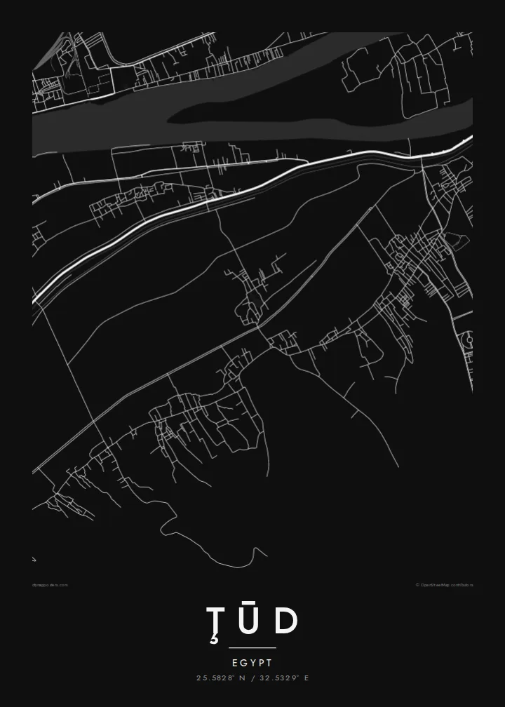
The river runs close to the west of the town, a wide pale band that separates Ţūd from Armant and anchors the whole composition.
Posta faʻafanua faigofie · Egypt
25.5828° N / 32.5329° E
A farming town on the Nile's east bank south of Luxor, between canal-cut fields and the edge of the desert.



Tasi le aai, lagona e lima
Tapi se sitaili e vaai ai i luga o le puipui. E tutusa uma le tau o sitaili — pe lolomiina, faapipiiina, pe avea ma faila HD.
 Pika Moni · Faila Lolomi 24 × 36″
Manino mo le lolomi
O se vaega atoa (100%) lenei mai le faila lolomi moni. O posita uma — pe lolomiina, faapipiiina pe download mai — e faia i luga o a matou server i le 300 DPI, e oo atu i le 7,200 × 10,800 pika, ina ia manino pea auala laiti i luga o se lolomiga 24 × 36″.
I luga o le puipui


Le faʻafanua
Ţūd lies in Luxor Governorate, south of Luxor on the east bank of the Nile, across the river from Armant. On a map it is a dense, irregular cluster of lanes and houses surrounded by a geometric patchwork of fields and irrigation canals. To the east, the cultivated strip ends abruptly at the desert, so the green valley and the dry land meet along a sharp, visible line.
The town is best known to archaeologists for the remains of a temple to Montu, the falcon-headed war god worshipped across the Theban region. In 1936, excavators found the Tod Treasure beneath its foundations. The hoard of silver and other precious objects dates from the Middle Kingdom and is now divided between museums in Cairo and Paris. The ancient site still lies within the modern town.
A Ţūd map poster reads almost like a diagram of Upper Egypt: the river on one side, fields and canals in the middle, desert beyond. The town's winding streets contrast with the straight field boundaries around it. It is an unusual subject that rewards people interested in Egyptology, as well as families who have farmed this stretch of the valley for generations.
The river runs close to the west of the town, a wide pale band that separates Ţūd from Armant and anchors the whole composition.
Irrigation channels and field boundaries form a fine rectangular mesh around the settlement. It contrasts strikingly with the winding lanes of the town itself.
The archaeological area around the Temple of Montu lies within the modern town. It marks a place of worship that goes back to ancient Egypt.
Fai mo oe
Faʻaopoopo se aso, se igoa po o sau lava upu, sui le sitaili, lapoʻa po o le itu.
O le preview e leai se totogi e maualalo le resolution ma iai se watermark. O lolomi ma faila HD e faia i le 300 DPI, e oo atu i le 7,200 × 10,800 px, e aunoa ma se watermark.
Aisea Ţūd
For Egyptology enthusiasts, travellers who explored beyond Luxor's main sites, and families from the area, a map of Ţūd is an understated keepsake. It shows the real structure of the Nile valley without the clichés of desert postcards.
Personalise the title in any spelling you prefer, add a subtitle and the coordinates line, and choose from Classic black & white, Noir, Paper, Blueprint or Sand. Sand is a natural fit here. Download 300 DPI files for $9, or order a printed poster.
Faatau le posita Ţūd| Lapoʻa lolomi | Manino | Faila |
|---|---|---|
| 30 × 40 cm (11.8 × 15.7″) | 3,543 × 4,724 px | PNG · PDF |
| 29.7 × 42 cm (A3, 11.7 × 16.5″) | 3,508 × 4,961 px | PNG · PDF |
| 42 × 59.4 cm (A2, 16.5 × 23.4″) | 4,961 × 7,016 px | PNG · PDF |
| 45.7 × 61 cm (18 × 24″) | 5,400 × 7,200 px | PNG · PDF |
| 50 × 70 cm (19.7 × 27.6″) | 5,906 × 8,268 px | PNG · PDF |
| 61 × 91.4 cm (24 × 36″) | 7,200 × 10,800 px | PNG · PDF |
Ae faʻatusatusa, o le faʻataʻitaʻiga e leai se totogi e 900 px le lautele, e iai le faʻailoga vai ma e mo mata. O faila HD e oʻo atu i le 8× le manino i itu taʻitasi ma e lolomi manino i le lapoʻa atoa o le posta.
Filifili se sitaili i le pito i luga o le itulau, ona filifili lea o le Posita Lolomi — se lapopoa ma, afai e te fiafia, se faavaa — po o Faila HD Numera. E na o le tasi laasaga o le Checkout, ma o le a fesuia'i lou itulau o oka i le taimi lava e mae'a ai le totogi.
E lolomiina i luga o pepa matte maualuga le tulaga e 200 gsm, i se tasi o lapopoa e ono, mai le 30 × 40 cm i le 24 × 36″. E amata le tau o posita lolomi mai le $39, aofia ai le auina atu.
Ioe. Filifili se faavaa laau malosi i le lanu uliuli, sina, oak masani, po o le laau pogisa. E aofia ai se tioata e le gau ma ua saunia e tautau i luga. E amata le tau o posita faavaa mai le $99, aofia ai le auina atu.
E leai se totogi mo le uta i le lalolagi atoa. O poster ta'itasi e lolomi e le paaga lolomi e latalata mai i matou i atunuu e 30+, ma e masani ona taunuu i aso faigaluega e 3–7. E mafai ona e mulimuli i le tulaga ma le tracking i le "Aʻu Oka". O nisi atunuu e 2–5 vaiaso, ma i atunuu matou te lei tuuina atu ai, e taʻu atu e le saite iā te oe ae e te leʻi totogiina.
Auina mai se ata i totonu o le 14 aso talu ona taunuu, ma o le a matou toe lolomiina e leai se totogi po o le toe faafoi atu lau tupe.
Ioe. I totonu o le editor i lenei itulau, suia le ulutala, le ulutala laititi ma le laina o coordinates i soo se mea e te fiafia i ai, ma filifili se sitaili ma le lapopoa. O oka lolomi, faavaa ma numera e faaaoga uma lava lau mamanu.
Mo le $9 e te maua ai faila PNG 300 DPI ma PDF ua saunia mo le lolomi i lapopoa uma e ono, e aunoa ma se watermark, e mafai ona lolomi i soo se mea. Le mautinoa lava? Download muamua se preview e leai se totogi ma le watermark.
Latalata ane
