Irrigation grid
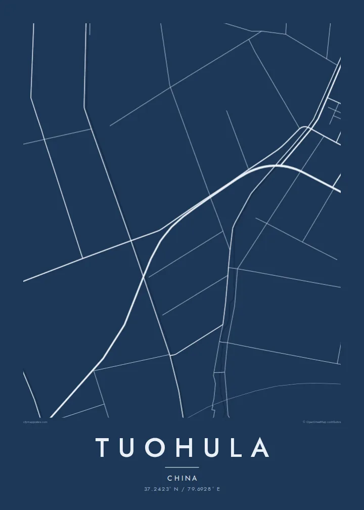
Canals and field roads divide the oasis into long, regular strips, a pattern shaped by water distribution that reads on the poster as a finely ruled geometric surface.
Posta faʻafanua faigofie · China
37.2423° N / 79.6928° E
An oasis settlement on the southern rim of the Taklamakan, drawn in irrigation channels, tree-lined roads and long field strips.



Tasi le aai, lagona e lima
Tapi se sitaili e vaai ai i luga o le puipui. E tutusa uma le tau o sitaili — pe lolomiina, faapipiiina, pe avea ma faila HD.
 Pika Moni · Faila Lolomi 24 × 36″
Manino mo le lolomi
O se vaega atoa (100%) lenei mai le faila lolomi moni. O posita uma — pe lolomiina, faapipiiina pe download mai — e faia i luga o a matou server i le 300 DPI, e oo atu i le 7,200 × 10,800 pika, ina ia manino pea auala laiti i luga o se lolomiga 24 × 36″.
I luga o le puipui


Le faʻafanua
Tuohula lies in the Hotan area of southern Xinjiang, within the band of oases along the northern foot of the Kunlun Mountains, at the edge of the Taklamakan Desert. Life here depends on meltwater rivers coming down from the mountains, and that dependence is written clearly on any map of the place.
Within the oasis, roads, canals and field boundaries form a closely ruled pattern of long rectangles, typically lined with rows of trees that act as windbreaks. Houses string along the roads rather than gathering into one dense centre. Beyond the last irrigated plots the lines stop abruptly, and the map turns to open desert with almost no markings.
A Tuohula map poster is a study in contrast between cultivated order and empty ground. It suits anyone interested in the oases of the Tarim Basin, where settlements have long depended on careful water management. The result is an unusually graphic print in which the edge of the green zone becomes the main subject.
Canals and field roads divide the oasis into long, regular strips, a pattern shaped by water distribution that reads on the poster as a finely ruled geometric surface.
Homes line the roads in continuous ribbons instead of forming a compact town, so the built-up area shows as linear strokes running through the fields.
Where irrigation ends, the map falls almost silent. The sharp boundary between farmed land and the Taklamakan is the most striking line in the composition.
Fai mo oe
Faʻaopoopo se aso, se igoa po o sau lava upu, sui le sitaili, lapoʻa po o le itu.
O le preview e leai se totogi e maualalo le resolution ma iai se watermark. O lolomi ma faila HD e faia i le 300 DPI, e oo atu i le 7,200 × 10,800 px, e aunoa ma se watermark.
Aisea Tuohula
For people from the Hotan region, the pattern of fields and channels around their village is deeply familiar. For others, the map is a striking abstract image of a community holding its ground at the edge of one of the world's great deserts.
Personalise the title, subtitle and coordinates, and pick one of five styles. Sand and Paper suit the desert setting. Digital files cost $9 and cover six print sizes, and printed posters on matte paper ship from partners in more than 30 countries.
Faatau le posita Tuohula| Lapoʻa lolomi | Manino | Faila |
|---|---|---|
| 30 × 40 cm11.8 × 15.7″ | 3,543 × 4,724 px | PNG · PDF |
| 29.7 × 42 cm (A3)11.7 × 16.5″ | 3,508 × 4,961 px | PNG · PDF |
| 42 × 59.4 cm (A2)16.5 × 23.4″ | 4,961 × 7,016 px | PNG · PDF |
| 45.7 × 61 cm18 × 24″ | 5,400 × 7,200 px | PNG · PDF |
| 50 × 70 cm19.7 × 27.6″ | 5,906 × 8,268 px | PNG · PDF |
| 61 × 91.4 cm24 × 36″ | 7,200 × 10,800 px | PNG · PDF |
Ae faʻatusatusa, o le faʻataʻitaʻiga e leai se totogi e 900 px le lautele, e iai le faʻailoga vai ma e mo mata. O faila HD e oʻo atu i le 8× le manino i itu taʻitasi ma e lolomi manino i le lapoʻa atoa o le posta.
Filifili se sitaili i le pito i luga o le itulau, ona filifili lea o le Posita Lolomi — se lapopoa ma, afai e te fiafia, se faavaa — po o Faila HD Numera. E na o le tasi laasaga o le Checkout, ma o le a fesuia'i lou itulau o oka i le taimi lava e mae'a ai le totogi.
E lolomiina i luga o pepa matte maualuga le tulaga e 200 gsm, i se tasi o lapopoa e ono, mai le 30 × 40 cm i le 24 × 36″. E amata le tau o posita lolomi mai le $39, aofia ai le auina atu.
Ioe. Filifili se faavaa laau malosi i le lanu uliuli, sina, oak masani, po o le laau pogisa. E aofia ai se tioata e le gau ma ua saunia e tautau i luga. E amata le tau o posita faavaa mai le $99, aofia ai le auina atu.
E leai se totogi mo le uta i le lalolagi atoa. O poster ta'itasi e lolomi e le paaga lolomi e latalata mai i matou i atunuu e 30+, ma e masani ona taunuu i aso faigaluega e 3–7. E mafai ona e mulimuli i le tulaga ma le tracking i le "Aʻu Oka". O nisi atunuu e 2–5 vaiaso, ma i atunuu matou te lei tuuina atu ai, e taʻu atu e le saite iā te oe ae e te leʻi totogiina.
Auina mai se ata i totonu o le 14 aso talu ona taunuu, ma o le a matou toe lolomiina e leai se totogi po o le toe faafoi atu lau tupe.
Ioe. I totonu o le editor i lenei itulau, suia le ulutala, le ulutala laititi ma le laina o coordinates i soo se mea e te fiafia i ai, ma filifili se sitaili ma le lapopoa. O oka lolomi, faavaa ma numera e faaaoga uma lava lau mamanu.
Mo le $9 e te maua ai faila PNG 300 DPI ma PDF ua saunia mo le lolomi i lapopoa uma e ono, e aunoa ma se watermark, e mafai ona lolomi i soo se mea. Le mautinoa lava? Download muamua se preview e leai se totogi ma le watermark.
Latalata ane
