Misumi West Port
A carefully engineered Meiji-era harbour of cut stone, with canals and quays, lies near the tip of the peninsula. It is one of the few ports of its era to survive largely intact.
Posta faʻafanua faigofie · Japan
32.6222° N / 130.6618° E
A coastal city at the root of the Uto Peninsula, facing two inland seas with a Meiji-era stone port at its western tip.

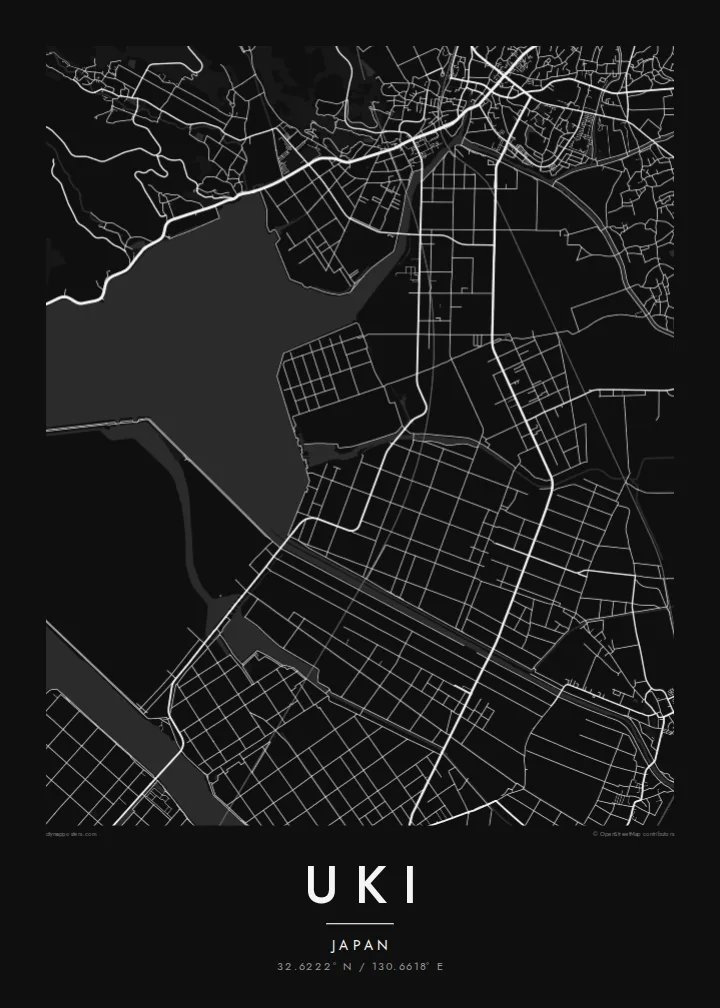


Tasi le aai, lagona e lima
Tapi se sitaili e vaai ai i luga o le puipui. E tutusa uma le tau o sitaili — pe lolomiina, faapipiiina, pe avea ma faila HD.
 Pika Moni · Faila Lolomi 24 × 36″
Manino mo le lolomi
O se vaega atoa (100%) lenei mai le faila lolomi moni. O posita uma — pe lolomiina, faapipiiina pe download mai — e faia i luga o a matou server i le 300 DPI, e oo atu i le 7,200 × 10,800 pika, ina ia manino pea auala laiti i luga o se lolomiga 24 × 36″.
I luga o le puipui


Le faʻafanua
Uki sits in Kumamoto Prefecture at the base of the Uto Peninsula, which reaches west toward the Amakusa islands. On a map the city stretches along the peninsula. The Ariake Sea lies to the north and the Yatsushiro Sea to the south, and small towns and fishing harbours are strung along both shores. Hills run down the centre of the peninsula, with farmland and orchards on their lower slopes.
At the western end lies Misumi West Port, a stone harbour built in the late nineteenth century to Dutch designs. It is now a UNESCO World Heritage site as part of the Sites of Japan's Meiji Industrial Revolution. The Yatsushiro Sea off Uki's coast is also associated with the shiranui, a rare optical phenomenon of flickering lights on the water described in local tradition.
A Uki map poster traces a long, narrow city defined by its shorelines. Coastal roads follow the edge of the land, while a railway runs out along the peninsula toward the port. Smaller settlements appear as clusters where valleys meet the sea. The water surrounding almost every side gives the map a strong, clean silhouette.
A carefully engineered Meiji-era harbour of cut stone, with canals and quays, lies near the tip of the peninsula. It is one of the few ports of its era to survive largely intact.
The Ariake Sea and the Yatsushiro Sea border the city on opposite sides. On the map the peninsula becomes a long strip of land between two open bodies of water.
Hills run along the centre of the peninsula, with roads and small valleys branching toward the coasts. This inland ridge divides the city's northern and southern shores.
Fai mo oe
Faʻaopoopo se aso, se igoa po o sau lava upu, sui le sitaili, lapoʻa po o le itu.
O le preview e leai se totogi e maualalo le resolution ma iai se watermark. O lolomi ma faila HD e faia i le 300 DPI, e oo atu i le 7,200 × 10,800 px, e aunoa ma se watermark.
Aisea Uki
Uki is a place of coastal drives, fishing harbours and evenings looking across the water toward Amakusa. A map of the peninsula keeps that geography in view for residents, for visitors and for anyone with family roots in Kumamoto.
Choose Classic black & white, Noir, Paper, Blueprint or Sand, and add your own title, subtitle and coordinates. The free preview lets you check the framing first. HD files cost $9, and printed posters can ship from partners in more than 30 countries.
Faatau le posita Uki| Lapoʻa lolomi | Manino | Faila |
|---|---|---|
| 30 × 40 cm (11.8 × 15.7″) | 3,543 × 4,724 px | PNG · PDF |
| 29.7 × 42 cm (A3, 11.7 × 16.5″) | 3,508 × 4,961 px | PNG · PDF |
| 42 × 59.4 cm (A2, 16.5 × 23.4″) | 4,961 × 7,016 px | PNG · PDF |
| 45.7 × 61 cm (18 × 24″) | 5,400 × 7,200 px | PNG · PDF |
| 50 × 70 cm (19.7 × 27.6″) | 5,906 × 8,268 px | PNG · PDF |
| 61 × 91.4 cm (24 × 36″) | 7,200 × 10,800 px | PNG · PDF |
Ae faʻatusatusa, o le faʻataʻitaʻiga e leai se totogi e 900 px le lautele, e iai le faʻailoga vai ma e mo mata. O faila HD e oʻo atu i le 8× le manino i itu taʻitasi ma e lolomi manino i le lapoʻa atoa o le posta.
Filifili se sitaili i le pito i luga o le itulau, ona filifili lea o le Posita Lolomi — se lapopoa ma, afai e te fiafia, se faavaa — po o Faila HD Numera. E na o le tasi laasaga o le Checkout, ma o le a fesuia'i lou itulau o oka i le taimi lava e mae'a ai le totogi.
E lolomiina i luga o pepa matte maualuga le tulaga e 200 gsm, i se tasi o lapopoa e ono, mai le 30 × 40 cm i le 24 × 36″. E amata le tau o posita lolomi mai le $39, aofia ai le auina atu.
Ioe. Filifili se faavaa laau malosi i le lanu uliuli, sina, oak masani, po o le laau pogisa. E aofia ai se tioata e le gau ma ua saunia e tautau i luga. E amata le tau o posita faavaa mai le $99, aofia ai le auina atu.
E leai se totogi mo le uta i le lalolagi atoa. O poster ta'itasi e lolomi e le paaga lolomi e latalata mai i matou i atunuu e 30+, ma e masani ona taunuu i aso faigaluega e 3–7. E mafai ona e mulimuli i le tulaga ma le tracking i le "Aʻu Oka". O nisi atunuu e 2–5 vaiaso, ma i atunuu matou te lei tuuina atu ai, e taʻu atu e le saite iā te oe ae e te leʻi totogiina.
Auina mai se ata i totonu o le 14 aso talu ona taunuu, ma o le a matou toe lolomiina e leai se totogi po o le toe faafoi atu lau tupe.
Ioe. I totonu o le editor i lenei itulau, suia le ulutala, le ulutala laititi ma le laina o coordinates i soo se mea e te fiafia i ai, ma filifili se sitaili ma le lapopoa. O oka lolomi, faavaa ma numera e faaaoga uma lava lau mamanu.
Mo le $9 e te maua ai faila PNG 300 DPI ma PDF ua saunia mo le lolomi i lapopoa uma e ono, e aunoa ma se watermark, e mafai ona lolomi i soo se mea. Le mautinoa lava? Download muamua se preview e leai se totogi ma le watermark.
Latalata ane
