Kiso River levees
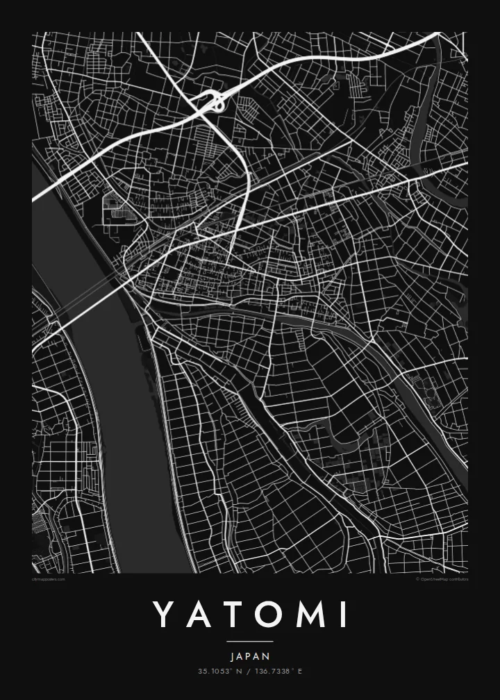
The wide river and its embankments run along the western edge of the city, a long, strong line separating Aichi from Mie.
Posta faʻafanua faigofie · Japan
35.1053° N / 136.7338° E
A low-lying Aichi city on the Kiso River delta, laced with drainage channels, rice fields and goldfish ponds west of Nagoya.



Tasi le aai, lagona e lima
Tapi se sitaili e vaai ai i luga o le puipui. E tutusa uma le tau o sitaili — pe lolomiina, faapipiiina, pe avea ma faila HD.
 Pika Moni · Faila Lolomi 24 × 36″
Manino mo le lolomi
O se vaega atoa (100%) lenei mai le faila lolomi moni. O posita uma — pe lolomiina, faapipiiina pe download mai — e faia i luga o a matou server i le 300 DPI, e oo atu i le 7,200 × 10,800 pika, ina ia manino pea auala laiti i luga o se lolomiga 24 × 36″.
I luga o le puipui


Le faʻafanua
Yatomi lies on the delta lands at the western edge of Aichi Prefecture, where the Kiso River forms the boundary with Mie. Much of the city was reclaimed from shallow bays and wetlands over centuries, and a large part of it sits at or below sea level. On a map this history appears as flat, carefully divided land crossed by embankments and drainage channels.
The street pattern is modest and practical, with residential districts clustered along main roads and rail lines, and the rest of the land given over to fields, ponds and waterways. Rivers and canals run roughly north to south toward Ise Bay, and the long embankments of the Kiso on the western side form one of the clearest lines in the composition.
Yatomi is widely known for goldfish farming, a tradition that has made it one of Japan's main producers, and the rectangular breeding ponds add a distinctive geometric texture to the landscape. A Yatomi map poster renders that water-shaped country in fine black lines, from the river levees to the patchwork of ponds and paddies around the town.
The wide river and its embankments run along the western edge of the city, a long, strong line separating Aichi from Mie.
Rectangular breeding ponds sit in neat rows among the fields, forming a repeating pattern that is specific to Yatomi and its goldfish trade.
Straight drainage channels and field boundaries divide land reclaimed from the bay, giving the southern part of the map a calm, ruled geometry.
Fai mo oe
Faʻaopoopo se aso, se igoa po o sau lava upu, sui le sitaili, lapoʻa po o le itu.
O le preview e leai se totogi e maualalo le resolution ma iai se watermark. O lolomi ma faila HD e faia i le 300 DPI, e oo atu i le 7,200 × 10,800 px, e aunoa ma se watermark.
Aisea Yatomi
For people from Yatomi, and for anyone who knows the flat, watery country west of Nagoya, this map captures a landscape shaped entirely by human effort against water. It is quiet, precise and full of subtle detail.
Add a title, a subtitle such as a year or family name, and the coordinates line, then choose Classic black & white, Noir, Paper, Blueprint or Sand. The $9 download includes A3, A2 and four other sizes as 300 DPI PNG and PDF.
Faatau le posita Yatomi| Lapoʻa lolomi | Manino | Faila |
|---|---|---|
| 30 × 40 cm11.8 × 15.7″ | 3,543 × 4,724 px | PNG · PDF |
| 29.7 × 42 cm (A3)11.7 × 16.5″ | 3,508 × 4,961 px | PNG · PDF |
| 42 × 59.4 cm (A2)16.5 × 23.4″ | 4,961 × 7,016 px | PNG · PDF |
| 45.7 × 61 cm18 × 24″ | 5,400 × 7,200 px | PNG · PDF |
| 50 × 70 cm19.7 × 27.6″ | 5,906 × 8,268 px | PNG · PDF |
| 61 × 91.4 cm24 × 36″ | 7,200 × 10,800 px | PNG · PDF |
Ae faʻatusatusa, o le faʻataʻitaʻiga e leai se totogi e 900 px le lautele, e iai le faʻailoga vai ma e mo mata. O faila HD e oʻo atu i le 8× le manino i itu taʻitasi ma e lolomi manino i le lapoʻa atoa o le posta.
Filifili se sitaili i le pito i luga o le itulau, ona filifili lea o le Posita Lolomi — se lapopoa ma, afai e te fiafia, se faavaa — po o Faila HD Numera. E na o le tasi laasaga o le Checkout, ma o le a fesuia'i lou itulau o oka i le taimi lava e mae'a ai le totogi.
E lolomiina i luga o pepa matte maualuga le tulaga e 200 gsm, i se tasi o lapopoa e ono, mai le 30 × 40 cm i le 24 × 36″. E amata le tau o posita lolomi mai le $39, aofia ai le auina atu.
Ioe. Filifili se faavaa laau malosi i le lanu uliuli, sina, oak masani, po o le laau pogisa. E aofia ai se tioata e le gau ma ua saunia e tautau i luga. E amata le tau o posita faavaa mai le $99, aofia ai le auina atu.
E leai se totogi o le auina atu i atunuu e 60+. O pepa ata taʻitasi e lolomiina e le tasi o matou paaga lolomi e latalata mai i atunuu e 30+, ma e masani ona taunuu i le 3–7 aso faigaluega. E mafai ona e mulimulitaia le tulaga ma le sailiga i lalo o My Orders. O nisi atunuu e 2–5 vaiaso, ma i nofoaga e lei matou auina atu iai, e taʻu atu e le saite ia te oe a o lei totogi.
Auina mai se ata i totonu o le 14 aso talu ona taunuu, ma o le a matou toe lolomiina e leai se totogi po o le toe faafoi atu lau tupe.
Ioe. I totonu o le editor i lenei itulau, suia le ulutala, le ulutala laititi ma le laina o coordinates i soo se mea e te fiafia i ai, ma filifili se sitaili ma le lapopoa. O oka lolomi, faavaa ma numera e faaaoga uma lava lau mamanu.
Mo le $9 e te maua ai faila PNG 300 DPI ma PDF ua saunia mo le lolomi i lapopoa uma e ono, e aunoa ma se watermark, e mafai ona lolomi i soo se mea. Le mautinoa lava? Download muamua se preview e leai se totogi ma le watermark.
Latalata ane
