Colonial grid
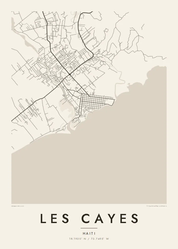
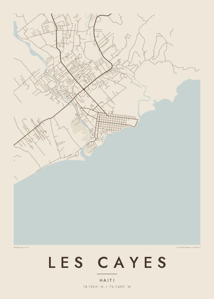
The historic centre is a regular grid of streets, laid out when the port was founded. It is the most recognisable feature of the town from above.
Póster mapa minimalista · Haiti
18.1920° N / 73.7495° W
A Caribbean port on Haiti's southern coast, its grid of streets opening onto a sheltered bay



Sidade ida, estilu lima
Hili estilu ida atu haree oinsá nia sai iha didin. Estilu hotu-hotu iha folin hanesan — imprime, kaixa moldura ka arkivu HD.
 Pixel loloos · arkivu imprime 24 × 36″
Moos atu imprime
Ida ne'e mak crop 100% husi arkivu imprime loloos. Poster ida-idak — imprime, kaixa moldura ka download — ami halo iha ami-nia servidor ho 300 DPI, to'o 7,200 × 10,800 pixel, atu dalan ki'ik liu mós sai klaru iha imprime 24 × 36″.
Iha Parede


Mapa
Les Cayes sits on the southern coast of Haiti's Tiburon Peninsula, facing the Caribbean. From above, the centre is a clear colonial-era grid of straight streets that ends at the waterfront. Rivers reach the sea on either side of the town, and the low coastal plain behind it is crossed by roads and field boundaries heading towards the mountains inland.
It is one of the main towns of the south and the capital of the Sud department. The town was founded in the eighteenth century as a port. Offshore lies Île-à-Vache, an island visible across the bay. The region has been hit hard by hurricanes and earthquakes, and the town's layout has been rebuilt many times while keeping its old street plan.
A Les Cayes map poster contrasts the neat grid with the curving coastline and river mouths. The bay forms a large, calm space along the bottom of the map. Streets meet the water at right angles. For the Haitian diaspora in Miami, Montreal, New York or Paris, it is a precise and personal map of a home port.
The historic centre is a regular grid of streets, laid out when the port was founded. It is the most recognisable feature of the town from above.
Les Cayes faces a wide bay of the Caribbean Sea. The shoreline forms the southern edge of the map and the town's open side.
Rivers reach the sea near the town, cutting across the coastal plain. Their winding courses frame the straight streets of the centre.
Halo ita-nia póster rasik
Aumenta data, naran ka liafuan rasik, troka estilu, tamañu ka orientasaun.
Preview grátis nian rezolusaun ki'ik no iha marka bee. Imprime no arkivu HD ami halo ho 300 DPI, to'o 7,200 × 10,800 px, laiha marka bee.
Tanba sa Les Cayes
Many people with family in the south of Haiti want a map of Les Cayes as a lasting link to the town, its streets and its bay. It also makes a meaningful gift across generations.
Personalise the title, subtitle and coordinates line, for example with a family name or a parish. Choose Classic black & white, Noir, Paper, Blueprint or Sand. The HD files are $9, and printed posters ship from partners in more than 30 countries.
Enkomenda poster Les Cayes| Tamañu imprime | Rezolusaun | Arkivu |
|---|---|---|
| 30 × 40 cm11.8 × 15.7″ | 3,543 × 4,724 px | PNG · PDF |
| 29.7 × 42 cm (A3)11.7 × 16.5″ | 3,508 × 4,961 px | PNG · PDF |
| 42 × 59.4 cm (A2)16.5 × 23.4″ | 4,961 × 7,016 px | PNG · PDF |
| 45.7 × 61 cm18 × 24″ | 5,400 × 7,200 px | PNG · PDF |
| 50 × 70 cm19.7 × 27.6″ | 5,906 × 8,268 px | PNG · PDF |
| 61 × 91.4 cm24 × 36″ | 7,200 × 10,800 px | PNG · PDF |
Atu kompara, previzaun gratuita luan 900 px, iha marka d'água no ba ekrã de'it. Arkivu HD iha rezolusaun to'o dala 8 boot liu iha direksaun ida-idak no imprime moos iha tamañu póster kompletu.
Hili estilu ida iha leten pájina, depois hili Poster Imprime — hili tamañu ida no, se hakarak, moldura ida — ka Arkivu Digital HD. Pagamentu halo iha pasu ida deit, no pájina enkomenda sei update kedas hafoin pagamentu remata.
Ami imprime iha papel matte kualidade aas 200 gsm, iha tamañu neen, husi 30 × 40 cm to'o 24 × 36″. Poster imprime hahú husi $39, haruka livre.
Bele. Hili moldura kayu solidu kór metan, mutin, oak natural ka kayu nakukun. Mai ho vidru la-kilat no prontu atu kandu iha didin. Poster ho moldura hahú husi $99, haruka livre.
Entrega gratuita ba país 60+. Poster ida-idak ami-nia parseiru impresaun besik liu mak imprime iha país 30+ no normalmente to'o iha loron-servisu 3–7. Ita bele haree estatutu no rastreiu iha Ha'u-nia Enkomenda. Países balu presiza semana 2–5, no iha fatin ne'ebé ami seidauk entrega, site sei hatete ba ita molok selu.
Haruka foto ba ami iha loron 14 hafoin simu, no ami sei imprime fali ho grátis ka selu fila fali osan.
Bele. Iha editor iha pájina ne'e, troka titulu, subtitulu no liña koordenadas ba buat ne'ebé ita hakarak, depois hili estilu no tamañu. Enkomenda imprime, moldura ka digital hotu-hotu uza sasán ita-nia desain loloos.
Ho $9 ita simu arkivu PNG 300 DPI no PDF prontu-imprime iha tamañu neen hotu, laiha marka bee, atu imprime iha fatin ida-ida. Seidauk lai serteza? Download uluk preview grátis ho marka bee.
