Mettur Dam
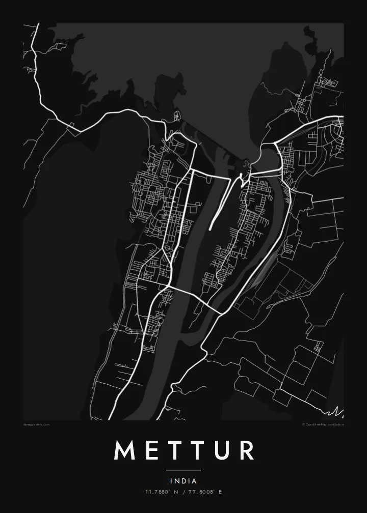
A long masonry dam across the Kaveri, completed in 1934. On the map it is a firm straight line between the reservoir and the town below.
Póster mapa minimalista · India
11.7880° N / 77.8008° E
A town gathered below a long masonry dam, with the broad Stanley Reservoir filling the valley behind it



Sidade ida, estilu lima
Hili estilu ida atu haree oinsá nia sai iha didin. Estilu hotu-hotu iha folin hanesan — imprime, kaixa moldura ka arkivu HD.
 Pixel loloos · arkivu imprime 24 × 36″
Moos atu imprime
Ida ne'e mak crop 100% husi arkivu imprime loloos. Poster ida-idak — imprime, kaixa moldura ka download — ami halo iha ami-nia servidor ho 300 DPI, to'o 7,200 × 10,800 pixel, atu dalan ki'ik liu mós sai klaru iha imprime 24 × 36″.
Iha Parede


Mapa
Mettur is built around the Kaveri river where it leaves the hills of Salem district. From above, one structure shapes everything: the long wall of the Mettur Dam, finished in 1934. Behind it the Stanley Reservoir fills the valley in a wide body of water with many fingers. Below it, the town and its industrial areas follow the river downstream.
The dam is one of the oldest large dams in India, and it controls water for irrigation across the Kaveri delta far to the east. Its release dates matter to farmers throughout the region. The streets on the map show how closely the settlement is tied to the dam: roads run along the embankments, and housing sits on the slopes nearby.
A Mettur map poster shows a town defined by engineering. The straight line of the dam divides the smooth expanse of the reservoir from the narrower river channel, and hills on both sides frame the scene. Printed in monochrome, the drawing is almost diagrammatic, like a cross-section of how the Kaveri has been held back and put to work.
A long masonry dam across the Kaveri, completed in 1934. On the map it is a firm straight line between the reservoir and the town below.
The lake behind the dam spreads upstream into branching inlets that follow the old valley, the largest open shape on the poster.
Downstream of the dam the Kaveri narrows again into a single channel, with the town's streets and works along its banks.
Halo ita-nia póster rasik
Aumenta data, naran ka liafuan rasik, troka estilu, tamañu ka orientasaun.
Preview grátis nian rezolusaun ki'ik no iha marka bee. Imprime no arkivu HD ami halo ho 300 DPI, to'o 7,200 × 10,800 px, laiha marka bee.
Tanba sa Mettur
Mettur means a lot to anyone whose family farms on Kaveri water or who grew up near the dam colonies. The poster turns a familiar landmark into a clean composition that people who know the place recognise at once.
Personalise the title, subtitle and coordinates line, and pick one of five styles: Classic black & white, Noir, Paper, Blueprint or Sand. Digital files cost $9 and come in six sizes as 300 DPI PNG and print-ready PDF. Printed posters ship from partners in over 30 countries.
Enkomenda poster Mettur| Tamañu imprime | Rezolusaun | Arkivu |
|---|---|---|
| 30 × 40 cm11.8 × 15.7″ | 3,543 × 4,724 px | PNG · PDF |
| 29.7 × 42 cm (A3)11.7 × 16.5″ | 3,508 × 4,961 px | PNG · PDF |
| 42 × 59.4 cm (A2)16.5 × 23.4″ | 4,961 × 7,016 px | PNG · PDF |
| 45.7 × 61 cm18 × 24″ | 5,400 × 7,200 px | PNG · PDF |
| 50 × 70 cm19.7 × 27.6″ | 5,906 × 8,268 px | PNG · PDF |
| 61 × 91.4 cm24 × 36″ | 7,200 × 10,800 px | PNG · PDF |
Atu kompara, previzaun gratuita luan 900 px, iha marka d'água no ba ekrã de'it. Arkivu HD iha rezolusaun to'o dala 8 boot liu iha direksaun ida-idak no imprime moos iha tamañu póster kompletu.
Hili estilu ida iha leten pájina, depois hili Poster Imprime — hili tamañu ida no, se hakarak, moldura ida — ka Arkivu Digital HD. Pagamentu halo iha pasu ida deit, no pájina enkomenda sei update kedas hafoin pagamentu remata.
Ami imprime iha papel matte kualidade aas 200 gsm, iha tamañu neen, husi 30 × 40 cm to'o 24 × 36″. Poster imprime hahú husi $39, haruka livre.
Bele. Hili moldura kayu solidu kór metan, mutin, oak natural ka kayu nakukun. Mai ho vidru la-kilat no prontu atu kandu iha didin. Poster ho moldura hahú husi $99, haruka livre.
Entrega gratuita ba país 60+. Poster ida-idak ami-nia parseiru impresaun besik liu mak imprime iha país 30+ no normalmente to'o iha loron-servisu 3–7. Ita bele haree estatutu no rastreiu iha Ha'u-nia Enkomenda. Países balu presiza semana 2–5, no iha fatin ne'ebé ami seidauk entrega, site sei hatete ba ita molok selu.
Haruka foto ba ami iha loron 14 hafoin simu, no ami sei imprime fali ho grátis ka selu fila fali osan.
Bele. Iha editor iha pájina ne'e, troka titulu, subtitulu no liña koordenadas ba buat ne'ebé ita hakarak, depois hili estilu no tamañu. Enkomenda imprime, moldura ka digital hotu-hotu uza sasán ita-nia desain loloos.
Ho $9 ita simu arkivu PNG 300 DPI no PDF prontu-imprime iha tamañu neen hotu, laiha marka bee, atu imprime iha fatin ida-ida. Seidauk lai serteza? Download uluk preview grátis ho marka bee.
