Parallel rail lines
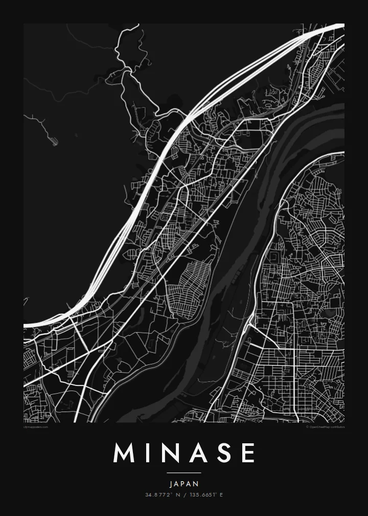
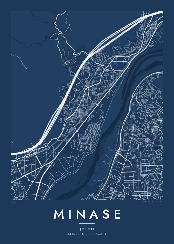
Several railways run side by side through the narrow corridor. They draw long, confident lines across the map from Kyoto toward Osaka.
Póster mapa minimalista · Japan
34.8772° N / 135.6651° E
A narrow corridor between hills and the Yodo River, threaded with railways where Osaka and Kyoto almost meet.



Sidade ida, estilu lima
Hili estilu ida atu haree oinsá nia sai iha didin. Estilu hotu-hotu iha folin hanesan — imprime, kaixa moldura ka arkivu HD.
 Pixel loloos · arkivu imprime 24 × 36″
Moos atu imprime
Ida ne'e mak crop 100% husi arkivu imprime loloos. Poster ida-idak — imprime, kaixa moldura ka download — ami halo iha ami-nia servidor ho 300 DPI, to'o 7,200 × 10,800 pixel, atu dalan ki'ik liu mós sai klaru iha imprime 24 × 36″.
Iha Parede


Mapa
Minase is a district of Shimamoto in the north-east of Osaka Prefecture, close to the border with Kyoto. The map here is defined by a squeeze. Wooded hills press down from the north-west, and the broad Yodo River and its floodplain spread to the south-east. Between them is a slim strip of flat land that roads, homes and several parallel rail lines all share.
The district gives its name to Minase Shrine, dedicated to Emperor Go-Toba, who kept a detached palace here in the early thirteenth century. The shrine's spring water is widely known, and people come with bottles to fill. A little further along the valley lies Yamazaki, long associated with whisky distilling because of its soft water and misty climate.
A Minase map poster fits one of Japan's busiest transport corridors into a very compact frame. The Shinkansen, JR and Hankyu lines run side by side, the river lies beyond them, and quiet residential streets sit tucked in between. The long, straight rail lines against the folded hills give the print strong graphic tension.
Several railways run side by side through the narrow corridor. They draw long, confident lines across the map from Kyoto toward Osaka.
The wide river and its embankments fill the south-eastern side, a broad band of open space just downstream of where three rivers join.
Forested slopes rise directly behind the residential streets, giving the northern edge of the map a soft, empty texture that frames the town.
Halo ita-nia póster rasik
Aumenta data, naran ka liafuan rasik, troka estilu, tamañu ka orientasaun.
Preview grátis nian rezolusaun ki'ik no iha marka bee. Imprime no arkivu HD ami halo ho 300 DPI, to'o 7,200 × 10,800 px, laiha marka bee.
Tanba sa Minase
Minase suits people who have lived along the Kyoto–Osaka line, commuted through it every day, or visited the shrine and nearby distilleries. The map reads as a concentrated portrait of the Kansai corridor, elegant enough for a small apartment wall.
Set your own title and subtitle, perhaps a street name or a year, and personalise the coordinates line. Paper and Sand have a gentle, handmade feel, while Noir and Blueprint suit a sharper interior. Classic black & white is always a clean choice.
Enkomenda poster Minase| Tamañu imprime | Rezolusaun | Arkivu |
|---|---|---|
| 30 × 40 cm11.8 × 15.7″ | 3,543 × 4,724 px | PNG · PDF |
| 29.7 × 42 cm (A3)11.7 × 16.5″ | 3,508 × 4,961 px | PNG · PDF |
| 42 × 59.4 cm (A2)16.5 × 23.4″ | 4,961 × 7,016 px | PNG · PDF |
| 45.7 × 61 cm18 × 24″ | 5,400 × 7,200 px | PNG · PDF |
| 50 × 70 cm19.7 × 27.6″ | 5,906 × 8,268 px | PNG · PDF |
| 61 × 91.4 cm24 × 36″ | 7,200 × 10,800 px | PNG · PDF |
Atu kompara, previzaun gratuita luan 900 px, iha marka d'água no ba ekrã de'it. Arkivu HD iha rezolusaun to'o dala 8 boot liu iha direksaun ida-idak no imprime moos iha tamañu póster kompletu.
Hili estilu ida iha leten pájina, depois hili Poster Imprime — hili tamañu ida no, se hakarak, moldura ida — ka Arkivu Digital HD. Pagamentu halo iha pasu ida deit, no pájina enkomenda sei update kedas hafoin pagamentu remata.
Ami imprime iha papel matte kualidade aas 200 gsm, iha tamañu neen, husi 30 × 40 cm to'o 24 × 36″. Poster imprime hahú husi $39, haruka livre.
Bele. Hili moldura kayu solidu kór metan, mutin, oak natural ka kayu nakukun. Mai ho vidru la-kilat no prontu atu kandu iha didin. Poster ho moldura hahú husi $99, haruka livre.
Entrega gratuita ba mundu tomak. Poster ida-idak imprime husi ami-nia parseiru impresaun ne'ebé besik liu iha nasaun 30+ no normalmente to'o iha loron servisu 3–7. Ita bele haree estadu no tracking iha Ha'u-nia Pedidu. Nasaun balu foti semana 2–5, no iha nasaun ne'ebé ami seidauk entrega, sítiu hatudu ba ita molok selu.
Haruka foto ba ami iha loron 14 hafoin simu, no ami sei imprime fali ho grátis ka selu fila fali osan.
Bele. Iha editor iha pájina ne'e, troka titulu, subtitulu no liña koordenadas ba buat ne'ebé ita hakarak, depois hili estilu no tamañu. Enkomenda imprime, moldura ka digital hotu-hotu uza sasán ita-nia desain loloos.
Ho $9 ita simu arkivu PNG 300 DPI no PDF prontu-imprime iha tamañu neen hotu, laiha marka bee, atu imprime iha fatin ida-ida. Seidauk lai serteza? Download uluk preview grátis ho marka bee.
