Yahagi River
A wide river running down the western side of the city, with long bridges across it. On the map it gives the whole layout a strong vertical edge.
Póster mapa minimalista · Japan
34.9500° N / 137.1667° E
A castle town on the Yahagi River, where the old Tokaido road bends through low hills and dense Aichi neighbourhoods.



Sidade ida, estilu lima
Hili estilu ida atu haree oinsá nia sai iha didin. Estilu hotu-hotu iha folin hanesan — imprime, kaixa moldura ka arkivu HD.
 Pixel loloos · arkivu imprime 24 × 36″
Moos atu imprime
Ida ne'e mak crop 100% husi arkivu imprime loloos. Poster ida-idak — imprime, kaixa moldura ka download — ami halo iha ami-nia servidor ho 300 DPI, to'o 7,200 × 10,800 pixel, atu dalan ki'ik liu mós sai klaru iha imprime 24 × 36″.
Iha Parede


Mapa
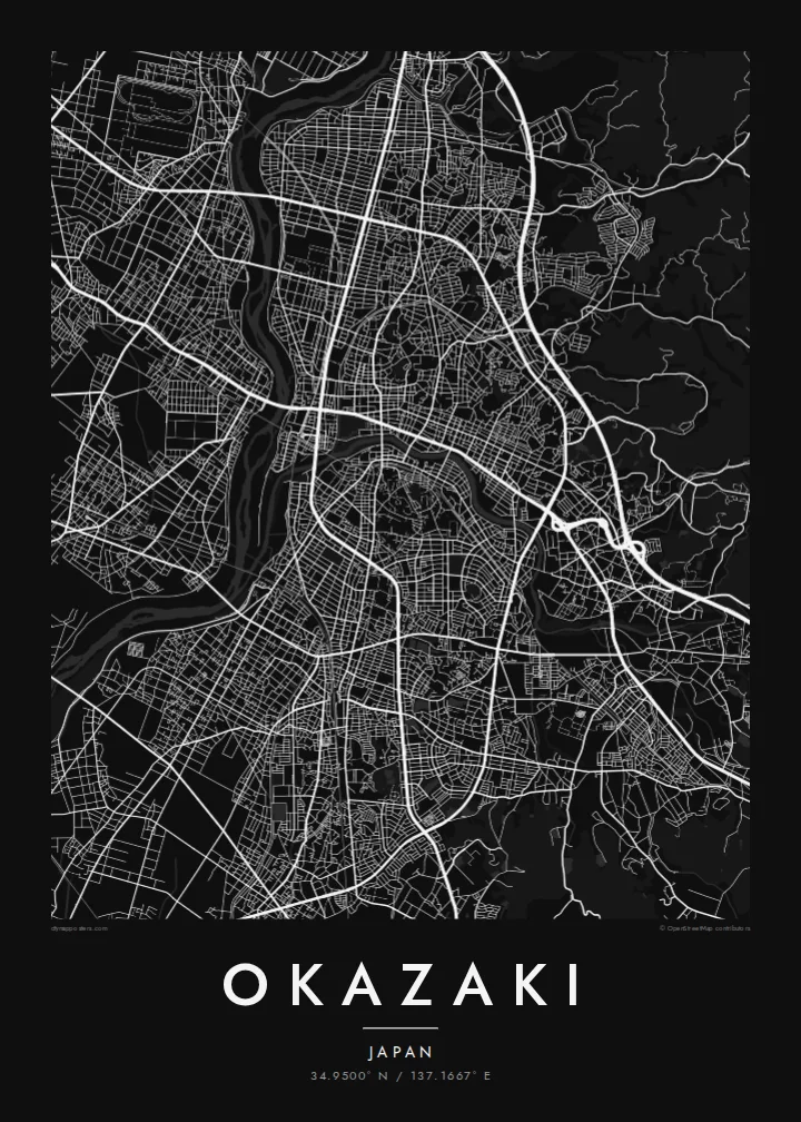
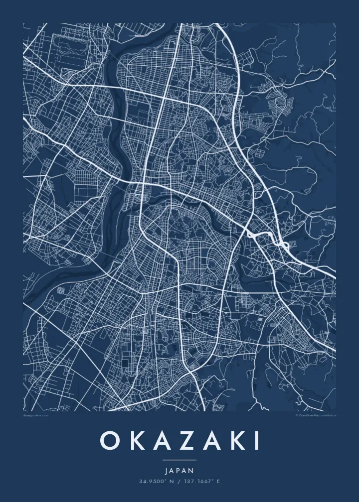
From above, Okazaki reads as a meeting of waters. The Yahagi River runs broadly north to south along the western side of the city, and the smaller Oto River threads east to west to join it. The historic core sits close to where they meet, around the grounds of Okazaki Castle. Newer districts spread outward across the flatter land and climb gradually into wooded hills to the east.
Okazaki is best known as the birthplace of Tokugawa Ieyasu, the founder of the shogunate that governed Japan for over two and a half centuries. The rebuilt castle keep stands in Okazaki Park, whose moats and green space show clearly on a detailed map. The town also grew as a post station on the Tokaido, the old highway linking Edo and Kyoto.
A Okazaki map poster shows how tightly the city is arranged along its rivers. Rail lines and main roads follow the valley floors, and small residential blocks fill the spaces between them. Farther out, the street pattern loosens into looping roads that follow the contours of the hills. In black and white, the pale river channels stand out against the fine grain of streets.
A wide river running down the western side of the city, with long bridges across it. On the map it gives the whole layout a strong vertical edge.
The castle grounds near the rivers' confluence, with moats and open lawns. They form a quiet green space at the centre of the old town.
East of the centre the grid breaks up into winding lanes and wooded slopes, so the dense city gives way to open land.
Halo ita-nia póster rasik
Aumenta data, naran ka liafuan rasik, troka estilu, tamañu ka orientasaun.
Preview grátis nian rezolusaun ki'ik no iha marka bee. Imprime no arkivu HD ami halo ho 300 DPI, to'o 7,200 × 10,800 px, laiha marka bee.
Tanba sa Okazaki
For people from Okazaki, the map is a way to keep the rivers, the castle park and familiar neighbourhoods on the wall. It also works as a quiet nod to Japanese history for anyone who has walked the old Tokaido route through the town.
You can personalise the title, subtitle and coordinates line, for example with a family name or a date that matters. Then choose one of five styles: Classic black & white, Noir, Paper, Blueprint or Sand.
Enkomenda poster Okazaki| Tamañu imprime | Rezolusaun | Arkivu |
|---|---|---|
| 30 × 40 cm11.8 × 15.7″ | 3,543 × 4,724 px | PNG · PDF |
| 29.7 × 42 cm (A3)11.7 × 16.5″ | 3,508 × 4,961 px | PNG · PDF |
| 42 × 59.4 cm (A2)16.5 × 23.4″ | 4,961 × 7,016 px | PNG · PDF |
| 45.7 × 61 cm18 × 24″ | 5,400 × 7,200 px | PNG · PDF |
| 50 × 70 cm19.7 × 27.6″ | 5,906 × 8,268 px | PNG · PDF |
| 61 × 91.4 cm24 × 36″ | 7,200 × 10,800 px | PNG · PDF |
Atu kompara, previzaun gratuita luan 900 px, iha marka d'água no ba ekrã de'it. Arkivu HD iha rezolusaun to'o dala 8 boot liu iha direksaun ida-idak no imprime moos iha tamañu póster kompletu.
Hili estilu ida iha leten pájina, depois hili Poster Imprime — hili tamañu ida no, se hakarak, moldura ida — ka Arkivu Digital HD. Pagamentu halo iha pasu ida deit, no pájina enkomenda sei update kedas hafoin pagamentu remata.
Ami imprime iha papel matte kualidade aas 200 gsm, iha tamañu neen, husi 30 × 40 cm to'o 24 × 36″. Poster imprime hahú husi $39, haruka livre.
Bele. Hili moldura kayu solidu kór metan, mutin, oak natural ka kayu nakukun. Mai ho vidru la-kilat no prontu atu kandu iha didin. Poster ho moldura hahú husi $99, haruka livre.
Entrega gratuita ba mundu tomak. Poster ida-idak imprime husi ami-nia parseiru impresaun ne'ebé besik liu iha nasaun 30+ no normalmente to'o iha loron servisu 3–7. Ita bele haree estadu no tracking iha Ha'u-nia Pedidu. Nasaun balu foti semana 2–5, no iha nasaun ne'ebé ami seidauk entrega, sítiu hatudu ba ita molok selu.
Haruka foto ba ami iha loron 14 hafoin simu, no ami sei imprime fali ho grátis ka selu fila fali osan.
Bele. Iha editor iha pájina ne'e, troka titulu, subtitulu no liña koordenadas ba buat ne'ebé ita hakarak, depois hili estilu no tamañu. Enkomenda imprime, moldura ka digital hotu-hotu uza sasán ita-nia desain loloos.
Ho $9 ita simu arkivu PNG 300 DPI no PDF prontu-imprime iha tamañu neen hotu, laiha marka bee, atu imprime iha fatin ida-ida. Seidauk lai serteza? Download uluk preview grátis ho marka bee.
