Lake Biwa shoreline
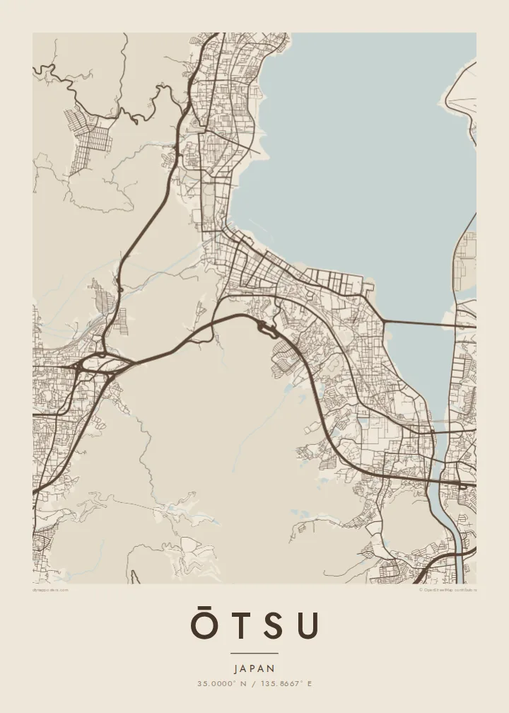
The lake fills a large part of the frame, and the city follows its edge in a long, gently curving strip of streets, promenades and reclaimed waterfront.
Póster mapa minimalista · Japan
35.0000° N / 135.8667° E
A long lakeside city on the southern tip of Lake Biwa, pressed between the water and the slopes of Mount Hiei


Sidade ida, estilu lima
Hili estilu ida atu haree oinsá nia sai iha didin. Estilu hotu-hotu iha folin hanesan — imprime, kaixa moldura ka arkivu HD.
 Pixel loloos · arkivu imprime 24 × 36″
Moos atu imprime
Ida ne'e mak crop 100% husi arkivu imprime loloos. Poster ida-idak — imprime, kaixa moldura ka download — ami halo iha ami-nia servidor ho 300 DPI, to'o 7,200 × 10,800 pixel, atu dalan ki'ik liu mós sai klaru iha imprime 24 × 36″.
Iha Parede


Mapa
Ōtsu, the capital of Shiga Prefecture, stretches along the southwestern shore of Lake Biwa, the largest lake in Japan. The city is long and narrow: a band of streets and rail lines squeezed between the lake and the wooded ridges that separate it from Kyoto. On a map the shoreline and the mountains define almost every neighbourhood.
The city's roots run deep. In the seventh century it briefly served as the imperial capital under Emperor Tenji, and above it, on Mount Hiei, stands Enryaku-ji, the head temple of Tendai Buddhism. Closer to the water are Mii-dera and, to the south, Ishiyama-dera, where Murasaki Shikibu is said to have begun The Tale of Genji.
At the lake's southern end the Seta River flows out beneath the old Seta bridge, and the Lake Biwa Canal leaves the city through tunnels towards Kyoto. An Ōtsu map poster traces these lines of water and movement: the shore, the river, the canal and the roads that have linked the lake to the old capital for centuries.
The lake fills a large part of the frame, and the city follows its edge in a long, gently curving strip of streets, promenades and reclaimed waterfront.
At the southern tip the lake narrows into the Seta River, its only natural outlet, crossed by the long Seta no Karahashi bridge that has stood at this point in various forms for centuries.
Behind the city the ground rises sharply into Mount Hiei and the neighbouring hills, where the street grid gives way to forest and winding temple roads.
Halo ita-nia póster rasik
Aumenta data, naran ka liafuan rasik, troka estilu, tamañu ka orientasaun.
Preview grátis nian rezolusaun ki'ik no iha marka bee. Imprime no arkivu HD ami halo ho 300 DPI, to'o 7,200 × 10,800 px, laiha marka bee.
Tanba sa Ōtsu
Ōtsu appeals to anyone who loves the meeting of water and mountains, and to those who know it from temple visits, lakeside walks or a daily commute to Kyoto. The long shoreline composition works especially well on a tall portrait format.
Personalise the title, subtitle and coordinates, perhaps with a date or a lakeside address, and select one of five styles: Classic black & white, Noir, Paper, Blueprint or Sand. Each style gives the broad shape of the lake a different weight against the streets.
Enkomenda poster Ōtsu| Tamañu imprime | Rezolusaun | Arkivu |
|---|---|---|
| 30 × 40 cm11.8 × 15.7″ | 3,543 × 4,724 px | PNG · PDF |
| 29.7 × 42 cm (A3)11.7 × 16.5″ | 3,508 × 4,961 px | PNG · PDF |
| 42 × 59.4 cm (A2)16.5 × 23.4″ | 4,961 × 7,016 px | PNG · PDF |
| 45.7 × 61 cm18 × 24″ | 5,400 × 7,200 px | PNG · PDF |
| 50 × 70 cm19.7 × 27.6″ | 5,906 × 8,268 px | PNG · PDF |
| 61 × 91.4 cm24 × 36″ | 7,200 × 10,800 px | PNG · PDF |
Atu kompara, previzaun gratuita luan 900 px, iha marka d'água no ba ekrã de'it. Arkivu HD iha rezolusaun to'o dala 8 boot liu iha direksaun ida-idak no imprime moos iha tamañu póster kompletu.
Hili estilu ida iha leten pájina, depois hili Poster Imprime — hili tamañu ida no, se hakarak, moldura ida — ka Arkivu Digital HD. Pagamentu halo iha pasu ida deit, no pájina enkomenda sei update kedas hafoin pagamentu remata.
Ami imprime iha papel matte kualidade aas 200 gsm, iha tamañu neen, husi 30 × 40 cm to'o 24 × 36″. Poster imprime hahú husi $39, haruka livre.
Bele. Hili moldura kayu solidu kór metan, mutin, oak natural ka kayu nakukun. Mai ho vidru la-kilat no prontu atu kandu iha didin. Poster ho moldura hahú husi $99, haruka livre.
Entrega gratuita ba país 60+. Poster ida-idak ami-nia parseiru impresaun besik liu mak imprime iha país 30+ no normalmente to'o iha loron-servisu 3–7. Ita bele haree estatutu no rastreiu iha Ha'u-nia Enkomenda. Países balu presiza semana 2–5, no iha fatin ne'ebé ami seidauk entrega, site sei hatete ba ita molok selu.
Haruka foto ba ami iha loron 14 hafoin simu, no ami sei imprime fali ho grátis ka selu fila fali osan.
Bele. Iha editor iha pájina ne'e, troka titulu, subtitulu no liña koordenadas ba buat ne'ebé ita hakarak, depois hili estilu no tamañu. Enkomenda imprime, moldura ka digital hotu-hotu uza sasán ita-nia desain loloos.
Ho $9 ita simu arkivu PNG 300 DPI no PDF prontu-imprime iha tamañu neen hotu, laiha marka bee, atu imprime iha fatin ida-ida. Seidauk lai serteza? Download uluk preview grátis ho marka bee.
