Kiso River levees
The wide river and its embankments run along the western edge of the city, a long, strong line separating Aichi from Mie.
Póster mapa minimalista · Japan
35.1053° N / 136.7338° E
A low-lying Aichi city on the Kiso River delta, laced with drainage channels, rice fields and goldfish ponds west of Nagoya.



Sidade ida, estilu lima
Hili estilu ida atu haree oinsá nia sai iha didin. Estilu hotu-hotu iha folin hanesan — imprime, kaixa moldura ka arkivu HD.
 Pixel loloos · arkivu imprime 24 × 36″
Moos atu imprime
Ida ne'e mak crop 100% husi arkivu imprime loloos. Poster ida-idak — imprime, kaixa moldura ka download — ami halo iha ami-nia servidor ho 300 DPI, to'o 7,200 × 10,800 pixel, atu dalan ki'ik liu mós sai klaru iha imprime 24 × 36″.
Iha Parede


Mapa
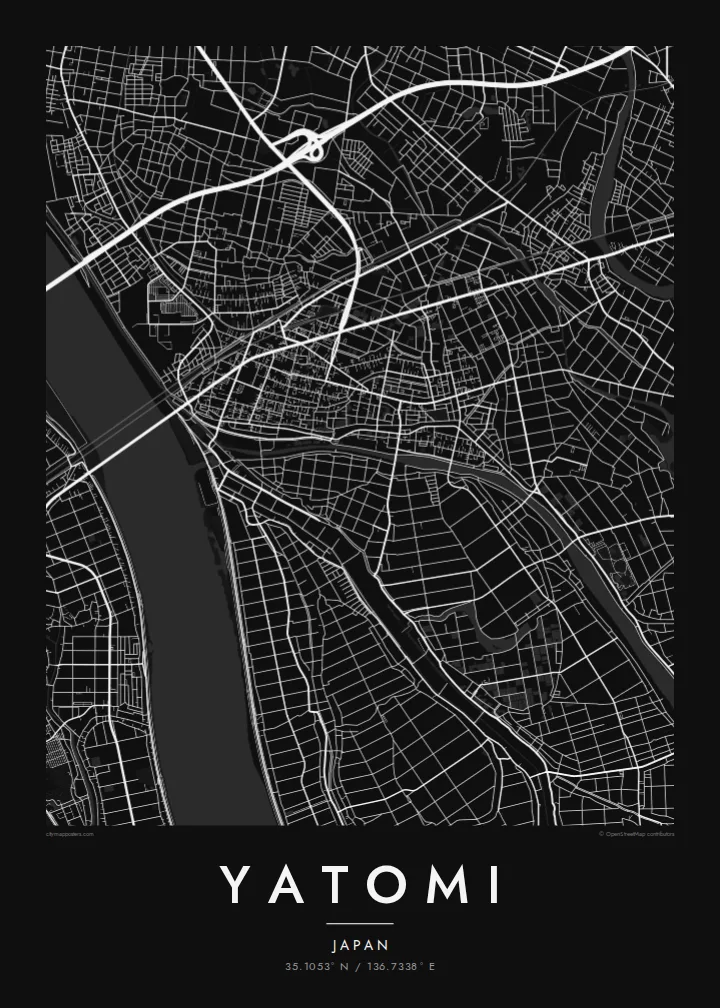
Yatomi lies on the delta lands at the western edge of Aichi Prefecture, where the Kiso River forms the boundary with Mie. Much of the city was reclaimed from shallow bays and wetlands over centuries, and a large part of it sits at or below sea level. On a map this history appears as flat, carefully divided land crossed by embankments and drainage channels.
The street pattern is modest and practical, with residential districts clustered along main roads and rail lines, and the rest of the land given over to fields, ponds and waterways. Rivers and canals run roughly north to south toward Ise Bay, and the long embankments of the Kiso on the western side form one of the clearest lines in the composition.
Yatomi is widely known for goldfish farming, a tradition that has made it one of Japan's main producers, and the rectangular breeding ponds add a distinctive geometric texture to the landscape. A Yatomi map poster renders that water-shaped country in fine black lines, from the river levees to the patchwork of ponds and paddies around the town.
The wide river and its embankments run along the western edge of the city, a long, strong line separating Aichi from Mie.
Rectangular breeding ponds sit in neat rows among the fields, forming a repeating pattern that is specific to Yatomi and its goldfish trade.
Straight drainage channels and field boundaries divide land reclaimed from the bay, giving the southern part of the map a calm, ruled geometry.
Halo ita-nia póster rasik
Aumenta data, naran ka liafuan rasik, troka estilu, tamañu ka orientasaun.
Preview grátis nian rezolusaun ki'ik no iha marka bee. Imprime no arkivu HD ami halo ho 300 DPI, to'o 7,200 × 10,800 px, laiha marka bee.
Tanba sa Yatomi
For people from Yatomi, and for anyone who knows the flat, watery country west of Nagoya, this map captures a landscape shaped entirely by human effort against water. It is quiet, precise and full of subtle detail.
Add a title, a subtitle such as a year or family name, and the coordinates line, then choose Classic black & white, Noir, Paper, Blueprint or Sand. The $9 download includes A3, A2 and four other sizes as 300 DPI PNG and PDF.
Enkomenda poster Yatomi| Tamañu imprime | Rezolusaun | Arkivu |
|---|---|---|
| 30 × 40 cm11.8 × 15.7″ | 3,543 × 4,724 px | PNG · PDF |
| 29.7 × 42 cm (A3)11.7 × 16.5″ | 3,508 × 4,961 px | PNG · PDF |
| 42 × 59.4 cm (A2)16.5 × 23.4″ | 4,961 × 7,016 px | PNG · PDF |
| 45.7 × 61 cm18 × 24″ | 5,400 × 7,200 px | PNG · PDF |
| 50 × 70 cm19.7 × 27.6″ | 5,906 × 8,268 px | PNG · PDF |
| 61 × 91.4 cm24 × 36″ | 7,200 × 10,800 px | PNG · PDF |
Atu kompara, previzaun gratuita luan 900 px, iha marka d'água no ba ekrã de'it. Arkivu HD iha rezolusaun to'o dala 8 boot liu iha direksaun ida-idak no imprime moos iha tamañu póster kompletu.
Hili estilu ida iha leten pájina, depois hili Poster Imprime — hili tamañu ida no, se hakarak, moldura ida — ka Arkivu Digital HD. Pagamentu halo iha pasu ida deit, no pájina enkomenda sei update kedas hafoin pagamentu remata.
Ami imprime iha papel matte kualidade aas 200 gsm, iha tamañu neen, husi 30 × 40 cm to'o 24 × 36″. Poster imprime hahú husi $39, haruka livre.
Bele. Hili moldura kayu solidu kór metan, mutin, oak natural ka kayu nakukun. Mai ho vidru la-kilat no prontu atu kandu iha didin. Poster ho moldura hahú husi $99, haruka livre.
Entrega gratuita ba país 60+. Poster ida-idak ami-nia parseiru impresaun besik liu mak imprime iha país 30+ no normalmente to'o iha loron-servisu 3–7. Ita bele haree estatutu no rastreiu iha Ha'u-nia Enkomenda. Países balu presiza semana 2–5, no iha fatin ne'ebé ami seidauk entrega, site sei hatete ba ita molok selu.
Haruka foto ba ami iha loron 14 hafoin simu, no ami sei imprime fali ho grátis ka selu fila fali osan.
Bele. Iha editor iha pájina ne'e, troka titulu, subtitulu no liña koordenadas ba buat ne'ebé ita hakarak, depois hili estilu no tamañu. Enkomenda imprime, moldura ka digital hotu-hotu uza sasán ita-nia desain loloos.
Ho $9 ita simu arkivu PNG 300 DPI no PDF prontu-imprime iha tamañu neen hotu, laiha marka bee, atu imprime iha fatin ida-ida. Seidauk lai serteza? Download uluk preview grátis ho marka bee.
