The Ring
Broad boulevards follow the line of the old city walls in a half-circle from riverbank to riverbank, enclosing the Altstadt and giving the map its signature shape.
Minimalistik karta plakaty · Germaniýa
50.9333° N / 6.9500° E
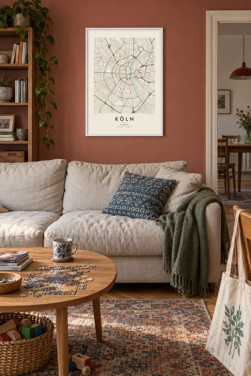
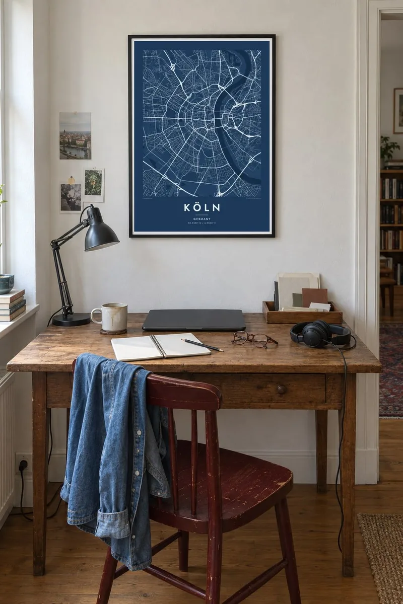
A half-circle old town pressed against the Rhine, wrapped in concentric boulevards and an outer ring of green.


Bir şäher, bäş keýp
Diwarda nähili görünjegini görmek üçin stile basyň. Ähli stiller bir bahadan — çap edilen, çarçuwaly ýa-da HD faýl görnüşinde.
 Hakyky pikseller · 24 × 36″ çap faýly
Çapda aýdyň
Bu hakyky çap faýlynyň 100% kesigi. Her poster — çap edilen, çarçuwaly ýa-da ýüklenen — serwerlerimizde 300 DPI, 7,200 × 10,800 piksele çenli işlenip taýýarlanýar, şonuň üçin iň kiçi köçeler hem 24 × 36″ çapda arassa görünýär.
Diwarda

Karta
Köln, or Cologne, spreads along both banks of the Rhine, but its historic core lies entirely on the west side. From above, the old town forms an almost perfect semicircle against the river, a shape inherited from the medieval city walls. When the walls were taken down in the nineteenth century, they were replaced by the Ring, a sequence of broad boulevards that still traces the arc.
Further out, the pattern repeats: another arc of roads and a railway belt, then the Grüngürtel, an inner and an outer green belt of parks and woodland around the city. Across the river, Deutz and the right-bank districts are linked by a series of bridges, among them the Hohenzollern Bridge, a railway bridge known for the thousands of padlocks left on it by couples.
At the centre stands Cologne Cathedral, a UNESCO World Heritage site that was completed only in 1880, more than six centuries after construction began. A Köln map poster shows why the city is so recognisable from above. The river, the arcs and the radial streets form a pattern that stays clear at any print size.
Broad boulevards follow the line of the old city walls in a half-circle from riverbank to riverbank, enclosing the Altstadt and giving the map its signature shape.
A row of bridges crosses the wide river between the old town and Deutz. They cut across the water in firm straight lines, linking the two halves of the city.
Two rings of parks and woodland circle the city further out, forming broad bands of open space that echo the arc of the Ring.
Özüňiziňki ediň
Sene, at ýa-da öz setiriňizi goşuň, stili, ölçegi ýa-da ugry üýtgediň.
Mugt deslapky görnüş pes durulykda we suw belgili. Çaplar we HD faýllar suw belgisiz, 300 DPI, 7,200 × 10,800 px çenli işlenip taýýarlanýar.
Näme üçin Köln
People feel strongly about Köln, whether they were born here, studied at the university or came for carnival and stayed. The half-circle plan is iconic, and the poster reads well from across a room.
Add your own title, either Köln or Cologne, and a subtitle such as a Veedel name or a date. Choose Classic black & white, Noir, Paper, Blueprint or Sand. The digital HD files cost $9, and you can see a free watermarked preview first.
Köln posterini sargyt ediň| Çap ölçegi | Çözgüt | Faýllar |
|---|---|---|
| 30 × 40 cm (11.8 × 15.7″) | 3,543 × 4,724 px | PNG · PDF |
| 29.7 × 42 cm (A3, 11.7 × 16.5″) | 3,508 × 4,961 px | PNG · PDF |
| 42 × 59.4 cm (A2, 16.5 × 23.4″) | 4,961 × 7,016 px | PNG · PDF |
| 45.7 × 61 cm (18 × 24″) | 5,400 × 7,200 px | PNG · PDF |
| 50 × 70 cm (19.7 × 27.6″) | 5,906 × 8,268 px | PNG · PDF |
| 61 × 91.4 cm (24 × 36″) | 7,200 × 10,800 px | PNG · PDF |
Deňeşdirmek üçin: mugt nusga 900 px giňlikde, suw belgili we ekranlar üçin niýetlenen. HD faýllaryň çözgüdi her tarapa 8 esse çenli ýokary we doly plakat ölçeginde arassa çap edilýär.
Sahypanyň ýokarsyndan stili saýlaň, soňra Çap edilen Poster — ölçegini we isleseňiz çarçuwasyny — ýa-da Sanly HD Faýllary saýlaň. Töleg bir ädimde amala aşyrylýar, tölegiňiz geçen dessine sargyt sahypaňyz täzelenýär.
Ol ýokary hilli 200 gsm mat kagyza, alty ölçegiň birinde, 30 × 40 sm-den 24 × 36″-a çenli çap edilýär. Çap edilen posterler {printFrom}-dan başlaýar, eltip bermek bahasy girýär.
Hawa. Gara, ak, tebigy dub ýa-da garaňky agaç reňkinde tutuş agaç çarçuwany saýlaň. Ol döwülmeýän aýna bilen gelýär we asmaga taýýar. Çarçuwaly posterler {framedFrom}-dan başlaýar, eltip bermek bahasy girýär.
Eltip bermek dünýäniň ähli ýerinde mugt. Her poster 30-dan gowrak ýurtdaky çap hyzmatdaşlarymyzyň iň ýakynynda çap edilýär we adatça 3–7 iş gününde gelýär. Ýagdaýyny we yzarlamany Sargytlarym bölüminde görüp bilersiňiz.
Eltilenden soň 14 günüň dowamynda bize surat iberiň, biz ony mugt gaýtadan çap ederis ýa-da puluňyzy yzyna gaýtararys.
Hawa. Bu sahypadaky redaktorda ady, kiçi ady we koordinatlar setirini islän zadyňyza üýtgediň, soňra stil we ölçeg saýlaň. Çap edilen, çarçuwaly we sanly sargytlaryň ählisi siziň dizaýnyňyzy takyk ulanýar.
$9 üçin ähli alty ölçegde, suw belgisiz, islendik ýerde çap edip bolýan 300 DPI PNG we çap etmäge taýyn PDF faýllaryny alýarsyňyz. Entek gutarnykly karara gelmediňizmi? Ilki mugt, suw belgili deslapky görnüşi göçürip alyň.
