Prytanée grounds
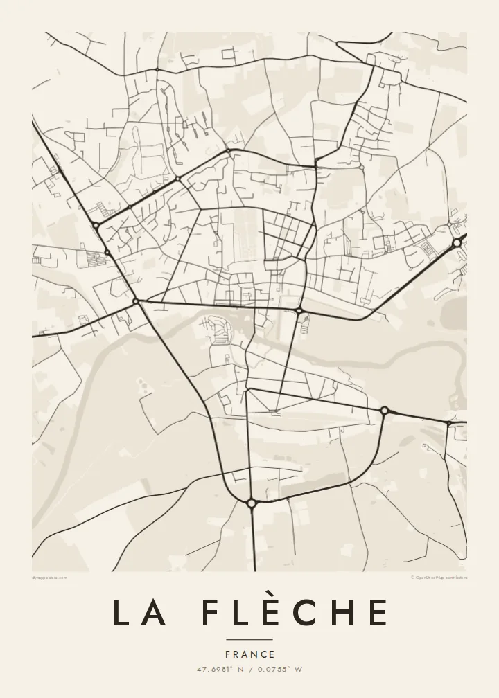
The former Jesuit college founded under Henri IV forms a large rectangular complex of buildings, courtyards and gardens, one of the most distinctive shapes on the map.
Minimalistik karta plakaty · Fransiýa
47.6981° N / 0.0755° W
A Loir valley town of broad avenues and river channels, with the long rectangle of the Prytanée at its heart.



Bir şäher, bäş keýp
Diwarda nähili görünjegini görmek üçin stile basyň. Ähli stiller bir bahadan — çap edilen, çarçuwaly ýa-da HD faýl görnüşinde.
 Hakyky pikseller · 24 × 36″ çap faýly
Çapda aýdyň
Bu hakyky çap faýlynyň 100% kesigi. Her poster — çap edilen, çarçuwaly ýa-da ýüklenen — serwerlerimizde 300 DPI, 7,200 × 10,800 piksele çenli işlenip taýýarlanýar, şonuň üçin iň kiçi köçeler hem 24 × 36″ çapda arassa görünýär.
Diwarda


Karta
La Flèche lies on the Loir in the Sarthe department, between Le Mans and Angers. Its best-known institution is the Prytanée national militaire, which was founded in 1604 as a Jesuit college under Henri IV. René Descartes was one of its pupils. Today it is a military school, and its large grounds still dominate the centre of town.
The town has a legible plan. The Loir and its side channels run past the centre, with a mill, quays and bridges. Straight streets and wide squares show a degree of planning unusual for a town of this size. Beyond the centre, residential districts spread onto the plateau, and the surroundings include woodland and the zoo that the town is also known for.
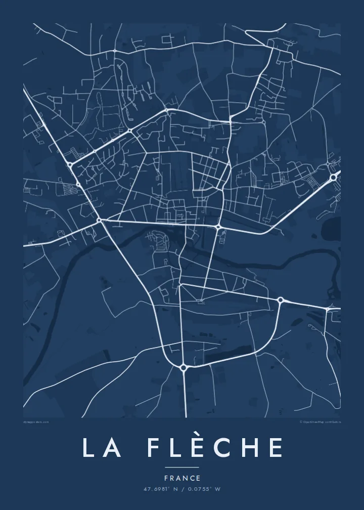
A La Flèche map poster puts the river and the Prytanée in dialogue. The water curves along one side of the old town, while the school's grounds form a large, calm geometric block. Streets radiate outward to the ring of newer districts, giving the print a balanced, readable structure.
The former Jesuit college founded under Henri IV forms a large rectangular complex of buildings, courtyards and gardens, one of the most distinctive shapes on the map.
The Loir passes the old town in several arms, with bridges and quays, drawing soft curves along the southern side of the centre.
Wide, direct streets and squares link the centre's key points, a clear urban pattern that makes the heart of La Flèche easy to read from above.
Özüňiziňki ediň
Sene, at ýa-da öz setiriňizi goşuň, stili, ölçegi ýa-da ugry üýtgediň.
Mugt deslapky görnüş pes durulykda we suw belgili. Çaplar we HD faýllar suw belgisiz, 300 DPI, 7,200 × 10,800 px çenli işlenip taýýarlanýar.
Näme üçin La Flèche
La Flèche means a lot to former pupils of the Prytanée, their families, and anyone who knows the Loir valley. The poster captures that combination of river and school in a form that is quiet and easy to recognise.
You can personalise the title, subtitle and coordinates, for instance with a graduating year, and choose one of five styles. Digital files cost $9 in six sizes, including A2 and 50×70 cm. Framed or unframed prints are also available.
La Flèche posterini sargyt ediň| Çap ölçegi | Çözgüt | Faýllar |
|---|---|---|
| 30 × 40 cm (11.8 × 15.7″) | 3,543 × 4,724 px | PNG · PDF |
| 29.7 × 42 cm (A3, 11.7 × 16.5″) | 3,508 × 4,961 px | PNG · PDF |
| 42 × 59.4 cm (A2, 16.5 × 23.4″) | 4,961 × 7,016 px | PNG · PDF |
| 45.7 × 61 cm (18 × 24″) | 5,400 × 7,200 px | PNG · PDF |
| 50 × 70 cm (19.7 × 27.6″) | 5,906 × 8,268 px | PNG · PDF |
| 61 × 91.4 cm (24 × 36″) | 7,200 × 10,800 px | PNG · PDF |
Deňeşdirmek üçin: mugt nusga 900 px giňlikde, suw belgili we ekranlar üçin niýetlenen. HD faýllaryň çözgüdi her tarapa 8 esse çenli ýokary we doly plakat ölçeginde arassa çap edilýär.
Sahypanyň ýokarsyndan stili saýlaň, soňra Çap edilen Poster — ölçegini we isleseňiz çarçuwasyny — ýa-da Sanly HD Faýllary saýlaň. Töleg bir ädimde amala aşyrylýar, tölegiňiz geçen dessine sargyt sahypaňyz täzelenýär.
Ol ýokary hilli 200 gsm mat kagyza, alty ölçegiň birinde, 30 × 40 sm-den 24 × 36″-a çenli çap edilýär. Çap edilen posterler {printFrom}-dan başlaýar, eltip bermek bahasy girýär.
Hawa. Gara, ak, tebigy dub ýa-da garaňky agaç reňkinde tutuş agaç çarçuwany saýlaň. Ol döwülmeýän aýna bilen gelýär we asmaga taýýar. Çarçuwaly posterler {framedFrom}-dan başlaýar, eltip bermek bahasy girýär.
Eltip bermek dünýäniň ähli ýerinde mugt. Her poster 30-dan gowrak ýurtdaky çap hyzmatdaşlarymyzyň iň ýakynynda çap edilýär we adatça 3–7 iş gününde gelýär. Ýagdaýyny we yzarlamany Sargytlarym bölüminde görüp bilersiňiz.
Eltilenden soň 14 günüň dowamynda bize surat iberiň, biz ony mugt gaýtadan çap ederis ýa-da puluňyzy yzyna gaýtararys.
Hawa. Bu sahypadaky redaktorda ady, kiçi ady we koordinatlar setirini islän zadyňyza üýtgediň, soňra stil we ölçeg saýlaň. Çap edilen, çarçuwaly we sanly sargytlaryň ählisi siziň dizaýnyňyzy takyk ulanýar.
$9 üçin ähli alty ölçegde, suw belgisiz, islendik ýerde çap edip bolýan 300 DPI PNG we çap etmäge taýyn PDF faýllaryny alýarsyňyz. Entek gutarnykly karara gelmediňizmi? Ilki mugt, suw belgili deslapky görnüşi göçürip alyň.
Golaýda
