Kalamos headland
A massive limestone rock forms the island's eastern tip. On the map it reads as a sharp, heavy promontory, a counterweight to the rounded hills of the rest of the island.
Qeeqabak kaartah poster · Greece
36.3734° N / 25.7929° E
A small, rugged Cycladic island with a hilltop village and a great limestone headland reaching out to the southeast


Inki magaala, konoy gaba
Qande inkih tibbixeeh derre baguley table. Kulli qande missoowa caagid—daabbisimta, dirbaabu-le kaadu HD fayla akah.
 Cagalah pixels · 24 × 36″ daabbi fayla
Maxxaacah qeeqa
Tama usuk cagalah daabbi faylak 100% qambaala. Kulli poster — daabbisimta, dirbaabu-le kaadu download geytimta — ni-server-ittal 300 DPI-l ederimta, 7,200 × 10,800 pixels fanah, tokkel iyyi ellee catoy 24 × 36″ daabbi baxsi bahisak raaqu.
Gidarih


Kaarta
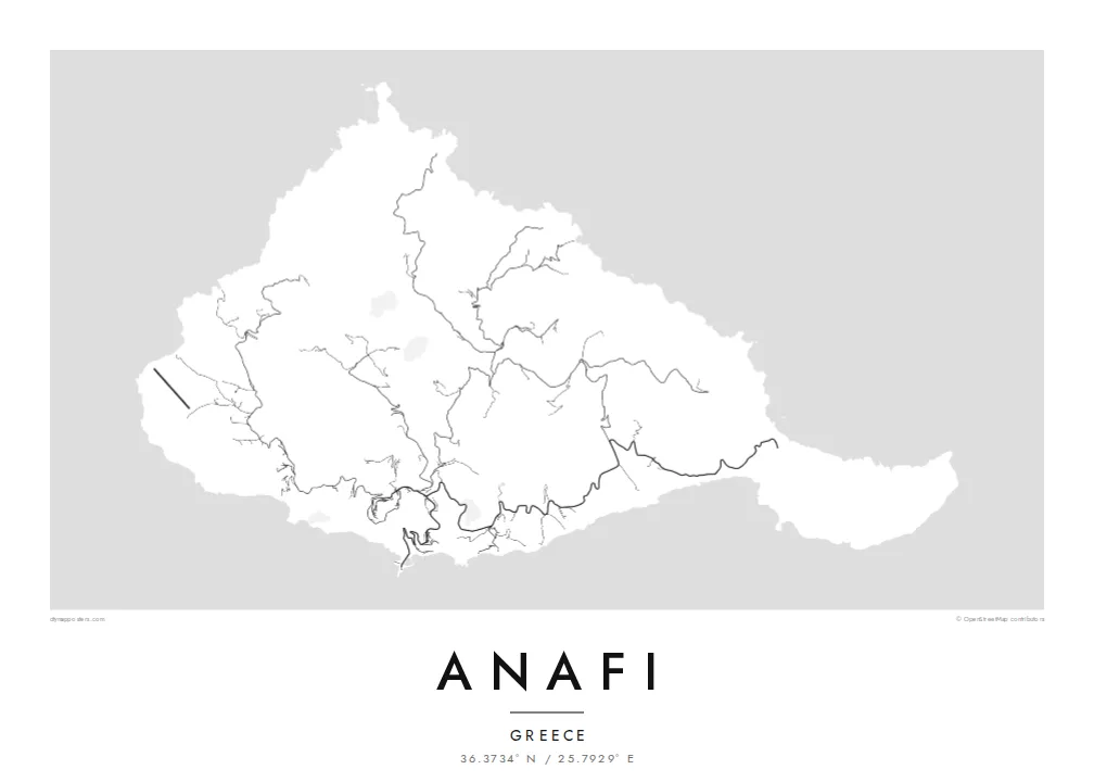
From above, Anafi looks like a compact knot of hills that ends in a long eastern arm. Roads are few and short. They climb from the small harbour to the white village of Chora on its ridge, then thin into footpaths that follow the valleys down to sheltered beaches on the south coast. Most of the island is bare slope, so the contour of the coastline carries most of the drawing.
The eastern arm ends at Kalamos, a huge limestone rock that rises straight from the sea and is often counted among the largest monoliths in the Mediterranean. A monastery sits high on its flank. In Greek myth, Apollo made the island appear out of the sea to shelter the Argonauts in a storm, and its name is usually linked to that moment of appearing.
An Anafi map poster works because there is so little on it. There is the harbour, a single winding road, the cluster of Chora and a scatter of chapels and tracks across the hills. Around it all, the Aegean fills the frame. Anafi lies just east of Santorini, but the map shows a much quieter place: an island measured in footpaths rather than streets.
A massive limestone rock forms the island's eastern tip. On the map it reads as a sharp, heavy promontory, a counterweight to the rounded hills of the rest of the island.
The main village sits high above the harbour, a tight cluster of lanes joined to the sea by one looping road. It is the densest set of lines on the whole island.
A row of small bays along the southern shore is reached by paths rather than roads. They cut a gentle scalloped edge into the coastline.
Kok tanim ab
Ayro, migaq hinnay kok tan xagar osis; gaba, ballaqa hinnay xiqa soorris.
Free preview qansarissi kee watermark-le. Daabbisimtaan kee HD fayla 300 DPI-l, 7,200 × 10,800 px fanah, watermark maleh ederimta.
Macah Anafi
Anafi tends to stay with people who went looking for the quieter end of the Cyclades, walked its paths and caught the ferry onward with some reluctance. The spare outline suits a calm wall, and the dark sea of the Noir style frames the island especially well.
Put your own words in the title and subtitle, such as the year you arrived or the name of the beach you walked to, and choose from five styles: Classic black & white, Noir, Paper, Blueprint or Sand. Download the HD files for $9, or order a matte print.
Anafi poster orme| Maxxaacah ballaqa | Qeeqa | Faylal |
|---|---|---|
| 30 × 40 cm (11.8 × 15.7″) | 3,543 × 4,724 px | PNG · PDF |
| 29.7 × 42 cm (A3, 11.7 × 16.5″) | 3,508 × 4,961 px | PNG · PDF |
| 42 × 59.4 cm (A2, 16.5 × 23.4″) | 4,961 × 7,016 px | PNG · PDF |
| 45.7 × 61 cm (18 × 24″) | 5,400 × 7,200 px | PNG · PDF |
| 50 × 70 cm (19.7 × 27.6″) | 5,906 × 8,268 px | PNG · PDF |
| 61 × 91.4 cm (24 × 36″) | 7,200 × 10,800 px | PNG · PDF |
Tabbaltah, limo-wayta xaqqa-le ablo 900 px ballaqa le, asta le, iskiriinih keh tan. HD faylal gexsoh inkih addal 8× fanah qeeqa le, poster ballaqa inkih addal meqeh maxxaacimta.
Baxxaqqa qari le qandiy dooriy, tohuk lakal Daabbisimtah Poster — kutuk kee, faxximek, dirbaabu — hinnay HD Digital Fayla dooru. Checkout inki wagitti geytima, kaadu ku-orme page keenih adissa akke waqdi caagoy kummite.
Usuk 200 gsm-le catam kutuk warqatal, lica katiy caagitte {printFrom}-ik hane ayta 30 × 40 cm-ik 24 × 36″ fanah, xaagu keenil warreeh.
Ee. Sarrah-le dirbaabu doori — bad, gudduc, oak-le hinnay bad-madabuy. Usuk finqisiimam ellee sange qarab-le kaadu qari umukku iyya keenih taagu. Dirbaabu-le poster {framedFrom}-ik hane, xaagu keenil warreeh.
Xaagu addunyal inkih cisab-le. Kulli poster 30+ ummattak ni-daabbi-mara mananih xayyoysa kaadu 3–7 caagu-ayróh fanah geeytima. Ku-orme kee xaagu tarikiy My Orders addal ablitta.
Geytimeek 14 ayróy addal foto naah rubbaay, cisab-le daabbisiynah hinnay ku-lacay gacisnaah.
Ee. Tama page-l edito addal, migaaq, subtitle kee coordinates sarrah faxxem fanah badal, kaadu qande kee katiy doori. Daabbisimtah, dirbaabu-le kaadu digital orme inkih ku-design cagalah yekkelen.
$9 bacisak 300 DPI PNG kee daabbisimtah adissime PDF fayla lica katiy inkih, watermark maleh, ayyi meki daabbisimtah geeytitta. Cisab makkoysemty ana? Awqak, watermark-le free preview download-eh.
