Bago River
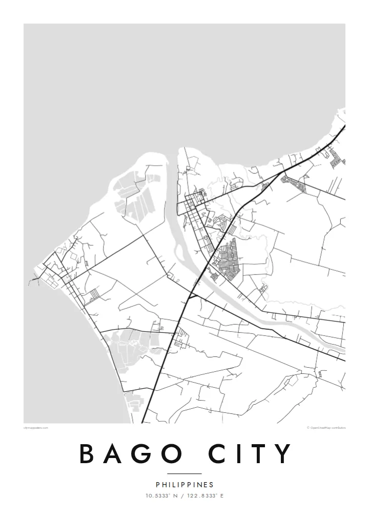
The river crosses the plain from the uplands to the coast, with the town centre close to its banks. On the map it is a clear curving line through the agricultural grid.
Qeeqabak kaartah poster · Philippines
10.5333° N / 122.8333° E
A sugar city on the coastal plain of Negros, stretching from the Guimaras Strait inland toward the slopes of Kanlaon.


Inki magaala, konoy gaba
Qande inkih tibbixeeh derre baguley table. Kulli qande missoowa caagid—daabbisimta, dirbaabu-le kaadu HD fayla akah.
 Cagalah pixels · 24 × 36″ daabbi fayla
Maxxaacah qeeqa
Tama usuk cagalah daabbi faylak 100% qambaala. Kulli poster — daabbisimta, dirbaabu-le kaadu download geytimta — ni-server-ittal 300 DPI-l ederimta, 7,200 × 10,800 pixels fanah, tokkel iyyi ellee catoy 24 × 36″ daabbi baxsi bahisak raaqu.
Gidarih


Kaarta
Bago City lies on the western side of Negros Island, just south of Bacolod, on a broad plain that rises gently from the Guimaras Strait toward the mountains of the interior. From above, the compact town centre sits near the Bago River, surrounded by an immense pattern of sugarcane fields, farm roads and scattered villages that stretch inland across the city's large territory.
Like much of Negros Occidental, Bago developed around sugar, and cane fields still shape almost every part of the map. The city is the birthplace of General Juan Araneta, a leader of the 1898 revolution on Negros, and to the east its territory reaches toward Mount Kanlaon, the island's highest peak and an active volcano.
A Bago City map poster captures the scale of this landscape: the river winding toward the sea, the town at its banks, the long roads across the plantations and the rising ground in the east. In black and white, the field boundaries and roads form a precise pattern of lines, like a surveyor's drawing.
The river crosses the plain from the uplands to the coast, with the town centre close to its banks. On the map it is a clear curving line through the agricultural grid.
Large plantation fields divided by farm roads cover much of the city's land. From above they create a wide, geometric mosaic that gives the poster its character.
To the west the city reaches the Guimaras Strait, where the plain meets the sea along a low, gently curving shore. It forms a quiet edge to the composition and a counterpoint to the fields.
Kok tanim ab
Ayro, migaq hinnay kok tan xagar osis; gaba, ballaqa hinnay xiqa soorris.
Free preview qansarissi kee watermark-le. Daabbisimtaan kee HD fayla 300 DPI-l, 7,200 × 10,800 px fanah, watermark maleh ederimta.
Macah Bago City
For people from Bago City, whether they still live on Negros or work abroad, a map of the town and its fields is a way of keeping home close. It also makes a considered gift for a homecoming, a graduation or a wedding.
Add a title, subtitle and coordinates line with a barangay name or a meaningful date, and choose one of five styles: Classic black & white, Noir, Paper, Blueprint or Sand. Sand pairs naturally with the colours of the cane fields.
Bago City poster orme| Maxxaacah ballaqa | Qeeqa | Faylal |
|---|---|---|
| 30 × 40 cm11.8 × 15.7″ | 3,543 × 4,724 px | PNG · PDF |
| 29.7 × 42 cm (A3)11.7 × 16.5″ | 3,508 × 4,961 px | PNG · PDF |
| 42 × 59.4 cm (A2)16.5 × 23.4″ | 4,961 × 7,016 px | PNG · PDF |
| 45.7 × 61 cm18 × 24″ | 5,400 × 7,200 px | PNG · PDF |
| 50 × 70 cm19.7 × 27.6″ | 5,906 × 8,268 px | PNG · PDF |
| 61 × 91.4 cm24 × 36″ | 7,200 × 10,800 px | PNG · PDF |
Tabbaltah, limo-wayta xaqqa-le ablo 900 px ballaqa le, asta le, iskiriinih keh tan. HD faylal gexsoh inkih addal 8× fanah qeeqa le, poster ballaqa inkih addal meqeh maxxaacimta.
Baxxaqqa qari le qandiy dooriy, tohuk lakal Daabbisimtah Poster — kutuk kee, faxximek, dirbaabu — hinnay HD Digital Fayla dooru. Checkout inki wagitti geytima, kaadu ku-orme page keenih adissa akke waqdi caagoy kummite.
Usuk 200 gsm-le catam kutuk warqatal, lica katiy caagitte $39-ik hane ayta 30 × 40 cm-ik 24 × 36″ fanah, xaagu keenil warreeh.
Ee. Sarrah-le dirbaabu doori — bad, gudduc, oak-le hinnay bad-madabuy. Usuk finqisiimam ellee sange qarab-le kaadu qari umukku iyya keenih taagu. Dirbaabu-le poster $99-ik hane, xaagu keenil warreeh.
Dirsa 60+ baaxoh bilsa. Poster kasa 30+ baaxoh nel print kaadu yan kee dirgeh kaxxa kee tanah printa, kee 3–7 xaqu ayyaamah yaaxigeeh. Xaaloo kee tracking "Ac Order" gexsitam. Kaadu baaxo 2–5 isbuuc yaaxigeeh, nanu dirsi yanin baaxoh sajiitah site ku kalah tekkeh.
Geytimeek 14 ayróy addal foto naah rubbaay, cisab-le daabbisiynah hinnay ku-lacay gacisnaah.
Ee. Tama page-l edito addal, migaaq, subtitle kee coordinates sarrah faxxem fanah badal, kaadu qande kee katiy doori. Daabbisimtah, dirbaabu-le kaadu digital orme inkih ku-design cagalah yekkelen.
$9 bacisak 300 DPI PNG kee daabbisimtah adissime PDF fayla lica katiy inkih, watermark maleh, ayyi meki daabbisimtah geeytitta. Cisab makkoysemty ana? Awqak, watermark-le free preview download-eh.
Xayyo
