Tidal creeks
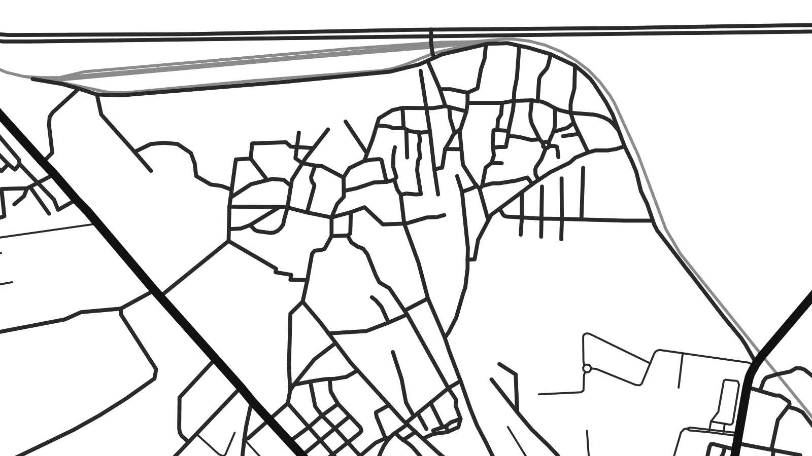
Narrow channels wind through the mudflats around the town, splitting and rejoining in patterns that look almost like tree branches when drawn from above.
Qeeqabak kaartah poster · India
22.5014° N / 70.0436° E
A small port on the southern shore of the Gulf of Kutch, where tidal creeks and mudflats meet the edge of Jamnagar


Inki magaala, konoy gaba
Qande inkih tibbixeeh derre baguley table. Kulli qande missoowa caagid—daabbisimta, dirbaabu-le kaadu HD fayla akah.
 Cagalah pixels · 24 × 36″ daabbi fayla
Maxxaacah qeeqa
Tama usuk cagalah daabbi faylak 100% qambaala. Kulli poster — daabbisimta, dirbaabu-le kaadu download geytimta — ni-server-ittal 300 DPI-l ederimta, 7,200 × 10,800 pixels fanah, tokkel iyyi ellee catoy 24 × 36″ daabbi baxsi bahisak raaqu.
Gidarih


Kaarta
Bedi lies on the Gulf of Kutch, just north of Jamnagar in Gujarat, where the coastline dissolves into creeks, salt flats and tidal mud. On a map, the town is a compact patch of streets on firm ground, bordered by a tangle of channels that change with the tides and stretch out towards the open water of the gulf.
Its port has long served Jamnagar, historically as the harbour of the princely state of Nawanagar, and it still handles cargo today. The waters offshore belong to the Marine National Park of the Gulf of Kutch, the first marine national park in India, known for its coral reefs, mangroves and scattered islands.
A Bedi map poster makes the most of this changeable shoreline. The creeks and flats produce intricate, branching forms, and their contrast with the straight lines of the town and its roads gives the composition a quietly striking look, particularly in the Blueprint and Noir styles.
Narrow channels wind through the mudflats around the town, splitting and rejoining in patterns that look almost like tree branches when drawn from above.
The port area pushes out towards the water, its jetties and access roads forming the clearest straight lines along an otherwise irregular coast.
The broad waters of the gulf fill the northern side of the map, fringed by mangroves and flats that are protected as part of the Marine National Park.
Kok tanim ab
Ayro, migaq hinnay kok tan xagar osis; gaba, ballaqa hinnay xiqa soorris.
Free preview qansarissi kee watermark-le. Daabbisimtaan kee HD fayla 300 DPI-l, 7,200 × 10,800 px fanah, watermark maleh ederimta.
Macah Bedi
People from Jamnagar and the surrounding coast choose Bedi for its connection to the sea and to family working lives at the port. It is also a striking map for anyone who simply likes coastlines, since the creeks make an unusual and graceful pattern.
Personalise the title, subtitle and coordinates line, and select from Classic black & white, Noir, Paper, Blueprint or Sand. The $9 HD download covers six print sizes as PNG and PDF, and printed posters can be shipped framed or unframed.
Bedi poster orme| Maxxaacah ballaqa | Qeeqa | Faylal |
|---|---|---|
| 30 × 40 cm (11.8 × 15.7″) | 3,543 × 4,724 px | PNG · PDF |
| 29.7 × 42 cm (A3, 11.7 × 16.5″) | 3,508 × 4,961 px | PNG · PDF |
| 42 × 59.4 cm (A2, 16.5 × 23.4″) | 4,961 × 7,016 px | PNG · PDF |
| 45.7 × 61 cm (18 × 24″) | 5,400 × 7,200 px | PNG · PDF |
| 50 × 70 cm (19.7 × 27.6″) | 5,906 × 8,268 px | PNG · PDF |
| 61 × 91.4 cm (24 × 36″) | 7,200 × 10,800 px | PNG · PDF |
Tabbaltah, limo-wayta xaqqa-le ablo 900 px ballaqa le, asta le, iskiriinih keh tan. HD faylal gexsoh inkih addal 8× fanah qeeqa le, poster ballaqa inkih addal meqeh maxxaacimta.
Baxxaqqa qari le qandiy dooriy, tohuk lakal Daabbisimtah Poster — kutuk kee, faxximek, dirbaabu — hinnay HD Digital Fayla dooru. Checkout inki wagitti geytima, kaadu ku-orme page keenih adissa akke waqdi caagoy kummite.
Usuk 200 gsm-le catam kutuk warqatal, lica katiy caagitte {printFrom}-ik hane ayta 30 × 40 cm-ik 24 × 36″ fanah, xaagu keenil warreeh.
Ee. Sarrah-le dirbaabu doori — bad, gudduc, oak-le hinnay bad-madabuy. Usuk finqisiimam ellee sange qarab-le kaadu qari umukku iyya keenih taagu. Dirbaabu-le poster {framedFrom}-ik hane, xaagu keenil warreeh.
Xaagu addunyal inkih cisab-le. Kulli poster 30+ ummattak ni-daabbi-mara mananih xayyoysa kaadu 3–7 caagu-ayróh fanah geeytima. Ku-orme kee xaagu tarikiy My Orders addal ablitta.
Geytimeek 14 ayróy addal foto naah rubbaay, cisab-le daabbisiynah hinnay ku-lacay gacisnaah.
Ee. Tama page-l edito addal, migaaq, subtitle kee coordinates sarrah faxxem fanah badal, kaadu qande kee katiy doori. Daabbisimtah, dirbaabu-le kaadu digital orme inkih ku-design cagalah yekkelen.
$9 bacisak 300 DPI PNG kee daabbisimtah adissime PDF fayla lica katiy inkih, watermark maleh, ayyi meki daabbisimtah geeytitta. Cisab makkoysemty ana? Awqak, watermark-le free preview download-eh.
Xayyo
