İstiklal Avenue
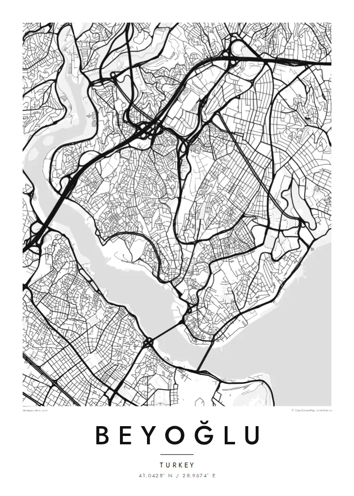
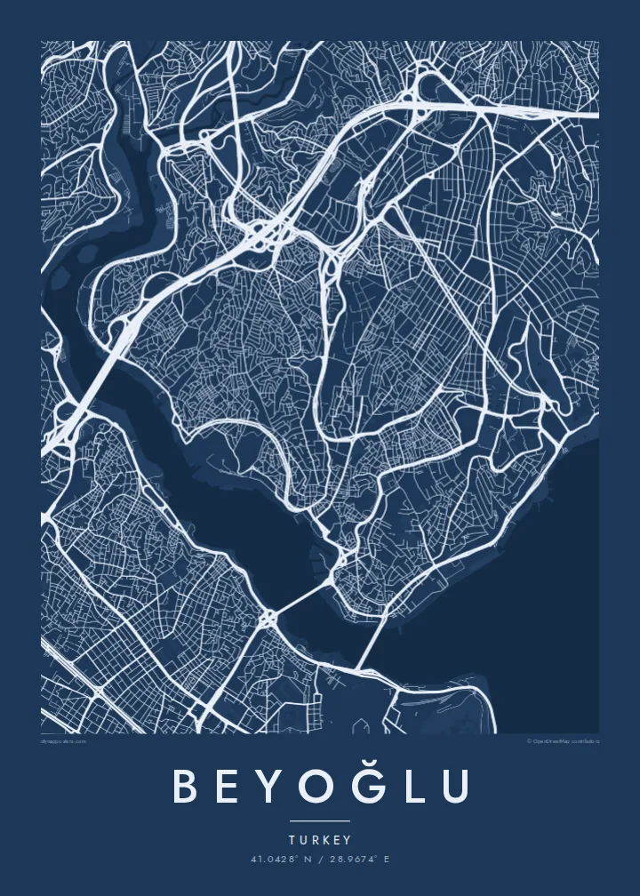
The pedestrian avenue from Taksim to Tünel follows the ridge in a long, slightly curving line. It is the clearest single stroke on the map.
Qeeqabak kaartah poster · Türkiye
41.0428° N / 28.9674° E
A hilly district above the Golden Horn and Bosphorus, with a pedestrian avenue running along the ridge from Taksim to Galata



Inki magaala, konoy gaba
Qande inkih tibbixeeh derre baguley table. Kulli qande missoowa caagid—daabbisimta, dirbaabu-le kaadu HD fayla akah.
 Cagalah pixels · 24 × 36″ daabbi fayla
Maxxaacah qeeqa
Tama usuk cagalah daabbi faylak 100% qambaala. Kulli poster — daabbisimta, dirbaabu-le kaadu download geytimta — ni-server-ittal 300 DPI-l ederimta, 7,200 × 10,800 pixels fanah, tokkel iyyi ellee catoy 24 × 36″ daabbi baxsi bahisak raaqu.
Gidarih


Kaarta
Beyoğlu covers the high ground north of the Golden Horn, where the land rises steeply from the water to a long ridge. The streets follow that terrain. Short, steep lanes and stairways drop down towards Karaköy and the Bosphorus shore, while the main avenue runs along the top. On the map, the district looks like a spine with ribs.
That spine is İstiklal Avenue, a pedestrian street about a kilometre and a half long. It links Taksim Square at the northern end to Tünel near the Galata Tower. A red heritage tram runs along it. At the southern end, the Tünel funicular, opened in 1875, carries passengers down the slope to Karaköy and is one of the oldest underground railways in the world.
Once known as Pera, the district was home to embassies, merchants and a large non-Muslim population in the late Ottoman period. Many of its apartment buildings and arcades date from that time. A Beyoğlu map poster shows how steep ground, a single strong avenue and two bodies of water shaped one of Istanbul's most distinctive districts.
The pedestrian avenue from Taksim to Tünel follows the ridge in a long, slightly curving line. It is the clearest single stroke on the map.
The medieval stone tower stands on the southern slope above Karaköy. It marks the point where the district begins its descent to the Golden Horn.
Short, steep streets and flights of steps connect the ridge to the waterfront, giving the map a dense, fine-grained texture on its southern and eastern edges.
Kok tanim ab
Ayro, migaq hinnay kok tan xagar osis; gaba, ballaqa hinnay xiqa soorris.
Free preview qansarissi kee watermark-le. Daabbisimtaan kee HD fayla 300 DPI-l, 7,200 × 10,800 px fanah, watermark maleh ederimta.
Macah Beyoğlu
Beyoğlu is where many people lived their Istanbul years, whether as students, new arrivals or night owls. A map of its ridge and slopes holds those streets together more faithfully than any photograph.
Personalise the title and subtitle with a date, an address or a line of your own. Choose one of five styles. Noir suits the district's late evenings, while Paper gives it the look of an old city plan.
Beyoğlu poster orme| Maxxaacah ballaqa | Qeeqa | Faylal |
|---|---|---|
| 30 × 40 cm (11.8 × 15.7″) | 3,543 × 4,724 px | PNG · PDF |
| 29.7 × 42 cm (A3, 11.7 × 16.5″) | 3,508 × 4,961 px | PNG · PDF |
| 42 × 59.4 cm (A2, 16.5 × 23.4″) | 4,961 × 7,016 px | PNG · PDF |
| 45.7 × 61 cm (18 × 24″) | 5,400 × 7,200 px | PNG · PDF |
| 50 × 70 cm (19.7 × 27.6″) | 5,906 × 8,268 px | PNG · PDF |
| 61 × 91.4 cm (24 × 36″) | 7,200 × 10,800 px | PNG · PDF |
Tabbaltah, limo-wayta xaqqa-le ablo 900 px ballaqa le, asta le, iskiriinih keh tan. HD faylal gexsoh inkih addal 8× fanah qeeqa le, poster ballaqa inkih addal meqeh maxxaacimta.
Baxxaqqa qari le qandiy dooriy, tohuk lakal Daabbisimtah Poster — kutuk kee, faxximek, dirbaabu — hinnay HD Digital Fayla dooru. Checkout inki wagitti geytima, kaadu ku-orme page keenih adissa akke waqdi caagoy kummite.
Usuk 200 gsm-le catam kutuk warqatal, lica katiy caagitte {printFrom}-ik hane ayta 30 × 40 cm-ik 24 × 36″ fanah, xaagu keenil warreeh.
Ee. Sarrah-le dirbaabu doori — bad, gudduc, oak-le hinnay bad-madabuy. Usuk finqisiimam ellee sange qarab-le kaadu qari umukku iyya keenih taagu. Dirbaabu-le poster {framedFrom}-ik hane, xaagu keenil warreeh.
Xaagu addunyal inkih cisab-le. Kulli poster 30+ ummattak ni-daabbi-mara mananih xayyoysa kaadu 3–7 caagu-ayróh fanah geeytima. Ku-orme kee xaagu tarikiy My Orders addal ablitta.
Geytimeek 14 ayróy addal foto naah rubbaay, cisab-le daabbisiynah hinnay ku-lacay gacisnaah.
Ee. Tama page-l edito addal, migaaq, subtitle kee coordinates sarrah faxxem fanah badal, kaadu qande kee katiy doori. Daabbisimtah, dirbaabu-le kaadu digital orme inkih ku-design cagalah yekkelen.
$9 bacisak 300 DPI PNG kee daabbisimtah adissime PDF fayla lica katiy inkih, watermark maleh, ayyi meki daabbisimtah geeytitta. Cisab makkoysemty ana? Awqak, watermark-le free preview download-eh.
Xayyo
