Humber Arm
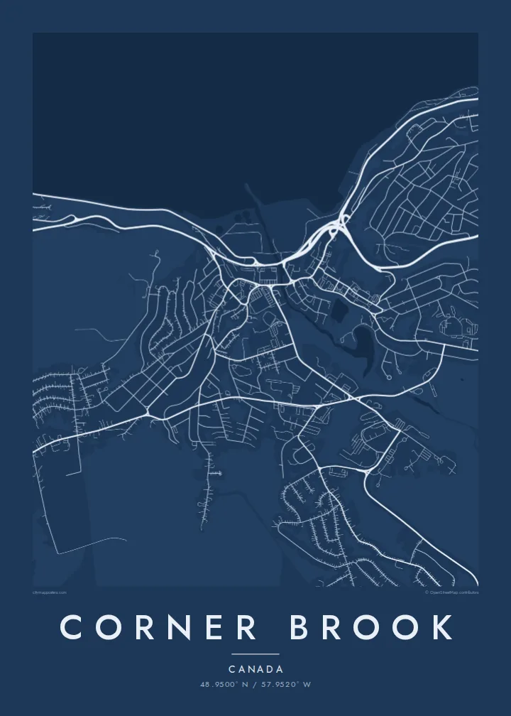
The long inlet runs inland from the Bay of Islands and ends at the city, giving the map a strong band of water along its lower edge.
Qeeqabak kaartah poster · Canada
48.9500° N / 57.9520° W
A city built on steep slopes above the Humber Arm, with its paper mill on the waterfront and streets winding uphill.



Inki magaala, konoy gaba
Qande inkih tibbixeeh derre baguley table. Kulli qande missoowa caagid—daabbisimta, dirbaabu-le kaadu HD fayla akah.
 Cagalah pixels · 24 × 36″ daabbi fayla
Maxxaacah qeeqa
Tama usuk cagalah daabbi faylak 100% qambaala. Kulli poster — daabbisimta, dirbaabu-le kaadu download geytimta — ni-server-ittal 300 DPI-l ederimta, 7,200 × 10,800 pixels fanah, tokkel iyyi ellee catoy 24 × 36″ daabbi baxsi bahisak raaqu.
Gidarih


Kaarta
Corner Brook sits on the west coast of Newfoundland at the head of the Humber Arm, a long, fjord-like inlet of the Bay of Islands. The city is built on hillsides that rise sharply from the water, so its streets rarely run straight for long. From above they bend and double back across the slopes, while the industrial waterfront takes up the shoreline below.
The pulp and paper mill dominates that waterfront. It has shaped the city since the 1920s and is still its best-known landmark. Corner Brook formed from several separate communities that merged in 1956, and the older centres can still be read in the street pattern, as clusters of denser streets separated by steep ground and wooded gullies.
Captain James Cook surveyed this coast in the 1760s, and a monument to him overlooks the city. Marble Mountain ski resort lies a short way up the Humber Valley. A Corner Brook map poster works best with plenty of water in the frame, so the Humber Arm can be seen cutting inland between the hills.
The long inlet runs inland from the Bay of Islands and ends at the city, giving the map a strong band of water along its lower edge.
Roads curve and climb across steep ground in layered, contour-like lines, so the city looks nothing like a flat grid.
The paper mill occupies a broad stretch of the shoreline, and its large industrial footprint anchors the centre of the city on the map.
Kok tanim ab
Ayro, migaq hinnay kok tan xagar osis; gaba, ballaqa hinnay xiqa soorris.
Free preview qansarissi kee watermark-le. Daabbisimtaan kee HD fayla 300 DPI-l, 7,200 × 10,800 px fanah, watermark maleh ederimta.
Macah Corner Brook
Newfoundlanders who have moved to the mainland or further away often keep strong ties to home, and people speak of Corner Brook with real attachment. A print of the Humber Arm and the hills around it is a steady reminder of that.
Add a neighbourhood, a family name or a year to the title and subtitle, and keep the coordinates as a precise marker. Noir and Blueprint suit the dramatic terrain well, and all five styles come as printed posters or print-ready files.
Corner Brook poster orme| Maxxaacah ballaqa | Qeeqa | Faylal |
|---|---|---|
| 30 × 40 cm (11.8 × 15.7″) | 3,543 × 4,724 px | PNG · PDF |
| 29.7 × 42 cm (A3, 11.7 × 16.5″) | 3,508 × 4,961 px | PNG · PDF |
| 42 × 59.4 cm (A2, 16.5 × 23.4″) | 4,961 × 7,016 px | PNG · PDF |
| 45.7 × 61 cm (18 × 24″) | 5,400 × 7,200 px | PNG · PDF |
| 50 × 70 cm (19.7 × 27.6″) | 5,906 × 8,268 px | PNG · PDF |
| 61 × 91.4 cm (24 × 36″) | 7,200 × 10,800 px | PNG · PDF |
Tabbaltah, limo-wayta xaqqa-le ablo 900 px ballaqa le, asta le, iskiriinih keh tan. HD faylal gexsoh inkih addal 8× fanah qeeqa le, poster ballaqa inkih addal meqeh maxxaacimta.
Baxxaqqa qari le qandiy dooriy, tohuk lakal Daabbisimtah Poster — kutuk kee, faxximek, dirbaabu — hinnay HD Digital Fayla dooru. Checkout inki wagitti geytima, kaadu ku-orme page keenih adissa akke waqdi caagoy kummite.
Usuk 200 gsm-le catam kutuk warqatal, lica katiy caagitte {printFrom}-ik hane ayta 30 × 40 cm-ik 24 × 36″ fanah, xaagu keenil warreeh.
Ee. Sarrah-le dirbaabu doori — bad, gudduc, oak-le hinnay bad-madabuy. Usuk finqisiimam ellee sange qarab-le kaadu qari umukku iyya keenih taagu. Dirbaabu-le poster {framedFrom}-ik hane, xaagu keenil warreeh.
Xaagu addunyal inkih cisab-le. Kulli poster 30+ ummattak ni-daabbi-mara mananih xayyoysa kaadu 3–7 caagu-ayróh fanah geeytima. Ku-orme kee xaagu tarikiy My Orders addal ablitta.
Geytimeek 14 ayróy addal foto naah rubbaay, cisab-le daabbisiynah hinnay ku-lacay gacisnaah.
Ee. Tama page-l edito addal, migaaq, subtitle kee coordinates sarrah faxxem fanah badal, kaadu qande kee katiy doori. Daabbisimtah, dirbaabu-le kaadu digital orme inkih ku-design cagalah yekkelen.
$9 bacisak 300 DPI PNG kee daabbisimtah adissime PDF fayla lica katiy inkih, watermark maleh, ayyi meki daabbisimtah geeytitta. Cisab makkoysemty ana? Awqak, watermark-le free preview download-eh.
