Udi escarpment
The high ground at the edge of the city limits growth in that direction, so streets thin out and curve as the terrain rises toward the hills where coal was once mined.
Qeeqabak kaartah poster · Nigeria
6.4413° N / 7.4988° E
A city spread across rolling land at the foot of an escarpment, cut by river valleys and wide layouts


Inki magaala, konoy gaba
Qande inkih tibbixeeh derre baguley table. Kulli qande missoowa caagid—daabbisimta, dirbaabu-le kaadu HD fayla akah.
 Cagalah pixels · 24 × 36″ daabbi fayla
Maxxaacah qeeqa
Tama usuk cagalah daabbi faylak 100% qambaala. Kulli poster — daabbisimta, dirbaabu-le kaadu download geytimta — ni-server-ittal 300 DPI-l ederimta, 7,200 × 10,800 pixels fanah, tokkel iyyi ellee catoy 24 × 36″ daabbi baxsi bahisak raaqu.
Gidarih


Kaarta
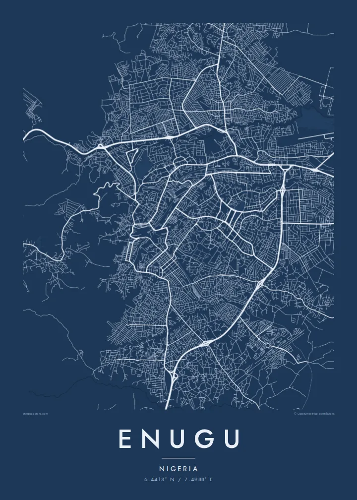
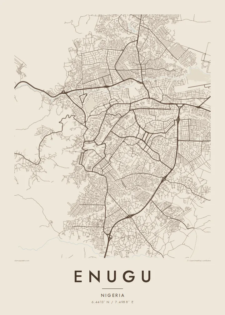
Enugu sits at the base of the Udi escarpment, and its map reflects that setting. The street pattern is uneven, bending around low ridges and dropping into valleys. The Ekulu River and its tributaries run through the city, leaving gaps and green corridors between neighbourhoods. In places the plan becomes more regular, where planned residential layouts were drawn out in grids and loops.
The city grew around coal. Deposits were found in the nearby hills in the early twentieth century, a railway followed to carry the coal south to the coast, and a town took shape around the mines. That origin gave Enugu its lasting nickname, the Coal City, and it later became an important administrative centre for the region.
An Enugu map poster traces the city across uneven ground, showing how roads follow valleys and ridgelines rather than a single axis. The eastern hills create a natural edge, while the city fans outward on gentler land to the west and south. It is a map shaped as much by terrain as by planning.
The high ground at the edge of the city limits growth in that direction, so streets thin out and curve as the terrain rises toward the hills where coal was once mined.
The river and its small tributaries wind through the urban area, opening green, unbuilt corridors that divide the city into clearly separated districts on the map.
Several residential areas were laid out with regular grids, crescents and looping roads, giving parts of the map a more geometric texture than the older, organic quarters.
Kok tanim ab
Ayro, migaq hinnay kok tan xagar osis; gaba, ballaqa hinnay xiqa soorris.
Free preview qansarissi kee watermark-le. Daabbisimtaan kee HD fayla 300 DPI-l, 7,200 × 10,800 px fanah, watermark maleh ederimta.
Macah Enugu
Enugu matters to people who grew up there, studied there or keep family ties to the region. Its irregular street pattern and river valleys give the map a textured, handmade quality that works well on a wall at home or in an office.
Add a custom title, subtitle and coordinates, perhaps a family name or a year. Pick from Classic black & white, Noir, Paper, Blueprint or Sand. Digital files include six print sizes, and printed posters ship from partners in more than 30 countries.
Enugu poster orme| Maxxaacah ballaqa | Qeeqa | Faylal |
|---|---|---|
| 30 × 40 cm11.8 × 15.7″ | 3,543 × 4,724 px | PNG · PDF |
| 29.7 × 42 cm (A3)11.7 × 16.5″ | 3,508 × 4,961 px | PNG · PDF |
| 42 × 59.4 cm (A2)16.5 × 23.4″ | 4,961 × 7,016 px | PNG · PDF |
| 45.7 × 61 cm18 × 24″ | 5,400 × 7,200 px | PNG · PDF |
| 50 × 70 cm19.7 × 27.6″ | 5,906 × 8,268 px | PNG · PDF |
| 61 × 91.4 cm24 × 36″ | 7,200 × 10,800 px | PNG · PDF |
Tabbaltah, limo-wayta xaqqa-le ablo 900 px ballaqa le, asta le, iskiriinih keh tan. HD faylal gexsoh inkih addal 8× fanah qeeqa le, poster ballaqa inkih addal meqeh maxxaacimta.
Baxxaqqa qari le qandiy dooriy, tohuk lakal Daabbisimtah Poster — kutuk kee, faxximek, dirbaabu — hinnay HD Digital Fayla dooru. Checkout inki wagitti geytima, kaadu ku-orme page keenih adissa akke waqdi caagoy kummite.
Usuk 200 gsm-le catam kutuk warqatal, lica katiy caagitte $39-ik hane ayta 30 × 40 cm-ik 24 × 36″ fanah, xaagu keenil warreeh.
Ee. Sarrah-le dirbaabu doori — bad, gudduc, oak-le hinnay bad-madabuy. Usuk finqisiimam ellee sange qarab-le kaadu qari umukku iyya keenih taagu. Dirbaabu-le poster $99-ik hane, xaagu keenil warreeh.
Dirsa 60+ baaxoh bilsa. Poster kasa 30+ baaxoh nel print kaadu yan kee dirgeh kaxxa kee tanah printa, kee 3–7 xaqu ayyaamah yaaxigeeh. Xaaloo kee tracking "Ac Order" gexsitam. Kaadu baaxo 2–5 isbuuc yaaxigeeh, nanu dirsi yanin baaxoh sajiitah site ku kalah tekkeh.
Geytimeek 14 ayróy addal foto naah rubbaay, cisab-le daabbisiynah hinnay ku-lacay gacisnaah.
Ee. Tama page-l edito addal, migaaq, subtitle kee coordinates sarrah faxxem fanah badal, kaadu qande kee katiy doori. Daabbisimtah, dirbaabu-le kaadu digital orme inkih ku-design cagalah yekkelen.
$9 bacisak 300 DPI PNG kee daabbisimtah adissime PDF fayla lica katiy inkih, watermark maleh, ayyi meki daabbisimtah geeytitta. Cisab makkoysemty ana? Awqak, watermark-le free preview download-eh.
Xayyo
