Niger waterfront
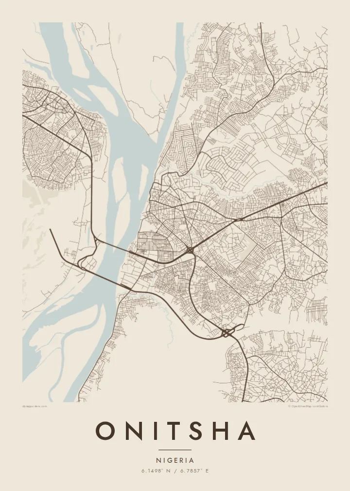
The wide river forms the entire western edge of the city, a smooth expanse that contrasts sharply with the dense street pattern pressed against its bank.
Qeeqabak kaartah poster · Nigeria
6.1498° N / 6.7857° E
A trading city on the Niger's eastern bank, facing Asaba across the wide river and its long road bridges.


Inki magaala, konoy gaba
Qande inkih tibbixeeh derre baguley table. Kulli qande missoowa caagid—daabbisimta, dirbaabu-le kaadu HD fayla akah.
 Cagalah pixels · 24 × 36″ daabbi fayla
Maxxaacah qeeqa
Tama usuk cagalah daabbi faylak 100% qambaala. Kulli poster — daabbisimta, dirbaabu-le kaadu download geytimta — ni-server-ittal 300 DPI-l ederimta, 7,200 × 10,800 pixels fanah, tokkel iyyi ellee catoy 24 × 36″ daabbi baxsi bahisak raaqu.
Gidarih


Kaarta
Onitsha lies on the east bank of the Niger River in Anambra State, at one of the main crossing points between eastern and western Nigeria. For centuries it has been a river port, and the city still turns toward the water, with markets, landings and main roads concentrated near the bank before the land rises to higher ground inland.
The Niger Bridge, opened in 1965, links Onitsha with Asaba on the opposite bank, and a second bridge downstream, opened to traffic in the early 2020s, draws another long line across the river. Onitsha Main Market, often described as one of the largest markets in West Africa, fills a dense block of streets near the waterfront and gives the city much of its economic weight.
The city is also remembered for Onitsha Market Literature, the pamphlets and chapbooks printed and sold here in the mid-twentieth century. An Onitsha map poster sets the tightly packed market districts, the network of roads leading inland and the broad sweep of the Niger against one another, a clear portrait of a city built on trade.
The wide river forms the entire western edge of the city, a smooth expanse that contrasts sharply with the dense street pattern pressed against its bank.
Near the river, the market area packs small blocks and narrow lanes into a tight cluster, the most intricate and crowded section of the map.
Long bridges cross the river toward Asaba, straight lines over open water that mark Onitsha's role as a gateway between the east and west of the country.
Kok tanim ab
Ayro, migaq hinnay kok tan xagar osis; gaba, ballaqa hinnay xiqa soorris.
Free preview qansarissi kee watermark-le. Daabbisimtaan kee HD fayla 300 DPI-l, 7,200 × 10,800 px fanah, watermark maleh ederimta.
Macah Onitsha
Many families across Nigeria and the diaspora trace their business or their roots to Onitsha. A map of the city, its market and its river is a meaningful gift for a trader, a returning relative or anyone who grew up there.
Add a family name, a shop, a year or a short line to the title and subtitle, and customise the coordinates. Choose Classic black & white, Noir, Paper, Blueprint or Sand, and print locally from the 300 DPI files.
Onitsha poster orme| Maxxaacah ballaqa | Qeeqa | Faylal |
|---|---|---|
| 30 × 40 cm (11.8 × 15.7″) | 3,543 × 4,724 px | PNG · PDF |
| 29.7 × 42 cm (A3, 11.7 × 16.5″) | 3,508 × 4,961 px | PNG · PDF |
| 42 × 59.4 cm (A2, 16.5 × 23.4″) | 4,961 × 7,016 px | PNG · PDF |
| 45.7 × 61 cm (18 × 24″) | 5,400 × 7,200 px | PNG · PDF |
| 50 × 70 cm (19.7 × 27.6″) | 5,906 × 8,268 px | PNG · PDF |
| 61 × 91.4 cm (24 × 36″) | 7,200 × 10,800 px | PNG · PDF |
Tabbaltah, limo-wayta xaqqa-le ablo 900 px ballaqa le, asta le, iskiriinih keh tan. HD faylal gexsoh inkih addal 8× fanah qeeqa le, poster ballaqa inkih addal meqeh maxxaacimta.
Baxxaqqa qari le qandiy dooriy, tohuk lakal Daabbisimtah Poster — kutuk kee, faxximek, dirbaabu — hinnay HD Digital Fayla dooru. Checkout inki wagitti geytima, kaadu ku-orme page keenih adissa akke waqdi caagoy kummite.
Usuk 200 gsm-le catam kutuk warqatal, lica katiy caagitte {printFrom}-ik hane ayta 30 × 40 cm-ik 24 × 36″ fanah, xaagu keenil warreeh.
Ee. Sarrah-le dirbaabu doori — bad, gudduc, oak-le hinnay bad-madabuy. Usuk finqisiimam ellee sange qarab-le kaadu qari umukku iyya keenih taagu. Dirbaabu-le poster {framedFrom}-ik hane, xaagu keenil warreeh.
Shipping is free worldwide. Each poster is printed by the nearest of our print partners in 30+ countries and usually arrives in 3–7 business days. You can follow the status and tracking under My Orders. A few countries take 2–5 weeks, and where we don't ship yet, the site tells you before you pay.
Geytimeek 14 ayróy addal foto naah rubbaay, cisab-le daabbisiynah hinnay ku-lacay gacisnaah.
Ee. Tama page-l edito addal, migaaq, subtitle kee coordinates sarrah faxxem fanah badal, kaadu qande kee katiy doori. Daabbisimtah, dirbaabu-le kaadu digital orme inkih ku-design cagalah yekkelen.
$9 bacisak 300 DPI PNG kee daabbisimtah adissime PDF fayla lica katiy inkih, watermark maleh, ayyi meki daabbisimtah geeytitta. Cisab makkoysemty ana? Awqak, watermark-le free preview download-eh.
Xayyo
