Hussain Sagar
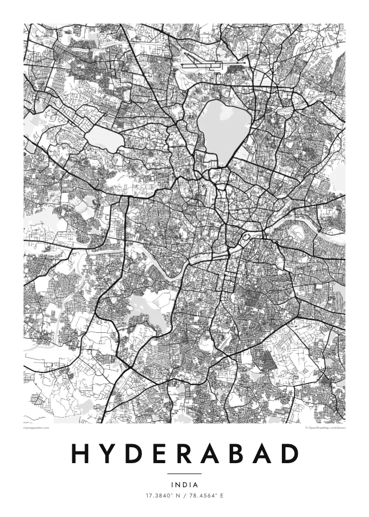
A sixteenth-century artificial lake near the centre of the map, with a large statue of the Buddha on an island and the Tank Bund road along its eastern side.
Qeeqabak kaartah poster · India
17.3840° N / 78.4564° E
A granite plateau city dotted with lakes, split by the Musi River between its historic south and its expanding north and west.


Inki magaala, konoy gaba
Qande inkih tibbixeeh derre baguley table. Kulli qande missoowa caagid—daabbisimta, dirbaabu-le kaadu HD fayla akah.
 Cagalah pixels · 24 × 36″ daabbi fayla
Maxxaacah qeeqa
Tama usuk cagalah daabbi faylak 100% qambaala. Kulli poster — daabbisimta, dirbaabu-le kaadu download geytimta — ni-server-ittal 300 DPI-l ederimta, 7,200 × 10,800 pixels fanah, tokkel iyyi ellee catoy 24 × 36″ daabbi baxsi bahisak raaqu.
Gidarih


Kaarta
Hyderabad sits on the Deccan Plateau, where rounded granite outcrops and dozens of lakes and tanks break up the street network. The Musi River crosses the city from west to east, and on the map it marks a clear boundary: south of it lies the old city founded in 1591, north of it the areas that grew under the Nizams and in the decades since.
At the heart of the old city stands the Charminar, the four-minaret monument from which the original streets were laid out, with markets such as Laad Bazaar branching off nearby. To the north, Hussain Sagar lake forms a large body of water between Hyderabad and its twin city Secunderabad, with the Tank Bund road running along its eastern embankment.
West of the centre, the landscape changes again. The ruins of Golconda Fort occupy a hill surrounded by old lanes, and further out the technology district known as HITEC City brings wide roads and large campuses. A Hyderabad map poster holds all of this together, ringed by the Outer Ring Road that now circles the metropolitan area.
A sixteenth-century artificial lake near the centre of the map, with a large statue of the Buddha on an island and the Tank Bund road along its eastern side.
Four arches and minarets at a crossroads from which the historic streets radiate, surrounded by one of the densest and most intricate street patterns in the city.
A winding river running west to east through the city, crossed by a series of bridges and separating the older southern quarters from the newer districts to the north.
Kok tanim ab
Ayro, migaq hinnay kok tan xagar osis; gaba, ballaqa hinnay xiqa soorris.
Free preview qansarissi kee watermark-le. Daabbisimtaan kee HD fayla 300 DPI-l, 7,200 × 10,800 px fanah, watermark maleh ederimta.
Macah Hyderabad
Hyderabad holds strong personal meaning for many people, whether they know it through family in the old city, years of study, or a career in the western tech districts. The map shows both worlds at once, and the lakes give it a calm balance that works well on a wall.
The title, subtitle and coordinates line can all be changed, so the poster can carry a name, a date or a neighbourhood. Choose among five styles, from Paper to Blueprint. Printed posters come on matte paper with an optional wooden frame, shipped through partners in more than 30 countries.
Hyderabad poster orme| Maxxaacah ballaqa | Qeeqa | Faylal |
|---|---|---|
| 30 × 40 cm11.8 × 15.7″ | 3,543 × 4,724 px | PNG · PDF |
| 29.7 × 42 cm (A3)11.7 × 16.5″ | 3,508 × 4,961 px | PNG · PDF |
| 42 × 59.4 cm (A2)16.5 × 23.4″ | 4,961 × 7,016 px | PNG · PDF |
| 45.7 × 61 cm18 × 24″ | 5,400 × 7,200 px | PNG · PDF |
| 50 × 70 cm19.7 × 27.6″ | 5,906 × 8,268 px | PNG · PDF |
| 61 × 91.4 cm24 × 36″ | 7,200 × 10,800 px | PNG · PDF |
Tabbaltah, limo-wayta xaqqa-le ablo 900 px ballaqa le, asta le, iskiriinih keh tan. HD faylal gexsoh inkih addal 8× fanah qeeqa le, poster ballaqa inkih addal meqeh maxxaacimta.
Baxxaqqa qari le qandiy dooriy, tohuk lakal Daabbisimtah Poster — kutuk kee, faxximek, dirbaabu — hinnay HD Digital Fayla dooru. Checkout inki wagitti geytima, kaadu ku-orme page keenih adissa akke waqdi caagoy kummite.
Usuk 200 gsm-le catam kutuk warqatal, lica katiy caagitte $39-ik hane ayta 30 × 40 cm-ik 24 × 36″ fanah, xaagu keenil warreeh.
Ee. Sarrah-le dirbaabu doori — bad, gudduc, oak-le hinnay bad-madabuy. Usuk finqisiimam ellee sange qarab-le kaadu qari umukku iyya keenih taagu. Dirbaabu-le poster $99-ik hane, xaagu keenil warreeh.
Dirsa 60+ baaxoh bilsa. Poster kasa 30+ baaxoh nel print kaadu yan kee dirgeh kaxxa kee tanah printa, kee 3–7 xaqu ayyaamah yaaxigeeh. Xaaloo kee tracking "Ac Order" gexsitam. Kaadu baaxo 2–5 isbuuc yaaxigeeh, nanu dirsi yanin baaxoh sajiitah site ku kalah tekkeh.
Geytimeek 14 ayróy addal foto naah rubbaay, cisab-le daabbisiynah hinnay ku-lacay gacisnaah.
Ee. Tama page-l edito addal, migaaq, subtitle kee coordinates sarrah faxxem fanah badal, kaadu qande kee katiy doori. Daabbisimtah, dirbaabu-le kaadu digital orme inkih ku-design cagalah yekkelen.
$9 bacisak 300 DPI PNG kee daabbisimtah adissime PDF fayla lica katiy inkih, watermark maleh, ayyi meki daabbisimtah geeytitta. Cisab makkoysemty ana? Awqak, watermark-le free preview download-eh.
