Indented coastline
Countless small bays, headlands and islets surround the island, producing an intricate edge that looks especially striking against open water on the map.
Qeeqabak kaartah poster · Japan
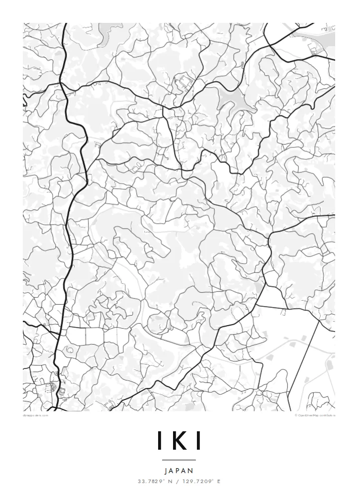
33.7829° N / 129.7209° E
An island city in the strait between Kyushu and Tsushima, low hills and small harbours tucked into a ragged coastline.


Inki magaala, konoy gaba
Qande inkih tibbixeeh derre baguley table. Kulli qande missoowa caagid—daabbisimta, dirbaabu-le kaadu HD fayla akah.
 Cagalah pixels · 24 × 36″ daabbi fayla
Maxxaacah qeeqa
Tama usuk cagalah daabbi faylak 100% qambaala. Kulli poster — daabbisimta, dirbaabu-le kaadu download geytimta — ni-server-ittal 300 DPI-l ederimta, 7,200 × 10,800 pixels fanah, tokkel iyyi ellee catoy 24 × 36″ daabbi baxsi bahisak raaqu.
Gidarih


Kaarta
Iki is an island city in Nagasaki Prefecture, set in the strait between northern Kyushu and Tsushima. The whole island fits on a single map: a compact, roughly rounded landmass with a heavily indented coastline, small bays and offshore islets. Inland, low hills and a surprisingly broad central plain are covered in fields and scattered villages rather than steep mountains.
Towns cluster around the harbours. Gōnoura in the southwest is the main ferry port, while Ashibe and others sit on sheltered inlets elsewhere on the coast. Roads loop between them across the island, and the network of rural lanes connecting farms gives the interior a fine, branching texture.
Iki has a long history as a stepping stone between Japan and the Asian mainland. The Harunotsuji site on the island is thought to be the centre of Ikikoku, one of the states mentioned in ancient Chinese records. The island is also known for barley shochu. An Iki map poster frames an entire island in one clear, legible shape.
Countless small bays, headlands and islets surround the island, producing an intricate edge that looks especially striking against open water on the map.
The main port sits in a sheltered bay on the southwest coast, where the densest streets meet ferry terminals and fishing piers.
The interior is unusually flat for an island in the region, with fields, farm roads and small settlements spread evenly across it.
Kok tanim ab
Ayro, migaq hinnay kok tan xagar osis; gaba, ballaqa hinnay xiqa soorris.
Free preview qansarissi kee watermark-le. Daabbisimtaan kee HD fayla 300 DPI-l, 7,200 × 10,800 px fanah, watermark maleh ederimta.
Macah Iki
Island maps have a completeness that city maps rarely do, and Iki is a fine example. It suits islanders who moved to the mainland, frequent visitors, and anyone drawn to Japan's quieter coastal places.
Add a name, a date or a line in Japanese to the title, subtitle and coordinates line. Choose among five styles, with Blueprint and Noir working especially well for coastlines, and download HD files for $9 or order a printed poster.
Iki poster orme| Maxxaacah ballaqa | Qeeqa | Faylal |
|---|---|---|
| 30 × 40 cm (11.8 × 15.7″) | 3,543 × 4,724 px | PNG · PDF |
| 29.7 × 42 cm (A3, 11.7 × 16.5″) | 3,508 × 4,961 px | PNG · PDF |
| 42 × 59.4 cm (A2, 16.5 × 23.4″) | 4,961 × 7,016 px | PNG · PDF |
| 45.7 × 61 cm (18 × 24″) | 5,400 × 7,200 px | PNG · PDF |
| 50 × 70 cm (19.7 × 27.6″) | 5,906 × 8,268 px | PNG · PDF |
| 61 × 91.4 cm (24 × 36″) | 7,200 × 10,800 px | PNG · PDF |
Tabbaltah, limo-wayta xaqqa-le ablo 900 px ballaqa le, asta le, iskiriinih keh tan. HD faylal gexsoh inkih addal 8× fanah qeeqa le, poster ballaqa inkih addal meqeh maxxaacimta.
Baxxaqqa qari le qandiy dooriy, tohuk lakal Daabbisimtah Poster — kutuk kee, faxximek, dirbaabu — hinnay HD Digital Fayla dooru. Checkout inki wagitti geytima, kaadu ku-orme page keenih adissa akke waqdi caagoy kummite.
Usuk 200 gsm-le catam kutuk warqatal, lica katiy caagitte {printFrom}-ik hane ayta 30 × 40 cm-ik 24 × 36″ fanah, xaagu keenil warreeh.
Ee. Sarrah-le dirbaabu doori — bad, gudduc, oak-le hinnay bad-madabuy. Usuk finqisiimam ellee sange qarab-le kaadu qari umukku iyya keenih taagu. Dirbaabu-le poster {framedFrom}-ik hane, xaagu keenil warreeh.
Shipping is free worldwide. Each poster is printed by the nearest of our print partners in 30+ countries and usually arrives in 3–7 business days. You can follow the status and tracking under My Orders. A few countries take 2–5 weeks, and where we don't ship yet, the site tells you before you pay.
Geytimeek 14 ayróy addal foto naah rubbaay, cisab-le daabbisiynah hinnay ku-lacay gacisnaah.
Ee. Tama page-l edito addal, migaaq, subtitle kee coordinates sarrah faxxem fanah badal, kaadu qande kee katiy doori. Daabbisimtah, dirbaabu-le kaadu digital orme inkih ku-design cagalah yekkelen.
$9 bacisak 300 DPI PNG kee daabbisimtah adissime PDF fayla lica katiy inkih, watermark maleh, ayyi meki daabbisimtah geeytitta. Cisab makkoysemty ana? Awqak, watermark-le free preview download-eh.
