Suzuka Mountains edge
The western part of the city is steep, forested ground with few roads. On the map it becomes a broad empty field that frames the valley below.
Qeeqabak kaartah poster · Japan
35.1134° N / 136.5720° E
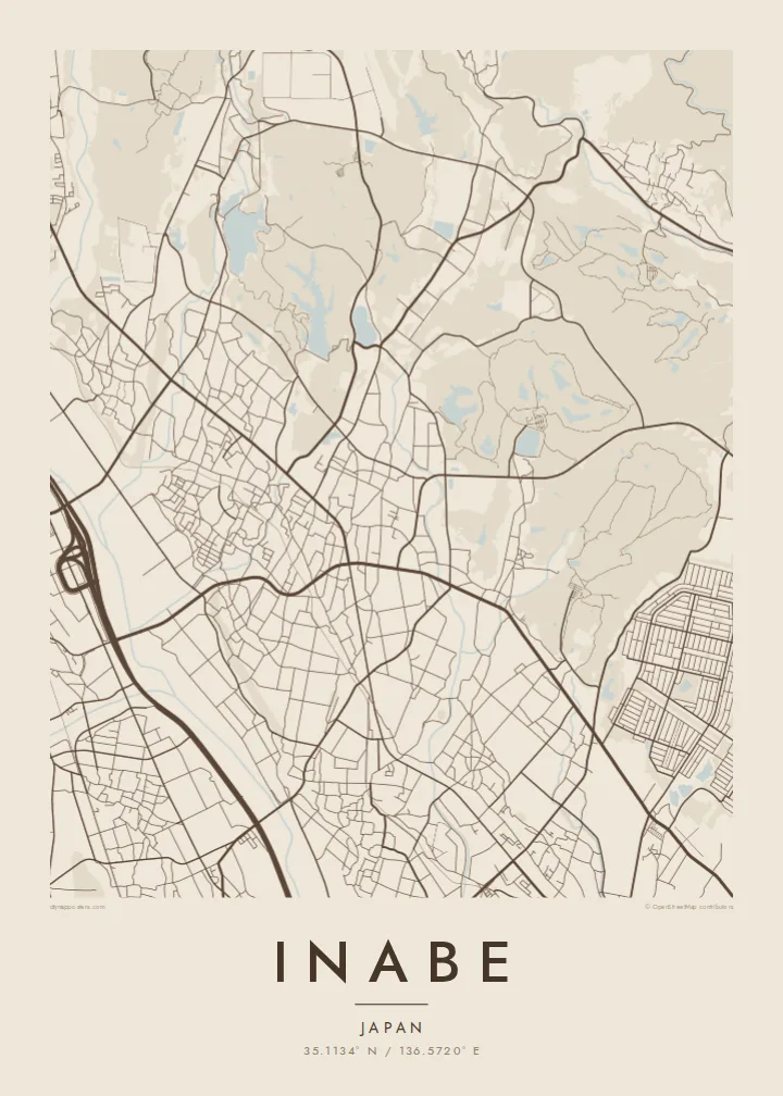
A rural city spread across a river valley, with farm roads fanning out below the Suzuka Mountains


Inki magaala, konoy gaba
Qande inkih tibbixeeh derre baguley table. Kulli qande missoowa caagid—daabbisimta, dirbaabu-le kaadu HD fayla akah.
 Cagalah pixels · 24 × 36″ daabbi fayla
Maxxaacah qeeqa
Tama usuk cagalah daabbi faylak 100% qambaala. Kulli poster — daabbisimta, dirbaabu-le kaadu download geytimta — ni-server-ittal 300 DPI-l ederimta, 7,200 × 10,800 pixels fanah, tokkel iyyi ellee catoy 24 × 36″ daabbi baxsi bahisak raaqu.
Gidarih


Kaarta
Inabe lies in the far north of Mie Prefecture. It was formed in 2003 when several towns merged, and it reads less like one city than a group of settlements in a shared valley. The Suzuka Mountains rise along its western side, and the land falls east toward the Ise Bay plain in a pattern of rice fields, streams and small built-up clusters.
This origin in several towns shows clearly on a map. There is no single dense centre. Instead, a number of compact neighbourhoods are joined by roads that follow the valley floor, while forest covers the slopes above with almost no roads at all. Seasonal hiking in the Suzuka range brings visitors up from the Nagoya area.
An Inabe map poster shows a Japan that city maps rarely include. Its fine field divisions, scattered hamlets and empty mountain terrain make a lighter, more open composition. It is a good choice for anyone who wants a map that feels calm rather than crowded.
The western part of the city is steep, forested ground with few roads. On the map it becomes a broad empty field that frames the valley below.
Several former town centres remain as separate small clusters of streets, connected by valley roads instead of combined into one urban core.
The lowland is divided into fine rectangular plots and irrigation channels, which gives the valley floor a quiet, regular texture.
Kok tanim ab
Ayro, migaq hinnay kok tan xagar osis; gaba, ballaqa hinnay xiqa soorris.
Free preview qansarissi kee watermark-le. Daabbisimtaan kee HD fayla 300 DPI-l, 7,200 × 10,800 px fanah, watermark maleh ederimta.
Macah Inabe
A map of Inabe suits people from its villages, or anyone who has hiked the Suzuka range and remembers the valley below. It shows countryside rather than skyline and works well in calm, minimal rooms.
Add a Japanese title, a subtitle or a meaningful date along with the coordinates, and choose one of five styles: Classic black & white, Noir, Paper, Blueprint or Sand. Before you buy, you can check the framing with a free watermarked preview.
Inabe poster orme| Maxxaacah ballaqa | Qeeqa | Faylal |
|---|---|---|
| 30 × 40 cm (11.8 × 15.7″) | 3,543 × 4,724 px | PNG · PDF |
| 29.7 × 42 cm (A3, 11.7 × 16.5″) | 3,508 × 4,961 px | PNG · PDF |
| 42 × 59.4 cm (A2, 16.5 × 23.4″) | 4,961 × 7,016 px | PNG · PDF |
| 45.7 × 61 cm (18 × 24″) | 5,400 × 7,200 px | PNG · PDF |
| 50 × 70 cm (19.7 × 27.6″) | 5,906 × 8,268 px | PNG · PDF |
| 61 × 91.4 cm (24 × 36″) | 7,200 × 10,800 px | PNG · PDF |
Tabbaltah, limo-wayta xaqqa-le ablo 900 px ballaqa le, asta le, iskiriinih keh tan. HD faylal gexsoh inkih addal 8× fanah qeeqa le, poster ballaqa inkih addal meqeh maxxaacimta.
Baxxaqqa qari le qandiy dooriy, tohuk lakal Daabbisimtah Poster — kutuk kee, faxximek, dirbaabu — hinnay HD Digital Fayla dooru. Checkout inki wagitti geytima, kaadu ku-orme page keenih adissa akke waqdi caagoy kummite.
Usuk 200 gsm-le catam kutuk warqatal, lica katiy caagitte {printFrom}-ik hane ayta 30 × 40 cm-ik 24 × 36″ fanah, xaagu keenil warreeh.
Ee. Sarrah-le dirbaabu doori — bad, gudduc, oak-le hinnay bad-madabuy. Usuk finqisiimam ellee sange qarab-le kaadu qari umukku iyya keenih taagu. Dirbaabu-le poster {framedFrom}-ik hane, xaagu keenil warreeh.
Xaagu addunyal inkih cisab-le. Kulli poster 30+ ummattak ni-daabbi-mara mananih xayyoysa kaadu 3–7 caagu-ayróh fanah geeytima. Ku-orme kee xaagu tarikiy My Orders addal ablitta.
Geytimeek 14 ayróy addal foto naah rubbaay, cisab-le daabbisiynah hinnay ku-lacay gacisnaah.
Ee. Tama page-l edito addal, migaaq, subtitle kee coordinates sarrah faxxem fanah badal, kaadu qande kee katiy doori. Daabbisimtah, dirbaabu-le kaadu digital orme inkih ku-design cagalah yekkelen.
$9 bacisak 300 DPI PNG kee daabbisimtah adissime PDF fayla lica katiy inkih, watermark maleh, ayyi meki daabbisimtah geeytitta. Cisab makkoysemty ana? Awqak, watermark-le free preview download-eh.
Xayyo
