Edge of the mountains
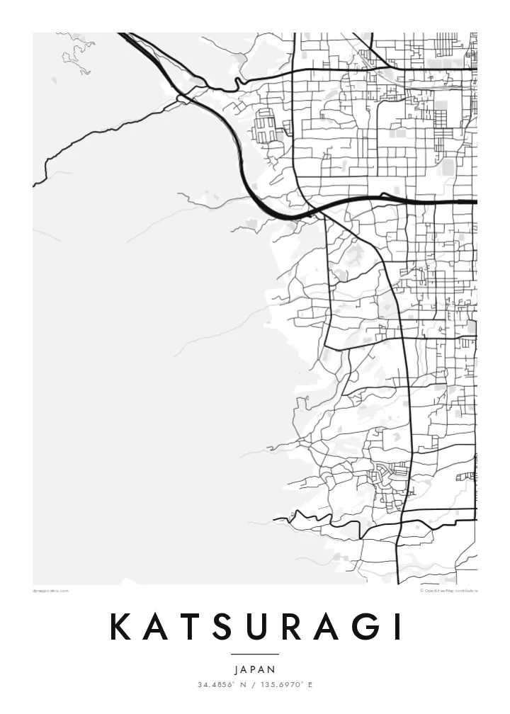
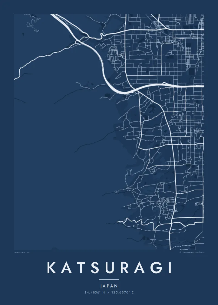
The west of the city climbs into the Katsuragi range, and the map shows streets fading out as the land rises towards Mount Nijō.
Qeeqabak kaartah poster · Japan
34.4856° N / 135.6970° E
A town at the foot of the Katsuragi mountains, with temple grounds, farmland and rail lines across the Nara Basin



Inki magaala, konoy gaba
Qande inkih tibbixeeh derre baguley table. Kulli qande missoowa caagid—daabbisimta, dirbaabu-le kaadu HD fayla akah.
 Cagalah pixels · 24 × 36″ daabbi fayla
Maxxaacah qeeqa
Tama usuk cagalah daabbi faylak 100% qambaala. Kulli poster — daabbisimta, dirbaabu-le kaadu download geytimta — ni-server-ittal 300 DPI-l ederimta, 7,200 × 10,800 pixels fanah, tokkel iyyi ellee catoy 24 × 36″ daabbi baxsi bahisak raaqu.
Gidarih


Kaarta
Katsuragi lies on the western edge of the Nara Basin, where the flat plain meets the mountains along the border with Osaka Prefecture. The city was formed in 2004 by merging the towns of Shinjō and Taima. On a map the eastern side is flat and fairly regular, while the west rises into wooded slopes, with streets thinning and giving way to forest.
The area is closely tied to early Japanese history. Taima-dera, a temple known for its two ancient pagodas, stands near the mountains, and the twin-peaked Mount Nijō rises above the town. Taima is also traditionally associated with the legendary origins of sumo, which a local museum commemorates.
A Katsuragi map poster shows the transition from plain to mountain very clearly. Railway lines cross the basin, small ponds and fields fill the gaps between neighbourhoods, and settlement clusters along roads at the base of the slopes. It is a composition of calm horizontals meeting the irregular forms of the hills, well suited to a minimalist print.
The west of the city climbs into the Katsuragi range, and the map shows streets fading out as the land rises towards Mount Nijō.
The temple precinct near the foothills appears as a distinct enclosed area among the lanes, a quiet anchor for the western part of town.
Across the flat eastern side, fields and small irrigation ponds sit between neighbourhoods and rail lines, giving the map an open, measured rhythm.
Kok tanim ab
Ayro, migaq hinnay kok tan xagar osis; gaba, ballaqa hinnay xiqa soorris.
Free preview qansarissi kee watermark-le. Daabbisimtaan kee HD fayla 300 DPI-l, 7,200 × 10,800 px fanah, watermark maleh ederimta.
Macah Katsuragi
Katsuragi is a place visited for its temples and mountain walks, and loved by those who live in its quiet neighbourhoods. A map poster brings that meeting of plain and mountain into a room, as a record of a trip or a home.
You can change the title, subtitle and coordinates line, perhaps adding Japanese characters or a date, and choose Classic black & white, Noir, Paper, Blueprint or Sand to match your space.
Katsuragi poster orme| Maxxaacah ballaqa | Qeeqa | Faylal |
|---|---|---|
| 30 × 40 cm11.8 × 15.7″ | 3,543 × 4,724 px | PNG · PDF |
| 29.7 × 42 cm (A3)11.7 × 16.5″ | 3,508 × 4,961 px | PNG · PDF |
| 42 × 59.4 cm (A2)16.5 × 23.4″ | 4,961 × 7,016 px | PNG · PDF |
| 45.7 × 61 cm18 × 24″ | 5,400 × 7,200 px | PNG · PDF |
| 50 × 70 cm19.7 × 27.6″ | 5,906 × 8,268 px | PNG · PDF |
| 61 × 91.4 cm24 × 36″ | 7,200 × 10,800 px | PNG · PDF |
Tabbaltah, limo-wayta xaqqa-le ablo 900 px ballaqa le, asta le, iskiriinih keh tan. HD faylal gexsoh inkih addal 8× fanah qeeqa le, poster ballaqa inkih addal meqeh maxxaacimta.
Baxxaqqa qari le qandiy dooriy, tohuk lakal Daabbisimtah Poster — kutuk kee, faxximek, dirbaabu — hinnay HD Digital Fayla dooru. Checkout inki wagitti geytima, kaadu ku-orme page keenih adissa akke waqdi caagoy kummite.
Usuk 200 gsm-le catam kutuk warqatal, lica katiy caagitte $39-ik hane ayta 30 × 40 cm-ik 24 × 36″ fanah, xaagu keenil warreeh.
Ee. Sarrah-le dirbaabu doori — bad, gudduc, oak-le hinnay bad-madabuy. Usuk finqisiimam ellee sange qarab-le kaadu qari umukku iyya keenih taagu. Dirbaabu-le poster $99-ik hane, xaagu keenil warreeh.
Dirsa 60+ baaxoh bilsa. Poster kasa 30+ baaxoh nel print kaadu yan kee dirgeh kaxxa kee tanah printa, kee 3–7 xaqu ayyaamah yaaxigeeh. Xaaloo kee tracking "Ac Order" gexsitam. Kaadu baaxo 2–5 isbuuc yaaxigeeh, nanu dirsi yanin baaxoh sajiitah site ku kalah tekkeh.
Geytimeek 14 ayróy addal foto naah rubbaay, cisab-le daabbisiynah hinnay ku-lacay gacisnaah.
Ee. Tama page-l edito addal, migaaq, subtitle kee coordinates sarrah faxxem fanah badal, kaadu qande kee katiy doori. Daabbisimtah, dirbaabu-le kaadu digital orme inkih ku-design cagalah yekkelen.
$9 bacisak 300 DPI PNG kee daabbisimtah adissime PDF fayla lica katiy inkih, watermark maleh, ayyi meki daabbisimtah geeytitta. Cisab makkoysemty ana? Awqak, watermark-le free preview download-eh.
Xayyo
