Krk Bridge
Two concrete arches leap from the mainland to the island via a rocky islet. They form the single fixed link at the northern tip.
Qeeqabak kaartah poster · Croatia
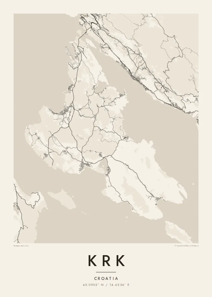
45.0902° N / 14.6256° E
A broad, stony island in the Kvarner Gulf, bridged to the mainland and scalloped with deep bays




Inki magaala, konoy gaba
Qande inkih tibbixeeh derre baguley table. Kulli qande missoowa caagid—daabbisimta, dirbaabu-le kaadu HD fayla akah.
 Cagalah pixels · 24 × 36″ daabbi fayla
Maxxaacah qeeqa
Tama usuk cagalah daabbi faylak 100% qambaala. Kulli poster — daabbisimta, dirbaabu-le kaadu download geytimta — ni-server-ittal 300 DPI-l ederimta, 7,200 × 10,800 pixels fanah, tokkel iyyi ellee catoy 24 × 36″ daabbi baxsi bahisak raaqu.
Gidarih


Kaarta
Krk sits in the Kvarner Gulf close to Rijeka, and it is one of the two largest islands in the Adriatic. Its outline is irregular. The north is wider, low and greener, while the south-east rises into bare limestone ridges above the long valley of Baška. The coast is scalloped by bays, the largest of which reach deep into the island at Punat and Soline.
In the north, the Krk Bridge links the island to the mainland. Opened in 1980, it runs in two concrete arches via a small islet, and Rijeka airport sits on the island near its landing. The towns are strung along the shore: Omišalj on its hill, Malinska and Njivice on the western coast, and the walled town of Krk on the south-west.
A Krk map poster also takes in the enclosed bay of Punat with the small islet of Košljun and its Franciscan monastery. In the south, Baška is where the Baška tablet was found. This stone slab carries one of the earliest inscriptions in Croatian, in the Glagolitic script, and is often cited as a founding text of the language.
Two concrete arches leap from the mainland to the island via a rocky islet. They form the single fixed link at the northern tip.
An almost enclosed bay south-east of Krk town, with the small islet of Košljun in the middle. On the map it looks like an inland lake.
A compact walled town on the south-west coast, with narrow streets inside the old defences and a small harbour on the waterfront.
Kok tanim ab
Ayro, migaq hinnay kok tan xagar osis; gaba, ballaqa hinnay xiqa soorris.
Free preview qansarissi kee watermark-le. Daabbisimtaan kee HD fayla 300 DPI-l, 7,200 × 10,800 px fanah, watermark maleh ederimta.
Macah Krk
Krk is where many families have spent summers for generations, arriving over the bridge from Rijeka. The island's bays and ridges give a poster plenty of detail without crowding, and it looks right in both large and small frames.
Add your own title, subtitle and coordinates line, such as a village name or a year. Choose Classic black & white, Noir, Paper, Blueprint or Sand, then get HD files for $9 or a printed poster with an optional wooden frame.
Krk poster orme| Maxxaacah ballaqa | Qeeqa | Faylal |
|---|---|---|
| 30 × 40 cm (11.8 × 15.7″) | 3,543 × 4,724 px | PNG · PDF |
| 29.7 × 42 cm (A3, 11.7 × 16.5″) | 3,508 × 4,961 px | PNG · PDF |
| 42 × 59.4 cm (A2, 16.5 × 23.4″) | 4,961 × 7,016 px | PNG · PDF |
| 45.7 × 61 cm (18 × 24″) | 5,400 × 7,200 px | PNG · PDF |
| 50 × 70 cm (19.7 × 27.6″) | 5,906 × 8,268 px | PNG · PDF |
| 61 × 91.4 cm (24 × 36″) | 7,200 × 10,800 px | PNG · PDF |
Tabbaltah, limo-wayta xaqqa-le ablo 900 px ballaqa le, asta le, iskiriinih keh tan. HD faylal gexsoh inkih addal 8× fanah qeeqa le, poster ballaqa inkih addal meqeh maxxaacimta.
Baxxaqqa qari le qandiy dooriy, tohuk lakal Daabbisimtah Poster — kutuk kee, faxximek, dirbaabu — hinnay HD Digital Fayla dooru. Checkout inki wagitti geytima, kaadu ku-orme page keenih adissa akke waqdi caagoy kummite.
Usuk 200 gsm-le catam kutuk warqatal, lica katiy caagitte {printFrom}-ik hane ayta 30 × 40 cm-ik 24 × 36″ fanah, xaagu keenil warreeh.
Ee. Sarrah-le dirbaabu doori — bad, gudduc, oak-le hinnay bad-madabuy. Usuk finqisiimam ellee sange qarab-le kaadu qari umukku iyya keenih taagu. Dirbaabu-le poster {framedFrom}-ik hane, xaagu keenil warreeh.
Xaagu addunyal inkih cisab-le. Kulli poster 30+ ummattak ni-daabbi-mara mananih xayyoysa kaadu 3–7 caagu-ayróh fanah geeytima. Ku-orme kee xaagu tarikiy My Orders addal ablitta.
Geytimeek 14 ayróy addal foto naah rubbaay, cisab-le daabbisiynah hinnay ku-lacay gacisnaah.
Ee. Tama page-l edito addal, migaaq, subtitle kee coordinates sarrah faxxem fanah badal, kaadu qande kee katiy doori. Daabbisimtah, dirbaabu-le kaadu digital orme inkih ku-design cagalah yekkelen.
$9 bacisak 300 DPI PNG kee daabbisimtah adissime PDF fayla lica katiy inkih, watermark maleh, ayyi meki daabbisimtah geeytitta. Cisab makkoysemty ana? Awqak, watermark-le free preview download-eh.
Xayyo
