Shichiri-mihama beach
A long, gently curving pebble shore runs south from the town, forming one of the cleanest and most striking lines anywhere on the map.
Qeeqabak kaartah poster · Japan
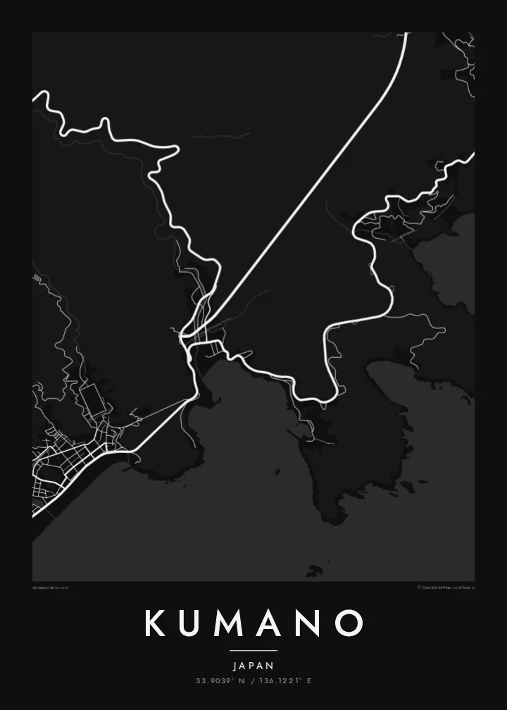
33.9039° N / 136.1221° E
A long Pacific shoreline of pebble beach and rocky cliffs backed by steep forested mountains of the Kii Peninsula.



Inki magaala, konoy gaba
Qande inkih tibbixeeh derre baguley table. Kulli qande missoowa caagid—daabbisimta, dirbaabu-le kaadu HD fayla akah.
 Cagalah pixels · 24 × 36″ daabbi fayla
Maxxaacah qeeqa
Tama usuk cagalah daabbi faylak 100% qambaala. Kulli poster — daabbisimta, dirbaabu-le kaadu download geytimta — ni-server-ittal 300 DPI-l ederimta, 7,200 × 10,800 pixels fanah, tokkel iyyi ellee catoy 24 × 36″ daabbi baxsi bahisak raaqu.
Gidarih


Kaarta
Kumano lies on the southern coast of Mie Prefecture, where the Kii Peninsula meets the Kumano Sea. Its map is defined by the sea on one side and mountains on the other. The town occupies a narrow band of flatter ground along the coast, and behind it the land rises quickly into steep, heavily forested ridges cut by valleys and small rivers.
To the south, the shoreline straightens into Shichiri-mihama, a long pebble beach that runs for many kilometres. To the north, the coast turns rocky at Onigajō, a stretch of eroded cliffs and caves. The area is part of the Kumano pilgrimage landscape, and Hana-no-Iwaya shrine, a vast rock face beside the sea, belongs to the World Heritage listing of the Kii Mountain Range sites.
A Kumano map poster brings these contrasts into one frame: the smooth arc of the beach, the jagged northern coast, and the dense contour-like pattern of mountain roads inland. The town is also known for its summer fireworks festival held over the sea, and for the terraced rice fields of Maruyama Senmaida in the hills.
A long, gently curving pebble shore runs south from the town, forming one of the cleanest and most striking lines anywhere on the map.
North of the centre, the coastline breaks into eroded cliffs and inlets, a jagged edge that contrasts with the smooth sweep of the beach.
Steep forested ridges rise directly behind the coast, and winding roads follow the valleys inland toward the pilgrimage routes of the Kii Peninsula.
Kok tanim ab
Ayro, migaq hinnay kok tan xagar osis; gaba, ballaqa hinnay xiqa soorris.
Free preview qansarissi kee watermark-le. Daabbisimtaan kee HD fayla 300 DPI-l, 7,200 × 10,800 px fanah, watermark maleh ederimta.
Macah Kumano
Kumano holds a place in the memory of pilgrims, hikers and families who have walked its beach or watched the fireworks over the sea. A map of the town and its coast keeps the quiet scale of this landscape in view.
Personalise the title, subtitle and coordinates line, perhaps with the date of a visit. Pick from Classic black & white, Noir, Paper, Blueprint or Sand, and choose a digital download or a printed poster on matte paper.
Kumano poster orme| Maxxaacah ballaqa | Qeeqa | Faylal |
|---|---|---|
| 30 × 40 cm11.8 × 15.7″ | 3,543 × 4,724 px | PNG · PDF |
| 29.7 × 42 cm (A3)11.7 × 16.5″ | 3,508 × 4,961 px | PNG · PDF |
| 42 × 59.4 cm (A2)16.5 × 23.4″ | 4,961 × 7,016 px | PNG · PDF |
| 45.7 × 61 cm18 × 24″ | 5,400 × 7,200 px | PNG · PDF |
| 50 × 70 cm19.7 × 27.6″ | 5,906 × 8,268 px | PNG · PDF |
| 61 × 91.4 cm24 × 36″ | 7,200 × 10,800 px | PNG · PDF |
Tabbaltah, limo-wayta xaqqa-le ablo 900 px ballaqa le, asta le, iskiriinih keh tan. HD faylal gexsoh inkih addal 8× fanah qeeqa le, poster ballaqa inkih addal meqeh maxxaacimta.
Baxxaqqa qari le qandiy dooriy, tohuk lakal Daabbisimtah Poster — kutuk kee, faxximek, dirbaabu — hinnay HD Digital Fayla dooru. Checkout inki wagitti geytima, kaadu ku-orme page keenih adissa akke waqdi caagoy kummite.
Usuk 200 gsm-le catam kutuk warqatal, lica katiy caagitte $39-ik hane ayta 30 × 40 cm-ik 24 × 36″ fanah, xaagu keenil warreeh.
Ee. Sarrah-le dirbaabu doori — bad, gudduc, oak-le hinnay bad-madabuy. Usuk finqisiimam ellee sange qarab-le kaadu qari umukku iyya keenih taagu. Dirbaabu-le poster $99-ik hane, xaagu keenil warreeh.
Dirsa 60+ baaxoh bilsa. Poster kasa 30+ baaxoh nel print kaadu yan kee dirgeh kaxxa kee tanah printa, kee 3–7 xaqu ayyaamah yaaxigeeh. Xaaloo kee tracking "Ac Order" gexsitam. Kaadu baaxo 2–5 isbuuc yaaxigeeh, nanu dirsi yanin baaxoh sajiitah site ku kalah tekkeh.
Geytimeek 14 ayróy addal foto naah rubbaay, cisab-le daabbisiynah hinnay ku-lacay gacisnaah.
Ee. Tama page-l edito addal, migaaq, subtitle kee coordinates sarrah faxxem fanah badal, kaadu qande kee katiy doori. Daabbisimtah, dirbaabu-le kaadu digital orme inkih ku-design cagalah yekkelen.
$9 bacisak 300 DPI PNG kee daabbisimtah adissime PDF fayla lica katiy inkih, watermark maleh, ayyi meki daabbisimtah geeytitta. Cisab makkoysemty ana? Awqak, watermark-le free preview download-eh.
