Wenceslas Square
It appears as a long, wide rectangle rather than a true square, running for roughly 750 metres. The National Museum closes it at the upper end.
Qeeqabak kaartah poster · Czechia
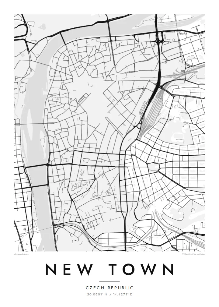
50.0801° N / 14.4271° E
Charles IV's planned extension of Prague, laid out in broad squares and long straight streets that run down to the Vltava.


Inki magaala, konoy gaba
Qande inkih tibbixeeh derre baguley table. Kulli qande missoowa caagid—daabbisimta, dirbaabu-le kaadu HD fayla akah.
 Cagalah pixels · 24 × 36″ daabbi fayla
Maxxaacah qeeqa
Tama usuk cagalah daabbi faylak 100% qambaala. Kulli poster — daabbisimta, dirbaabu-le kaadu download geytimta — ni-server-ittal 300 DPI-l ederimta, 7,200 × 10,800 pixels fanah, tokkel iyyi ellee catoy 24 × 36″ daabbi baxsi bahisak raaqu.
Gidarih


Kaarta
New Town, or Nové Město, was founded by Charles IV in 1348 as a deliberate expansion of Prague beyond the older walls. The name has stayed the same for nearly seven centuries, and on a map the district still looks planned. Its wider streets, generous market squares and clear framework stand apart from the tangled lanes of the Old Town to the north.
Two large open spaces anchor the district. Wenceslas Square began as a horse market and is really a long boulevard that climbs gently toward the National Museum. Charles Square, further south, is one of the largest squares in Europe and today holds a park. Between them runs a grid of blocks full of arcades, passages and inner courtyards.
The western edge follows the Vltava embankment, where the Dancing House stands facing the river. A New Town map poster shows the whole sequence within about three square kilometres: the squares, the riverbank, and streets such as Na Příkopě, whose name recalls the old moat that once separated this district from the Old Town.
It appears as a long, wide rectangle rather than a true square, running for roughly 750 metres. The National Museum closes it at the upper end.
This vast rectangle was laid out as the medieval cattle market and is now planted as a park. On the map it is an open block framed by streets, with the New Town Hall on its northern side.
The district's western edge is a continuous riverfront road facing Slavonic Island and the opposite bank, with bridges crossing the water at regular intervals.
Kok tanim ab
Ayro, migaq hinnay kok tan xagar osis; gaba, ballaqa hinnay xiqa soorris.
Free preview qansarissi kee watermark-le. Daabbisimtaan kee HD fayla 300 DPI-l, 7,200 × 10,800 px fanah, watermark maleh ederimta.
Macah New Town
New Town is where many people actually lived, studied or worked in Prague, among its squares, tram lines and side streets. A map of the district recalls that everyday city more than the postcard view from the bridge, which makes it a quietly personal choice.
Personalise the title, subtitle and coordinates line with a name, an address or the year you arrived, then pick one of five styles, from Classic black & white to Blueprint or Sand. The $9 digital files come in six sizes without a watermark, and printed posters ship from partners in more than 30 countries.
New Town poster orme| Maxxaacah ballaqa | Qeeqa | Faylal |
|---|---|---|
| 30 × 40 cm11.8 × 15.7″ | 3,543 × 4,724 px | PNG · PDF |
| 29.7 × 42 cm (A3)11.7 × 16.5″ | 3,508 × 4,961 px | PNG · PDF |
| 42 × 59.4 cm (A2)16.5 × 23.4″ | 4,961 × 7,016 px | PNG · PDF |
| 45.7 × 61 cm18 × 24″ | 5,400 × 7,200 px | PNG · PDF |
| 50 × 70 cm19.7 × 27.6″ | 5,906 × 8,268 px | PNG · PDF |
| 61 × 91.4 cm24 × 36″ | 7,200 × 10,800 px | PNG · PDF |
Tabbaltah, limo-wayta xaqqa-le ablo 900 px ballaqa le, asta le, iskiriinih keh tan. HD faylal gexsoh inkih addal 8× fanah qeeqa le, poster ballaqa inkih addal meqeh maxxaacimta.
Baxxaqqa qari le qandiy dooriy, tohuk lakal Daabbisimtah Poster — kutuk kee, faxximek, dirbaabu — hinnay HD Digital Fayla dooru. Checkout inki wagitti geytima, kaadu ku-orme page keenih adissa akke waqdi caagoy kummite.
Usuk 200 gsm-le catam kutuk warqatal, lica katiy caagitte $39-ik hane ayta 30 × 40 cm-ik 24 × 36″ fanah, xaagu keenil warreeh.
Ee. Sarrah-le dirbaabu doori — bad, gudduc, oak-le hinnay bad-madabuy. Usuk finqisiimam ellee sange qarab-le kaadu qari umukku iyya keenih taagu. Dirbaabu-le poster $99-ik hane, xaagu keenil warreeh.
Dirsa 60+ baaxoh bilsa. Poster kasa 30+ baaxoh nel print kaadu yan kee dirgeh kaxxa kee tanah printa, kee 3–7 xaqu ayyaamah yaaxigeeh. Xaaloo kee tracking "Ac Order" gexsitam. Kaadu baaxo 2–5 isbuuc yaaxigeeh, nanu dirsi yanin baaxoh sajiitah site ku kalah tekkeh.
Geytimeek 14 ayróy addal foto naah rubbaay, cisab-le daabbisiynah hinnay ku-lacay gacisnaah.
Ee. Tama page-l edito addal, migaaq, subtitle kee coordinates sarrah faxxem fanah badal, kaadu qande kee katiy doori. Daabbisimtah, dirbaabu-le kaadu digital orme inkih ku-design cagalah yekkelen.
$9 bacisak 300 DPI PNG kee daabbisimtah adissime PDF fayla lica katiy inkih, watermark maleh, ayyi meki daabbisimtah geeytitta. Cisab makkoysemty ana? Awqak, watermark-le free preview download-eh.
Xayyo
