Vltava and its bridges
The river curves through the city in a broad S, crossed by Charles Bridge and a series of later bridges. Several islands divide the channel.
Qeeqabak kaartah poster · Czechia
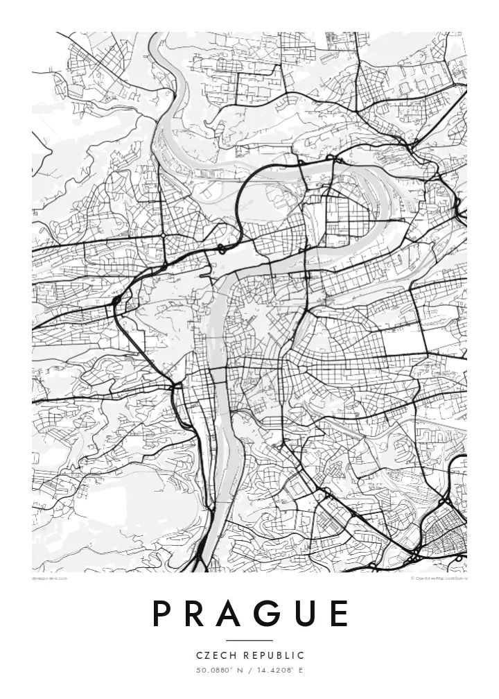
50.0880° N / 14.4208° E
A city built along a deep bend of the Vltava, with the castle on one bank and the Old Town on the other.


Inki magaala, konoy gaba
Qande inkih tibbixeeh derre baguley table. Kulli qande missoowa caagid—daabbisimta, dirbaabu-le kaadu HD fayla akah.
 Cagalah pixels · 24 × 36″ daabbi fayla
Maxxaacah qeeqa
Tama usuk cagalah daabbi faylak 100% qambaala. Kulli poster — daabbisimta, dirbaabu-le kaadu download geytimta — ni-server-ittal 300 DPI-l ederimta, 7,200 × 10,800 pixels fanah, tokkel iyyi ellee catoy 24 × 36″ daabbi baxsi bahisak raaqu.
Gidarih


Kaarta
The Vltava flows north through Prague in a wide S-shaped curve and divides the city into two clearly different halves. On the left bank, the castle complex stretches along a ridge above Malá Strana, with the green slopes of Petřín hill to the south. On the right bank are the Old Town and the New Town, whose streets gather toward the river from the flatter ground to the east.
Charles Bridge, begun in 1357, links the two banks and remains one of the most recognisable elements of any Prague map poster. Upstream and downstream, a series of later bridges crosses the river at regular intervals, and islands such as Kampa and Střelecký ostrov divide the water. The Old Town's streets meet at the square with the astronomical clock, first installed in 1410.
The New Town was founded by Charles IV in 1348 and was laid out on an ambitious scale for its time. Wenceslas Square and Charles Square are still among the largest open spaces in the city. To the south, the fortress of Vyšehrad sits above the river on a rocky outcrop. Together these layers make Prague one of Europe's most detailed and rewarding maps.
The river curves through the city in a broad S, crossed by Charles Bridge and a series of later bridges. Several islands divide the channel.
On the left bank, the long castle complex follows the ridge above the Lesser Town. The winding lanes of Malá Strana descend from it toward the river.
Charles IV's fourteenth-century plan introduced large squares and wide streets. Wenceslas Square is still the long, clear rectangle at the centre of the modern city.
Kok tanim ab
Ayro, migaq hinnay kok tan xagar osis; gaba, ballaqa hinnay xiqa soorris.
Free preview qansarissi kee watermark-le. Daabbisimtaan kee HD fayla 300 DPI-l, 7,200 × 10,800 px fanah, watermark maleh ederimta.
Macah Prague
Prague is where many people studied, fell in love or spent a significant trip, and its river, bridges and castle create one of the most balanced city maps in Europe. It works at both small and large sizes.
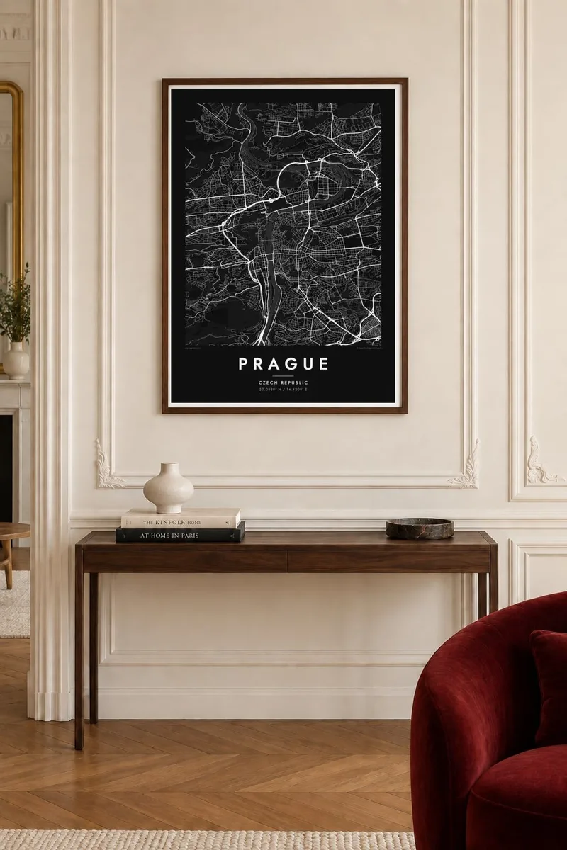
Add a title such as Praha, a subtitle and your own coordinates or date, and choose Classic black & white, Noir, Paper, Blueprint or Sand. Download HD files or order a print with an optional wooden frame.
Prague poster orme| Maxxaacah ballaqa | Qeeqa | Faylal |
|---|---|---|
| 30 × 40 cm (11.8 × 15.7″) | 3,543 × 4,724 px | PNG · PDF |
| 29.7 × 42 cm (A3, 11.7 × 16.5″) | 3,508 × 4,961 px | PNG · PDF |
| 42 × 59.4 cm (A2, 16.5 × 23.4″) | 4,961 × 7,016 px | PNG · PDF |
| 45.7 × 61 cm (18 × 24″) | 5,400 × 7,200 px | PNG · PDF |
| 50 × 70 cm (19.7 × 27.6″) | 5,906 × 8,268 px | PNG · PDF |
| 61 × 91.4 cm (24 × 36″) | 7,200 × 10,800 px | PNG · PDF |
Tabbaltah, limo-wayta xaqqa-le ablo 900 px ballaqa le, asta le, iskiriinih keh tan. HD faylal gexsoh inkih addal 8× fanah qeeqa le, poster ballaqa inkih addal meqeh maxxaacimta.
Baxxaqqa qari le qandiy dooriy, tohuk lakal Daabbisimtah Poster — kutuk kee, faxximek, dirbaabu — hinnay HD Digital Fayla dooru. Checkout inki wagitti geytima, kaadu ku-orme page keenih adissa akke waqdi caagoy kummite.
Usuk 200 gsm-le catam kutuk warqatal, lica katiy caagitte {printFrom}-ik hane ayta 30 × 40 cm-ik 24 × 36″ fanah, xaagu keenil warreeh.
Ee. Sarrah-le dirbaabu doori — bad, gudduc, oak-le hinnay bad-madabuy. Usuk finqisiimam ellee sange qarab-le kaadu qari umukku iyya keenih taagu. Dirbaabu-le poster {framedFrom}-ik hane, xaagu keenil warreeh.
Xaagu addunyal inkih cisab-le. Kulli poster 30+ ummattak ni-daabbi-mara mananih xayyoysa kaadu 3–7 caagu-ayróh fanah geeytima. Ku-orme kee xaagu tarikiy My Orders addal ablitta.
Geytimeek 14 ayróy addal foto naah rubbaay, cisab-le daabbisiynah hinnay ku-lacay gacisnaah.
Ee. Tama page-l edito addal, migaaq, subtitle kee coordinates sarrah faxxem fanah badal, kaadu qande kee katiy doori. Daabbisimtah, dirbaabu-le kaadu digital orme inkih ku-design cagalah yekkelen.
$9 bacisak 300 DPI PNG kee daabbisimtah adissime PDF fayla lica katiy inkih, watermark maleh, ayyi meki daabbisimtah geeytitta. Cisab makkoysemty ana? Awqak, watermark-le free preview download-eh.
Xayyo
