The Kosi riverbed
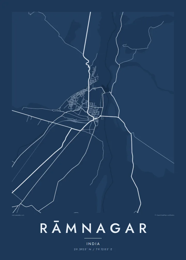
The Kosi runs past the town in a wide, shifting bed of channels and gravel bars. It makes a broad pale band that sets the frame for everything around it.
Qeeqabak kaartah poster · India
29.3925° N / 79.1283° E
A foothill town beside the wide braided bed of the Kosi, where the plains stop and forested Kumaon ridges begin



Inki magaala, konoy gaba
Qande inkih tibbixeeh derre baguley table. Kulli qande missoowa caagid—daabbisimta, dirbaabu-le kaadu HD fayla akah.
 Cagalah pixels · 24 × 36″ daabbi fayla
Maxxaacah qeeqa
Tama usuk cagalah daabbi faylak 100% qambaala. Kulli poster — daabbisimta, dirbaabu-le kaadu download geytimta — ni-server-ittal 300 DPI-l ederimta, 7,200 × 10,800 pixels fanah, tokkel iyyi ellee catoy 24 × 36″ daabbi baxsi bahisak raaqu.
Gidarih


Kaarta
Rāmnagar sits right where the Gangetic plain meets the first ridges of the Kumaon Himalaya. On a map, the town's compact streets gather on the flat ground near the Kosi River. To the north and west the drawing turns almost empty, because forest takes over and roads become rare. The river's broad, braided channel is the strongest line on the sheet, curving down from the hills and spreading out as it reaches the plain.
The town is best known as the main gateway to Jim Corbett National Park, India's oldest national park, established in 1936. That explains the pattern of roads leaving town. A few routes head into the reserve and the hills, while others run south and east across farmland towards the plains. The contrast between a dense core and the open edges gives the layout a clear sense of place.
A Rāmnagar map poster shows that threshold in black and white. On one side there are the lanes and markets of a working town. On the other are the long pale spaces of river gravel and forest, crossed by only a few thin lines. It suits someone who has passed through on the way to Corbett, or who grew up in the town, where the mountains are always close.
The Kosi runs past the town in a wide, shifting bed of channels and gravel bars. It makes a broad pale band that sets the frame for everything around it.
Roads leave the compact centre in several directions, some towards the protected forest and hill country, others out across the plains. The town reads as a junction between two landscapes.
North and west of town the street network thins out quickly, marking where the Corbett landscape begins. On the poster that open space is as expressive as the streets.
Kok tanim ab
Ayro, migaq hinnay kok tan xagar osis; gaba, ballaqa hinnay xiqa soorris.
Free preview qansarissi kee watermark-le. Daabbisimtaan kee HD fayla 300 DPI-l, 7,200 × 10,800 px fanah, watermark maleh ederimta.
Macah Rāmnagar
For many people Rāmnagar is where a journey into the hills or a first safari began. A map of it keeps that moment in a quieter form. The river, the town and the edge of the forest sit on one sheet, which suits a hallway, a study or a cabin wall.
You can add your own title, a subtitle such as a trip date, and a coordinates line. Then choose one of five styles: Classic black & white, Noir, Paper, Blueprint or Sand. Sand and Paper suit the dry riverbed especially well.
Rāmnagar poster orme| Maxxaacah ballaqa | Qeeqa | Faylal |
|---|---|---|
| 30 × 40 cm (11.8 × 15.7″) | 3,543 × 4,724 px | PNG · PDF |
| 29.7 × 42 cm (A3, 11.7 × 16.5″) | 3,508 × 4,961 px | PNG · PDF |
| 42 × 59.4 cm (A2, 16.5 × 23.4″) | 4,961 × 7,016 px | PNG · PDF |
| 45.7 × 61 cm (18 × 24″) | 5,400 × 7,200 px | PNG · PDF |
| 50 × 70 cm (19.7 × 27.6″) | 5,906 × 8,268 px | PNG · PDF |
| 61 × 91.4 cm (24 × 36″) | 7,200 × 10,800 px | PNG · PDF |
Tabbaltah, limo-wayta xaqqa-le ablo 900 px ballaqa le, asta le, iskiriinih keh tan. HD faylal gexsoh inkih addal 8× fanah qeeqa le, poster ballaqa inkih addal meqeh maxxaacimta.
Baxxaqqa qari le qandiy dooriy, tohuk lakal Daabbisimtah Poster — kutuk kee, faxximek, dirbaabu — hinnay HD Digital Fayla dooru. Checkout inki wagitti geytima, kaadu ku-orme page keenih adissa akke waqdi caagoy kummite.
Usuk 200 gsm-le catam kutuk warqatal, lica katiy caagitte {printFrom}-ik hane ayta 30 × 40 cm-ik 24 × 36″ fanah, xaagu keenil warreeh.
Ee. Sarrah-le dirbaabu doori — bad, gudduc, oak-le hinnay bad-madabuy. Usuk finqisiimam ellee sange qarab-le kaadu qari umukku iyya keenih taagu. Dirbaabu-le poster {framedFrom}-ik hane, xaagu keenil warreeh.
Xaagu addunyal inkih cisab-le. Kulli poster 30+ ummattak ni-daabbi-mara mananih xayyoysa kaadu 3–7 caagu-ayróh fanah geeytima. Ku-orme kee xaagu tarikiy My Orders addal ablitta.
Geytimeek 14 ayróy addal foto naah rubbaay, cisab-le daabbisiynah hinnay ku-lacay gacisnaah.
Ee. Tama page-l edito addal, migaaq, subtitle kee coordinates sarrah faxxem fanah badal, kaadu qande kee katiy doori. Daabbisimtah, dirbaabu-le kaadu digital orme inkih ku-design cagalah yekkelen.
$9 bacisak 300 DPI PNG kee daabbisimtah adissime PDF fayla lica katiy inkih, watermark maleh, ayyi meki daabbisimtah geeytitta. Cisab makkoysemty ana? Awqak, watermark-le free preview download-eh.
Xayyo
