Atlantic shoreline
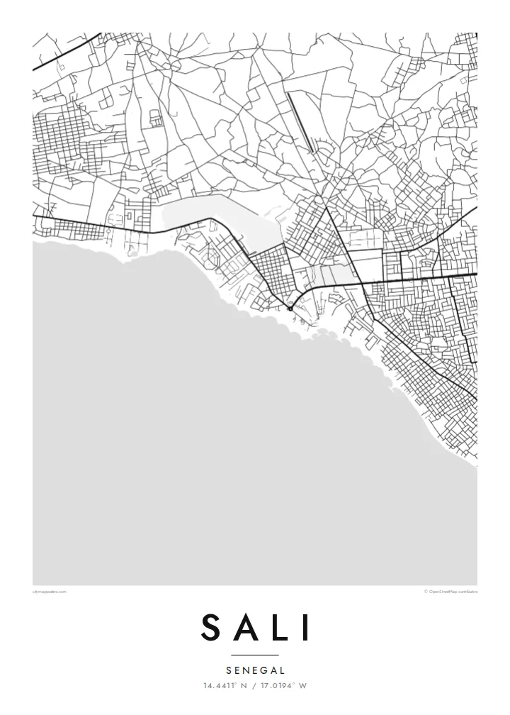
The beach runs as an almost unbroken line along the coast. In black and white it becomes the defining edge of the poster, with the ocean left as open space.
Qeeqabak kaartah poster · Senegal
14.4411° N / 17.0194° W
A resort town on Senegal's Petite Côte, laid out along a straight Atlantic beach south of Dakar.


Inki magaala, konoy gaba
Qande inkih tibbixeeh derre baguley table. Kulli qande missoowa caagid—daabbisimta, dirbaabu-le kaadu HD fayla akah.
 Cagalah pixels · 24 × 36″ daabbi fayla
Maxxaacah qeeqa
Tama usuk cagalah daabbi faylak 100% qambaala. Kulli poster — daabbisimta, dirbaabu-le kaadu download geytimta — ni-server-ittal 300 DPI-l ederimta, 7,200 × 10,800 pixels fanah, tokkel iyyi ellee catoy 24 × 36″ daabbi baxsi bahisak raaqu.
Gidarih


Kaarta
Sali, often written Saly, lies on the Petite Côte, the stretch of Atlantic shore that runs south-east from the Cap-Vert peninsula toward the Saloum delta. It sits just north-west of Mbour and has become one of Senegal's best-known beach destinations. Hotels, residences and villages spread along a long, gently curving sandy coast.
The town's full name, Saly-Portudal, recalls Portudal, a trading post used by Portuguese and later other European merchants on this coast. Today the map shows how tourism has shaped the place. Properties and access roads line the shore, older settlement and newer neighbourhoods sit further inland, and the main road links the town to Mbour and Dakar.
A Sali map poster traces the narrow strip between the road and the sea. The coast forms a clean edge along one side of the frame, and residential streets and resort plots fill the land behind it. It is a simple, strong composition for a place defined above all by its beach and the Atlantic.
The beach runs as an almost unbroken line along the coast. In black and white it becomes the defining edge of the poster, with the ocean left as open space.
Hotels and residences occupy a band close to the shore, each reached by its own access road. This creates a rhythm of short parallel lines between the main road and the sea.
Sali lies just north-west of the fishing town of Mbour, and roads connect the two closely. The map can show them as one continuous stretch of coastal settlement.
Kok tanim ab
Ayro, migaq hinnay kok tan xagar osis; gaba, ballaqa hinnay xiqa soorris.
Free preview qansarissi kee watermark-le. Daabbisimtaan kee HD fayla 300 DPI-l, 7,200 × 10,800 px fanah, watermark maleh ederimta.
Macah Sali
Sali is where many travellers first see Senegal's coast, and where many Senegalese families spend weekends and holidays. A map of the shoreline makes a restrained souvenir that lasts longer than a photograph and fits easily into any room.
You can personalise the title, subtitle and coordinates, adding the dates of a stay or an anniversary. There are five styles: Classic black & white, Noir, Paper, Blueprint and Sand. Buy the HD files for $9 or order a matte print, with or without a wooden frame.
Sali poster orme| Maxxaacah ballaqa | Qeeqa | Faylal |
|---|---|---|
| 30 × 40 cm (11.8 × 15.7″) | 3,543 × 4,724 px | PNG · PDF |
| 29.7 × 42 cm (A3, 11.7 × 16.5″) | 3,508 × 4,961 px | PNG · PDF |
| 42 × 59.4 cm (A2, 16.5 × 23.4″) | 4,961 × 7,016 px | PNG · PDF |
| 45.7 × 61 cm (18 × 24″) | 5,400 × 7,200 px | PNG · PDF |
| 50 × 70 cm (19.7 × 27.6″) | 5,906 × 8,268 px | PNG · PDF |
| 61 × 91.4 cm (24 × 36″) | 7,200 × 10,800 px | PNG · PDF |
Tabbaltah, limo-wayta xaqqa-le ablo 900 px ballaqa le, asta le, iskiriinih keh tan. HD faylal gexsoh inkih addal 8× fanah qeeqa le, poster ballaqa inkih addal meqeh maxxaacimta.
Baxxaqqa qari le qandiy dooriy, tohuk lakal Daabbisimtah Poster — kutuk kee, faxximek, dirbaabu — hinnay HD Digital Fayla dooru. Checkout inki wagitti geytima, kaadu ku-orme page keenih adissa akke waqdi caagoy kummite.
Usuk 200 gsm-le catam kutuk warqatal, lica katiy caagitte {printFrom}-ik hane ayta 30 × 40 cm-ik 24 × 36″ fanah, xaagu keenil warreeh.
Ee. Sarrah-le dirbaabu doori — bad, gudduc, oak-le hinnay bad-madabuy. Usuk finqisiimam ellee sange qarab-le kaadu qari umukku iyya keenih taagu. Dirbaabu-le poster {framedFrom}-ik hane, xaagu keenil warreeh.
Xaagu addunyal inkih cisab-le. Kulli poster 30+ ummattak ni-daabbi-mara mananih xayyoysa kaadu 3–7 caagu-ayróh fanah geeytima. Ku-orme kee xaagu tarikiy My Orders addal ablitta.
Geytimeek 14 ayróy addal foto naah rubbaay, cisab-le daabbisiynah hinnay ku-lacay gacisnaah.
Ee. Tama page-l edito addal, migaaq, subtitle kee coordinates sarrah faxxem fanah badal, kaadu qande kee katiy doori. Daabbisimtah, dirbaabu-le kaadu digital orme inkih ku-design cagalah yekkelen.
$9 bacisak 300 DPI PNG kee daabbisimtah adissime PDF fayla lica katiy inkih, watermark maleh, ayyi meki daabbisimtah geeytitta. Cisab makkoysemty ana? Awqak, watermark-le free preview download-eh.
Xayyo
