Spokane Falls
Near downtown the river tumbles over a series of basalt ledges. These are the falls that first drew settlement here, and they still set the city's orientation.
Qeeqabak kaartah poster · United States
47.6597° N / 117.4291° W
A river city of falls and bridges, its downtown grid split by the Spokane River and climbing onto the South Hill


Inki magaala, konoy gaba
Qande inkih tibbixeeh derre baguley table. Kulli qande missoowa caagid—daabbisimta, dirbaabu-le kaadu HD fayla akah.
 Cagalah pixels · 24 × 36″ daabbi fayla
Maxxaacah qeeqa
Tama usuk cagalah daabbi faylak 100% qambaala. Kulli poster — daabbisimta, dirbaabu-le kaadu download geytimta — ni-server-ittal 300 DPI-l ederimta, 7,200 × 10,800 pixels fanah, tokkel iyyi ellee catoy 24 × 36″ daabbi baxsi bahisak raaqu.
Gidarih


Kaarta
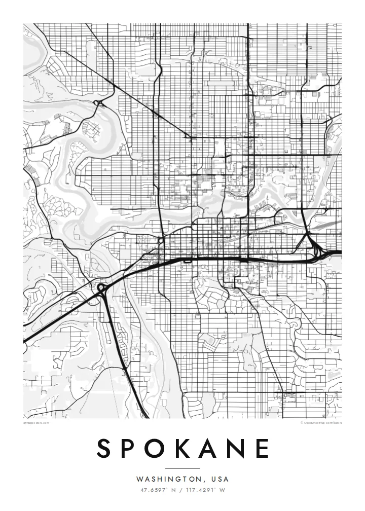
Spokane grew up around a set of waterfalls on the Spokane River, and the river still runs straight through the heart of the city. On the map it arrives from the east, splits around islands near downtown, drops over the falls and then winds away north-west in a deep gorge. The downtown grid sits right beside it, with bridges crossing at close intervals.
Riverfront Park fills the islands and banks at the centre. The site hosted the 1974 World's Fair, when the railyards there were cleared. Just downstream, the Monroe Street Bridge crosses the gorge on a broad concrete arch. South of downtown the land rises sharply onto the South Hill, where the streets start to bend around slopes and parks.
Beyond the centre, the grid extends in long, regular blocks across the valley floor toward the north and east. Arterial roads break it up, and the campus of Gonzaga University sits near the river. A Spokane map poster shows how firmly the city is anchored to its water, with every neighbourhood arranged in relation to that one bending line.
Near downtown the river tumbles over a series of basalt ledges. These are the falls that first drew settlement here, and they still set the city's orientation.
The islands and banks of the river form a large park at the centre, a green space created for Expo '74 and now crossed by footbridges and paths.
South of downtown the streets climb a steep rise, and the regular grid gives way to curving roads, terraces and parkland that read clearly on the map.
Kok tanim ab
Ayro, migaq hinnay kok tan xagar osis; gaba, ballaqa hinnay xiqa soorris.
Free preview qansarissi kee watermark-le. Daabbisimtaan kee HD fayla 300 DPI-l, 7,200 × 10,800 px fanah, watermark maleh ederimta.
Macah Spokane
People connect with Spokane through its river: a walk around the falls, a college year near Gonzaga, a house on the South Hill. A map collects those places into one frame, which is why it works so well as a housewarming or graduation gift.
Each poster can carry your own title, subtitle and coordinates, and comes in Classic black and white, Noir, Paper, Blueprint or Sand. Buy the digital files for $9, including 18×24″ and 24×36″ sizes, or order a printed poster with an optional wooden frame.
Spokane poster orme| Maxxaacah ballaqa | Qeeqa | Faylal |
|---|---|---|
| 30 × 40 cm (11.8 × 15.7″) | 3,543 × 4,724 px | PNG · PDF |
| 29.7 × 42 cm (A3, 11.7 × 16.5″) | 3,508 × 4,961 px | PNG · PDF |
| 42 × 59.4 cm (A2, 16.5 × 23.4″) | 4,961 × 7,016 px | PNG · PDF |
| 45.7 × 61 cm (18 × 24″) | 5,400 × 7,200 px | PNG · PDF |
| 50 × 70 cm (19.7 × 27.6″) | 5,906 × 8,268 px | PNG · PDF |
| 61 × 91.4 cm (24 × 36″) | 7,200 × 10,800 px | PNG · PDF |
Tabbaltah, limo-wayta xaqqa-le ablo 900 px ballaqa le, asta le, iskiriinih keh tan. HD faylal gexsoh inkih addal 8× fanah qeeqa le, poster ballaqa inkih addal meqeh maxxaacimta.
Baxxaqqa qari le qandiy dooriy, tohuk lakal Daabbisimtah Poster — kutuk kee, faxximek, dirbaabu — hinnay HD Digital Fayla dooru. Checkout inki wagitti geytima, kaadu ku-orme page keenih adissa akke waqdi caagoy kummite.
Usuk 200 gsm-le catam kutuk warqatal, lica katiy caagitte {printFrom}-ik hane ayta 30 × 40 cm-ik 24 × 36″ fanah, xaagu keenil warreeh.
Ee. Sarrah-le dirbaabu doori — bad, gudduc, oak-le hinnay bad-madabuy. Usuk finqisiimam ellee sange qarab-le kaadu qari umukku iyya keenih taagu. Dirbaabu-le poster {framedFrom}-ik hane, xaagu keenil warreeh.
Xaagu addunyal inkih cisab-le. Kulli poster 30+ ummattak ni-daabbi-mara mananih xayyoysa kaadu 3–7 caagu-ayróh fanah geeytima. Ku-orme kee xaagu tarikiy My Orders addal ablitta.
Geytimeek 14 ayróy addal foto naah rubbaay, cisab-le daabbisiynah hinnay ku-lacay gacisnaah.
Ee. Tama page-l edito addal, migaaq, subtitle kee coordinates sarrah faxxem fanah badal, kaadu qande kee katiy doori. Daabbisimtah, dirbaabu-le kaadu digital orme inkih ku-design cagalah yekkelen.
$9 bacisak 300 DPI PNG kee daabbisimtah adissime PDF fayla lica katiy inkih, watermark maleh, ayyi meki daabbisimtah geeytitta. Cisab makkoysemty ana? Awqak, watermark-le free preview download-eh.
