Sanmachi Suji
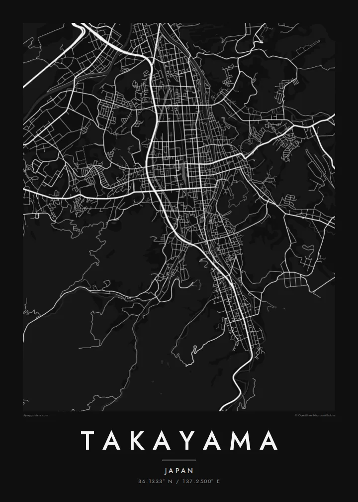
Parallel lanes of preserved merchant houses form the heart of the old town, a fine, regular grid that stands out clearly against the newer streets around it.
Qeeqabak kaartah poster · Japan
36.1333° N / 137.2500° E
A mountain town in the Hida highlands, its preserved merchant lanes laid in a tight grid beside the Miyagawa River.



Inki magaala, konoy gaba
Qande inkih tibbixeeh derre baguley table. Kulli qande missoowa caagid—daabbisimta, dirbaabu-le kaadu HD fayla akah.
 Cagalah pixels · 24 × 36″ daabbi fayla
Maxxaacah qeeqa
Tama usuk cagalah daabbi faylak 100% qambaala. Kulli poster — daabbisimta, dirbaabu-le kaadu download geytimta — ni-server-ittal 300 DPI-l ederimta, 7,200 × 10,800 pixels fanah, tokkel iyyi ellee catoy 24 × 36″ daabbi baxsi bahisak raaqu.
Gidarih


Kaarta
Takayama lies in a basin of the Hida highlands in Gifu Prefecture, surrounded by the peaks of the Japanese Alps. The Miyagawa River runs north through the town, and the old centre sits on its east bank. From above, the historic streets form a compact grid of narrow lanes, bordered by forested hills rising toward the old castle site.
The Sanmachi Suji district preserves rows of Edo-period merchant houses, sake breweries and shops along a few parallel streets. Nearby, the Takayama Jinya, a former government office of the shogunate, occupies a large walled compound. Morning markets are held along the Miyagawa and in front of the Jinya. A Takayama map poster places all of these within a few blocks of each other.
The town is famous for the Takayama Festival, held in spring and autumn, when elaborately decorated floats are drawn through the streets. Since municipal mergers in 2005, Takayama has been Japan's largest municipality by area, stretching deep into the mountains. The town itself remains small, walkable and closely bound to its river and hills.
Parallel lanes of preserved merchant houses form the heart of the old town, a fine, regular grid that stands out clearly against the newer streets around it.
The river runs north through the centre, crossed by a series of short bridges. Its banks host one of the town's morning markets, and it divides old and new Takayama.
East of the old town, the wooded hill where Takayama Castle once stood is now Shiroyama Park, a soft green mass that frames the tight streets below.
Kok tanim ab
Ayro, migaq hinnay kok tan xagar osis; gaba, ballaqa hinnay xiqa soorris.
Free preview qansarissi kee watermark-le. Daabbisimtaan kee HD fayla 300 DPI-l, 7,200 × 10,800 px fanah, watermark maleh ederimta.
Macah Takayama
Takayama is a place people remember precisely: the lanes of Sanmachi, the red bridges, the festival floats. A map of the old town makes a calm, detailed print for anyone who has walked there, and it sits well alongside prints of Kyoto or Kanazawa.
Personalise the title and subtitle, perhaps in Japanese or with the date of your visit, and adjust the coordinates line. Choose from Classic black and white, Noir, Paper, Blueprint and Sand. Paper suits the historic streets especially well.
Takayama poster orme| Maxxaacah ballaqa | Qeeqa | Faylal |
|---|---|---|
| 30 × 40 cm11.8 × 15.7″ | 3,543 × 4,724 px | PNG · PDF |
| 29.7 × 42 cm (A3)11.7 × 16.5″ | 3,508 × 4,961 px | PNG · PDF |
| 42 × 59.4 cm (A2)16.5 × 23.4″ | 4,961 × 7,016 px | PNG · PDF |
| 45.7 × 61 cm18 × 24″ | 5,400 × 7,200 px | PNG · PDF |
| 50 × 70 cm19.7 × 27.6″ | 5,906 × 8,268 px | PNG · PDF |
| 61 × 91.4 cm24 × 36″ | 7,200 × 10,800 px | PNG · PDF |
Tabbaltah, limo-wayta xaqqa-le ablo 900 px ballaqa le, asta le, iskiriinih keh tan. HD faylal gexsoh inkih addal 8× fanah qeeqa le, poster ballaqa inkih addal meqeh maxxaacimta.
Baxxaqqa qari le qandiy dooriy, tohuk lakal Daabbisimtah Poster — kutuk kee, faxximek, dirbaabu — hinnay HD Digital Fayla dooru. Checkout inki wagitti geytima, kaadu ku-orme page keenih adissa akke waqdi caagoy kummite.
Usuk 200 gsm-le catam kutuk warqatal, lica katiy caagitte $39-ik hane ayta 30 × 40 cm-ik 24 × 36″ fanah, xaagu keenil warreeh.
Ee. Sarrah-le dirbaabu doori — bad, gudduc, oak-le hinnay bad-madabuy. Usuk finqisiimam ellee sange qarab-le kaadu qari umukku iyya keenih taagu. Dirbaabu-le poster $99-ik hane, xaagu keenil warreeh.
Dirsa 60+ baaxoh bilsa. Poster kasa 30+ baaxoh nel print kaadu yan kee dirgeh kaxxa kee tanah printa, kee 3–7 xaqu ayyaamah yaaxigeeh. Xaaloo kee tracking "Ac Order" gexsitam. Kaadu baaxo 2–5 isbuuc yaaxigeeh, nanu dirsi yanin baaxoh sajiitah site ku kalah tekkeh.
Geytimeek 14 ayróy addal foto naah rubbaay, cisab-le daabbisiynah hinnay ku-lacay gacisnaah.
Ee. Tama page-l edito addal, migaaq, subtitle kee coordinates sarrah faxxem fanah badal, kaadu qande kee katiy doori. Daabbisimtah, dirbaabu-le kaadu digital orme inkih ku-design cagalah yekkelen.
$9 bacisak 300 DPI PNG kee daabbisimtah adissime PDF fayla lica katiy inkih, watermark maleh, ayyi meki daabbisimtah geeytitta. Cisab makkoysemty ana? Awqak, watermark-le free preview download-eh.
Xayyo
