Lake Tefé shore
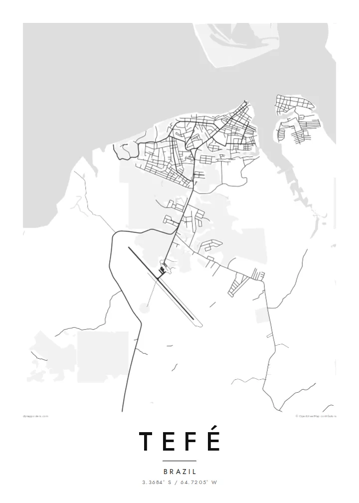
The town faces a broad lake that connects to the Solimões, and its waterfront edge is the strongest line on the map.
Qeeqabak kaartah poster · Brazil
3.3684° S / 64.7205° W
A river town on the shore of Lake Tefé, surrounded by Amazon forest and channels of water


Inki magaala, konoy gaba
Qande inkih tibbixeeh derre baguley table. Kulli qande missoowa caagid—daabbisimta, dirbaabu-le kaadu HD fayla akah.
 Cagalah pixels · 24 × 36″ daabbi fayla
Maxxaacah qeeqa
Tama usuk cagalah daabbi faylak 100% qambaala. Kulli poster — daabbisimta, dirbaabu-le kaadu download geytimta — ni-server-ittal 300 DPI-l ederimta, 7,200 × 10,800 pixels fanah, tokkel iyyi ellee catoy 24 × 36″ daabbi baxsi bahisak raaqu.
Gidarih


Kaarta
Tefé lies in the middle of Brazil's Amazonas state, on the shore of Lake Tefé, a wide body of water that opens onto the Solimões, as the Amazon is called in this stretch. There is no road link to Manaus, so the town depends on boats and flights. On a map it is a compact cluster of streets set against water on one side and forest on the others.
The town is the base of the Mamirauá Institute, which studies the flooded várzea forests of the nearby reserves, and the region is known for research on river dolphins and seasonal flooding. Water levels here change a great deal through the year, moving the shoreline and reshaping the channels that connect the lake to the main river.
A Tefé map poster works almost like a sketch of the Amazon itself: a small grid of streets, a lake edge, and wide empty ground where the forest continues beyond the frame. The contrast is striking in black and white. It shows how much of this landscape belongs to water and trees, and how tightly the town holds onto its shore.
The town faces a broad lake that connects to the Solimões, and its waterfront edge is the strongest line on the map.
With no road connection to the wider region, the streets stay close together, forming a small, dense grid that ends abruptly at forest and water.
Around the town, the map opens into forest and seasonally flooded ground, with channels and lakes that change shape through the year.
Kok tanim ab
Ayro, migaq hinnay kok tan xagar osis; gaba, ballaqa hinnay xiqa soorris.
Free preview qansarissi kee watermark-le. Daabbisimtaan kee HD fayla 300 DPI-l, 7,200 × 10,800 px fanah, watermark maleh ederimta.
Macah Tefé
Tefé is a place people rarely reach by accident. A print of it suits researchers who worked on the rivers, families from Amazonas, or anyone who simply wants the lake and forest on their wall.
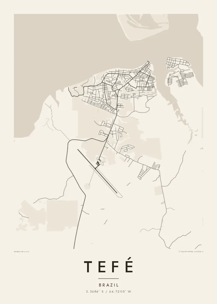
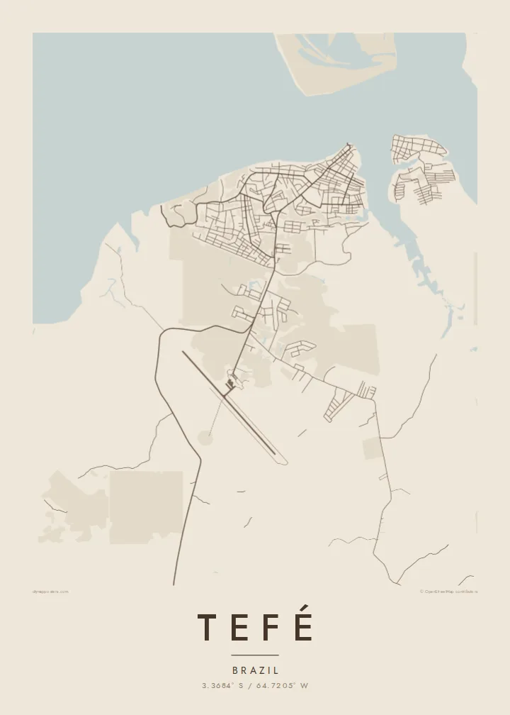
You can set a title, add a subtitle with a date or expedition name, and edit the coordinates line. Choose between Classic black & white, Noir, Paper, Blueprint and Sand. Blueprint suits a map this full of water.
Tefé poster orme| Maxxaacah ballaqa | Qeeqa | Faylal |
|---|---|---|
| 30 × 40 cm (11.8 × 15.7″) | 3,543 × 4,724 px | PNG · PDF |
| 29.7 × 42 cm (A3, 11.7 × 16.5″) | 3,508 × 4,961 px | PNG · PDF |
| 42 × 59.4 cm (A2, 16.5 × 23.4″) | 4,961 × 7,016 px | PNG · PDF |
| 45.7 × 61 cm (18 × 24″) | 5,400 × 7,200 px | PNG · PDF |
| 50 × 70 cm (19.7 × 27.6″) | 5,906 × 8,268 px | PNG · PDF |
| 61 × 91.4 cm (24 × 36″) | 7,200 × 10,800 px | PNG · PDF |
Tabbaltah, limo-wayta xaqqa-le ablo 900 px ballaqa le, asta le, iskiriinih keh tan. HD faylal gexsoh inkih addal 8× fanah qeeqa le, poster ballaqa inkih addal meqeh maxxaacimta.
Baxxaqqa qari le qandiy dooriy, tohuk lakal Daabbisimtah Poster — kutuk kee, faxximek, dirbaabu — hinnay HD Digital Fayla dooru. Checkout inki wagitti geytima, kaadu ku-orme page keenih adissa akke waqdi caagoy kummite.
Usuk 200 gsm-le catam kutuk warqatal, lica katiy caagitte {printFrom}-ik hane ayta 30 × 40 cm-ik 24 × 36″ fanah, xaagu keenil warreeh.
Ee. Sarrah-le dirbaabu doori — bad, gudduc, oak-le hinnay bad-madabuy. Usuk finqisiimam ellee sange qarab-le kaadu qari umukku iyya keenih taagu. Dirbaabu-le poster {framedFrom}-ik hane, xaagu keenil warreeh.
Xaagu addunyal inkih cisab-le. Kulli poster 30+ ummattak ni-daabbi-mara mananih xayyoysa kaadu 3–7 caagu-ayróh fanah geeytima. Ku-orme kee xaagu tarikiy My Orders addal ablitta.
Geytimeek 14 ayróy addal foto naah rubbaay, cisab-le daabbisiynah hinnay ku-lacay gacisnaah.
Ee. Tama page-l edito addal, migaaq, subtitle kee coordinates sarrah faxxem fanah badal, kaadu qande kee katiy doori. Daabbisimtah, dirbaabu-le kaadu digital orme inkih ku-design cagalah yekkelen.
$9 bacisak 300 DPI PNG kee daabbisimtah adissime PDF fayla lica katiy inkih, watermark maleh, ayyi meki daabbisimtah geeytitta. Cisab makkoysemty ana? Awqak, watermark-le free preview download-eh.
