Skanderbeg Square
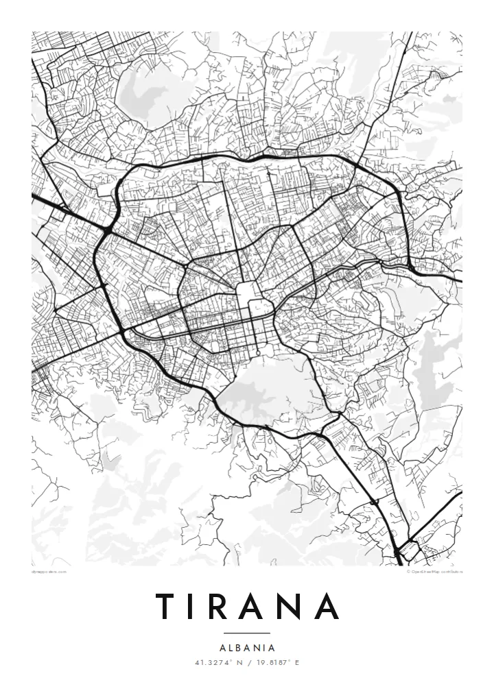
A very large pedestrianised square at the centre, from which main roads radiate. On the poster it appears as an open space ringed by government and cultural buildings.
Qeeqabak kaartah poster · Albania
41.3274° N / 19.8187° E
A capital laid out around a broad central square and boulevard, with the Lana stream, an artificial lake and Mount Dajti beyond


Inki magaala, konoy gaba
Qande inkih tibbixeeh derre baguley table. Kulli qande missoowa caagid—daabbisimta, dirbaabu-le kaadu HD fayla akah.
 Cagalah pixels · 24 × 36″ daabbi fayla
Maxxaacah qeeqa
Tama usuk cagalah daabbi faylak 100% qambaala. Kulli poster — daabbisimta, dirbaabu-le kaadu download geytimta — ni-server-ittal 300 DPI-l ederimta, 7,200 × 10,800 pixels fanah, tokkel iyyi ellee catoy 24 × 36″ daabbi baxsi bahisak raaqu.
Gidarih


Kaarta
Tirana's map is organised around a strong north–south axis. The Boulevard of the Martyrs of the Nation runs from the university toward Skanderbeg Square, a vast open space at the city's heart, and the line continues north beyond it. The axis was shaped largely by Italian architects in the 1920s and 1930s, and its monumental straightness still stands out against the looser streets around it.
Crossing this axis from east to west is the Lana, a small river channelled between embankments and flanked by roads. South of the centre lies the Grand Park, with its artificial lake and wooded paths. A Tirana map poster shows these elements clearly, framed by a ring road and the dense, irregular neighbourhoods that grew rapidly after the 1990s.
Tirana became Albania's capital in 1920. Mount Dajti rises steeply to the east, reached by a cable car, and forms the backdrop visible from much of the city. Former restricted areas such as the Blloku district are now among the busiest neighbourhoods, and brightly painted facades introduced in the 2000s changed the look of many buildings.
A very large pedestrianised square at the centre, from which main roads radiate. On the poster it appears as an open space ringed by government and cultural buildings.
A straight monumental avenue running south to the university, drawing a firm axis through the grid and giving the map its central spine.
South of the centre, an artificial lake is enclosed by wooded parkland and paths, offering a soft, irregular shape at the edge of the city.
Kok tanim ab
Ayro, migaq hinnay kok tan xagar osis; gaba, ballaqa hinnay xiqa soorris.
Free preview qansarissi kee watermark-le. Daabbisimtaan kee HD fayla 300 DPI-l, 7,200 × 10,800 px fanah, watermark maleh ederimta.
Macah Tirana
Tirana has changed rapidly, and a map captures the city at a particular moment, whether it is a birthplace, a place of study or the start of a new life. Add a title, subtitle and coordinates line to make it personal.
Choose Classic black & white, Noir, Paper, Blueprint or Sand. HD files for $9 cover six print sizes, each as a 300 DPI PNG and print-ready PDF, and a free 900 px preview lets you check the composition before buying.
Tirana poster orme| Maxxaacah ballaqa | Qeeqa | Faylal |
|---|---|---|
| 30 × 40 cm11.8 × 15.7″ | 3,543 × 4,724 px | PNG · PDF |
| 29.7 × 42 cm (A3)11.7 × 16.5″ | 3,508 × 4,961 px | PNG · PDF |
| 42 × 59.4 cm (A2)16.5 × 23.4″ | 4,961 × 7,016 px | PNG · PDF |
| 45.7 × 61 cm18 × 24″ | 5,400 × 7,200 px | PNG · PDF |
| 50 × 70 cm19.7 × 27.6″ | 5,906 × 8,268 px | PNG · PDF |
| 61 × 91.4 cm24 × 36″ | 7,200 × 10,800 px | PNG · PDF |
Tabbaltah, limo-wayta xaqqa-le ablo 900 px ballaqa le, asta le, iskiriinih keh tan. HD faylal gexsoh inkih addal 8× fanah qeeqa le, poster ballaqa inkih addal meqeh maxxaacimta.
Baxxaqqa qari le qandiy dooriy, tohuk lakal Daabbisimtah Poster — kutuk kee, faxximek, dirbaabu — hinnay HD Digital Fayla dooru. Checkout inki wagitti geytima, kaadu ku-orme page keenih adissa akke waqdi caagoy kummite.
Usuk 200 gsm-le catam kutuk warqatal, lica katiy caagitte $39-ik hane ayta 30 × 40 cm-ik 24 × 36″ fanah, xaagu keenil warreeh.
Ee. Sarrah-le dirbaabu doori — bad, gudduc, oak-le hinnay bad-madabuy. Usuk finqisiimam ellee sange qarab-le kaadu qari umukku iyya keenih taagu. Dirbaabu-le poster $99-ik hane, xaagu keenil warreeh.
Dirsa 60+ baaxoh bilsa. Poster kasa 30+ baaxoh nel print kaadu yan kee dirgeh kaxxa kee tanah printa, kee 3–7 xaqu ayyaamah yaaxigeeh. Xaaloo kee tracking "Ac Order" gexsitam. Kaadu baaxo 2–5 isbuuc yaaxigeeh, nanu dirsi yanin baaxoh sajiitah site ku kalah tekkeh.
Geytimeek 14 ayróy addal foto naah rubbaay, cisab-le daabbisiynah hinnay ku-lacay gacisnaah.
Ee. Tama page-l edito addal, migaaq, subtitle kee coordinates sarrah faxxem fanah badal, kaadu qande kee katiy doori. Daabbisimtah, dirbaabu-le kaadu digital orme inkih ku-design cagalah yekkelen.
$9 bacisak 300 DPI PNG kee daabbisimtah adissime PDF fayla lica katiy inkih, watermark maleh, ayyi meki daabbisimtah geeytitta. Cisab makkoysemty ana? Awqak, watermark-le free preview download-eh.
