Trans-Caspian line
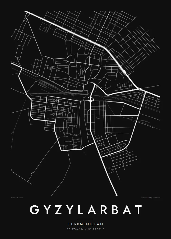
The railway runs through the town along the foot of the mountains. It is the main axis around which the streets are organised.
মিনিমালিস্ট ম্যাপ পোস্টার · তুর্কমেনিস্তান
38.9764° N / 56.2758° E
A railway town laid out on the plain at the foot of the Kopetdag, between mountains and the Karakum



এক শহর, পাঁচ মেজাজ
একটি স্টাইলে ট্যাপ করে দেয়ালে দেখুন। প্রতিটি স্টাইলের দাম একই — প্রিন্ট, ফ্রেমসহ বা HD ফাইল হিসেবে।
 প্রকৃত পিক্সেল · 24 × 36″ প্রিন্ট ফাইল
প্রিন্টে ঝকঝকে
এটি আসল প্রিন্ট ফাইলের ১০০% ক্রপ। প্রতিটি পোস্টার — প্রিন্ট করা, ফ্রেমসহ বা ডাউনলোড করা — আমাদের সার্ভারে 300 DPI-তে, 7,200 × 10,800 পিক্সেল পর্যন্ত রেন্ডার করা হয়, তাই 24 × 36″ প্রিন্টেও সবচেয়ে ছোট গলিটাও স্পষ্ট থাকে।
দেয়ালে


ম্যাপ
Gyzylarbat, officially renamed Serdar, is a town in western Turkmenistan's Balkan region. It stands on the narrow strip of habitable land between the Kopetdag mountains to the south and the Karakum Desert to the north. It grew as a station on the Trans-Caspian Railway, which runs along this corridor between the Caspian coast and Ashgabat.
That position still defines the town's shape. The railway and the main road run roughly parallel through it, and the streets extend on a fairly regular plan on either side. To the south, the ground rises toward bare foothills. To the north, it opens into flat, dry country.
A Gyzylarbat map poster reads as a long, horizontal composition: transport lines crossing the frame, a grid gathered around them, and the relief and emptiness of the landscape beyond. It suits anyone with ties to the town or anyone interested in the old railway settlements of Central Asia.
The railway runs through the town along the foot of the mountains. It is the main axis around which the streets are organised.
South of the town the land rises into bare ridges. On the map they appear as open space beyond the last streets.
North of the settlement the country flattens toward the Karakum. That broad, empty ground gives the design strong negative space.
নিজের মতো করে নিন
একটি তারিখ, নাম বা নিজের কোনো লাইন যোগ করুন, স্টাইল, সাইজ বা ওরিয়েন্টেশন বদলান।
ফ্রি প্রিভিউ কম রেজোলিউশনের ও ওয়াটারমার্কযুক্ত। প্রিন্ট ও HD ফাইল 300 DPI-তে, 7,200 × 10,800 px পর্যন্ত, ওয়াটারমার্ক ছাড়া রেন্ডার করা হয়।
কেন Gyzylarbat
For families who lived along the railway in western Turkmenistan, the streets of Gyzylarbat hold a lot of memory. A clean map of the town is a quiet way to honour that, under either the old name or the new one.
You can write the title as Gyzylarbat or Serdar, add a subtitle and edit the coordinates line. Choose from five styles: Classic black & white, Noir, Paper, Blueprint and Sand.
Gyzylarbat পোস্টার অর্ডার করুন| প্রিন্ট সাইজ | রেজোলিউশন | ফাইল |
|---|---|---|
| 30 × 40 cm11.8 × 15.7″ | 3,543 × 4,724 px | PNG · PDF |
| 29.7 × 42 cm (A3)11.7 × 16.5″ | 3,508 × 4,961 px | PNG · PDF |
| 42 × 59.4 cm (A2)16.5 × 23.4″ | 4,961 × 7,016 px | PNG · PDF |
| 45.7 × 61 cm18 × 24″ | 5,400 × 7,200 px | PNG · PDF |
| 50 × 70 cm19.7 × 27.6″ | 5,906 × 8,268 px | PNG · PDF |
| 61 × 91.4 cm24 × 36″ | 7,200 × 10,800 px | PNG · PDF |
তুলনার জন্য, ফ্রি প্রিভিউটি 900 px চওড়া, ওয়াটারমার্কসহ এবং স্ক্রিনে দেখার জন্য তৈরি। HD ফাইলগুলোর রেজোলিউশন প্রতিটি দিকে সর্বোচ্চ ৮ গুণ বেশি এবং পূর্ণ পোস্টার সাইজে পরিষ্কার প্রিন্ট হয়।
পেজের উপরে একটি স্টাইল বেছে নিন, তারপর প্রিন্টেড পোস্টার — একটি সাইজ ও, চাইলে, একটি ফ্রেম — অথবা ডিজিটাল HD ফাইল বেছে নিন। চেকআউট মাত্র এক ধাপে হয়, আর পেমেন্ট সম্পন্ন হওয়া মাত্রই আপনার অর্ডার পেজ আপডেট হয়ে যায়।
এটি প্রিমিয়াম 200 gsm ম্যাট পেপারে ছয়টি সাইজের যেকোনো একটিতে প্রিন্ট করা হয়, 30 × 40 সেমি থেকে 24 × 36″ পর্যন্ত। প্রিন্টেড পোস্টার শুরু হয় $39 থেকে, শিপিং সহ।
হ্যাঁ। কালো, সাদা, ন্যাচারাল ওক বা ডার্ক উডের সলিড কাঠের ফ্রেম বেছে নিন। এতে রয়েছে শ্যাটারপ্রুফ গ্লেজিং এবং এটি দেয়ালে টাঙানোর জন্য প্রস্তুত থাকে। ফ্রেমসহ পোস্টার শুরু হয় $99 থেকে, শিপিং সহ।
৬০+ দেশে শিপিং বিনামূল্যে। প্রতিটি পোস্টার ৩০+ দেশে থাকা আমাদের প্রিন্ট পার্টনারদের মধ্যে সবচেয়ে কাছের জন প্রিন্ট করে এবং সাধারণত ৩–৭ কার্যদিবসে পৌঁছে যায়। স্ট্যাটাস ও ট্র্যাকিং দেখতে পারবেন "আমার অর্ডার" পেজে। কিছু দেশে ২–৫ সপ্তাহ লাগে, আর যেসব দেশে আমরা এখনও শিপ করি না, পেমেন্টের আগেই সাইট আপনাকে জানিয়ে দেবে।
ডেলিভারির 14 দিনের মধ্যে আমাদের একটি ছবি পাঠান, আমরা বিনামূল্যে আবার প্রিন্ট করে দেব বা রিফান্ড করব।
হ্যাঁ। এই পেজের এডিটরে টাইটেল, সাবটাইটেল ও কোঅর্ডিনেট লাইন আপনার ইচ্ছেমতো বদলে নিন, আর একটি স্টাইল ও সাইজ বেছে নিন। প্রিন্টেড, ফ্রেমসহ ও ডিজিটাল — সব অর্ডারই ঠিক আপনার ডিজাইন অনুযায়ী তৈরি হয়।
$9-এ আপনি পাবেন 300 DPI PNG ও প্রিন্ট-রেডি PDF ফাইল, সবগুলো ছয়টি সাইজে, ওয়াটারমার্ক ছাড়া, যেকোনো জায়গায় প্রিন্ট করার জন্য। এখনো নিশ্চিত নন? আগে একটি ফ্রি ওয়াটারমার্কযুক্ত প্রিভিউ ডাউনলোড করে দেখুন।
