The Indus
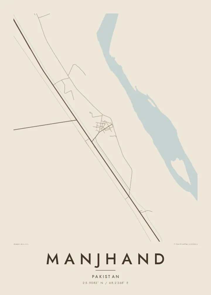
The great river runs to the east of the town, and its broad floodplain forms a wide, open band across one side of the map.
মিনিমালিস্ট ম্যাপ পোস্টার · পাকিস্তান
25.9083° N / 68.2368° E
A Sindh river town on the west bank of the Indus, between the water and the dry hills


এক শহর, পাঁচ মেজাজ
একটি স্টাইলে ট্যাপ করে দেয়ালে দেখুন। প্রতিটি স্টাইলের দাম একই — প্রিন্ট, ফ্রেমসহ বা HD ফাইল হিসেবে।
 প্রকৃত পিক্সেল · 24 × 36″ প্রিন্ট ফাইল
প্রিন্টে ঝকঝকে
এটি আসল প্রিন্ট ফাইলের ১০০% ক্রপ। প্রতিটি পোস্টার — প্রিন্ট করা, ফ্রেমসহ বা ডাউনলোড করা — আমাদের সার্ভারে 300 DPI-তে, 7,200 × 10,800 পিক্সেল পর্যন্ত রেন্ডার করা হয়, তাই 24 × 36″ প্রিন্টেও সবচেয়ে ছোট গলিটাও স্পষ্ট থাকে।
দেয়ালে


ম্যাপ
Manjhand is in Jamshoro District in Sindh, on the western side of the Indus. On the map, it sits between two very different landscapes: the flat, irrigated floodplain along the river and the dry, rocky ground that rises toward the Kirthar hills to the west. The town grows along the line where these meet.
The streets are compact and irregular at the centre, where the houses cluster closely together. Roads lead out toward the river and to neighbouring towns along the Indus. Around the town, irrigation channels and field boundaries divide the farmland into narrow plots, forming a fine texture of lines across the lower part of the frame.
Like many towns along the lower Indus, Manjhand depends on the river for water and farming, and its setting shapes how people live. A Manjhand map poster shows a small town between river and hills, with the fields and canals that support it spread out around the streets.
The great river runs to the east of the town, and its broad floodplain forms a wide, open band across one side of the map.
Irrigation canals and field boundaries cut the land around the town into narrow plots, a detailed pattern of fine lines.
Toward the west, the farmland gives way to dry, rising ground, where the streets thin out and the landscape becomes open and bare.
নিজের মতো করে নিন
একটি তারিখ, নাম বা নিজের কোনো লাইন যোগ করুন, স্টাইল, সাইজ বা ওরিয়েন্টেশন বদলান।
ফ্রি প্রিভিউ কম রেজোলিউশনের ও ওয়াটারমার্কযুক্ত। প্রিন্ট ও HD ফাইল 300 DPI-তে, 7,200 × 10,800 px পর্যন্ত, ওয়াটারমার্ক ছাড়া রেন্ডার করা হয়।
কেন Manjhand
A map of Manjhand is a personal piece for people who grew up there or whose families come from the town, especially those living far away. It records the town, the fields and the river that define it.
You can write the title and subtitle in the form you prefer and add exact coordinates. Choose from five styles: Classic black & white, Noir, Paper, Blueprint and Sand. Download 300 DPI files in six sizes, or order a printed poster.
Manjhand পোস্টার অর্ডার করুন| প্রিন্ট সাইজ | রেজোলিউশন | ফাইল |
|---|---|---|
| 30 × 40 cm (11.8 × 15.7″) | 3,543 × 4,724 px | PNG · PDF |
| 29.7 × 42 cm (A3, 11.7 × 16.5″) | 3,508 × 4,961 px | PNG · PDF |
| 42 × 59.4 cm (A2, 16.5 × 23.4″) | 4,961 × 7,016 px | PNG · PDF |
| 45.7 × 61 cm (18 × 24″) | 5,400 × 7,200 px | PNG · PDF |
| 50 × 70 cm (19.7 × 27.6″) | 5,906 × 8,268 px | PNG · PDF |
| 61 × 91.4 cm (24 × 36″) | 7,200 × 10,800 px | PNG · PDF |
তুলনার জন্য, ফ্রি প্রিভিউটি 900 px চওড়া, ওয়াটারমার্কসহ এবং স্ক্রিনে দেখার জন্য তৈরি। HD ফাইলগুলোর রেজোলিউশন প্রতিটি দিকে সর্বোচ্চ ৮ গুণ বেশি এবং পূর্ণ পোস্টার সাইজে পরিষ্কার প্রিন্ট হয়।
পেজের উপরে একটি স্টাইল বেছে নিন, তারপর প্রিন্টেড পোস্টার — একটি সাইজ ও, চাইলে, একটি ফ্রেম — অথবা ডিজিটাল HD ফাইল বেছে নিন। চেকআউট মাত্র এক ধাপে হয়, আর পেমেন্ট সম্পন্ন হওয়া মাত্রই আপনার অর্ডার পেজ আপডেট হয়ে যায়।
এটি প্রিমিয়াম 200 gsm ম্যাট পেপারে ছয়টি সাইজের যেকোনো একটিতে প্রিন্ট করা হয়, 30 × 40 সেমি থেকে 24 × 36″ পর্যন্ত। প্রিন্টেড পোস্টার শুরু হয় $39 থেকে, শিপিং সহ।
হ্যাঁ। কালো, সাদা, ন্যাচারাল ওক বা ডার্ক উডের সলিড কাঠের ফ্রেম বেছে নিন। এতে রয়েছে শ্যাটারপ্রুফ গ্লেজিং এবং এটি দেয়ালে টাঙানোর জন্য প্রস্তুত থাকে। ফ্রেমসহ পোস্টার শুরু হয় $99 থেকে, শিপিং সহ।
সারা বিশ্বে শিপিং ফ্রি। ৩০টিরও বেশি দেশে আমাদের প্রিন্ট পার্টনারদের মধ্যে সবচেয়ে কাছের জন প্রতিটি পোস্টার প্রিন্ট করে, আর সাধারণত ৩–৭ কার্যদিবসের মধ্যে পৌঁছে যায়। আমার অর্ডার-এ গিয়ে স্ট্যাটাস ও ট্র্যাকিং দেখতে পারবেন। কিছু দেশে ২–৫ সপ্তাহ লাগে, আর যেসব দেশে এখনও শিপ করি না, পেমেন্টের আগেই সাইট আপনাকে জানিয়ে দেবে।
ডেলিভারির 14 দিনের মধ্যে আমাদের একটি ছবি পাঠান, আমরা বিনামূল্যে আবার প্রিন্ট করে দেব বা রিফান্ড করব।
হ্যাঁ। এই পেজের এডিটরে টাইটেল, সাবটাইটেল ও কোঅর্ডিনেট লাইন আপনার ইচ্ছেমতো বদলে নিন, আর একটি স্টাইল ও সাইজ বেছে নিন। প্রিন্টেড, ফ্রেমসহ ও ডিজিটাল — সব অর্ডারই ঠিক আপনার ডিজাইন অনুযায়ী তৈরি হয়।
$9-এ আপনি পাবেন 300 DPI PNG ও প্রিন্ট-রেডি PDF ফাইল, সবগুলো ছয়টি সাইজে, ওয়াটারমার্ক ছাড়া, যেকোনো জায়গায় প্রিন্ট করার জন্য। এখনো নিশ্চিত নন? আগে একটি ফ্রি ওয়াটারমার্কযুক্ত প্রিভিউ ডাউনলোড করে দেখুন।
