Paddy patterns
Around the built-up areas, rice fields form a regular grid of small plots. They give the map the finely divided texture typical of the Nara Basin.
মিনিমালিস্ট ম্যাপ পোস্টার · জাপান
34.5542° N / 135.7930° E
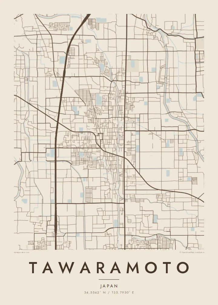
A flat town in the Nara Basin, where rice paddies, two rail lines and small village clusters form a quiet patchwork.


এক শহর, পাঁচ মেজাজ
একটি স্টাইলে ট্যাপ করে দেয়ালে দেখুন। প্রতিটি স্টাইলের দাম একই — প্রিন্ট, ফ্রেমসহ বা HD ফাইল হিসেবে।
 প্রকৃত পিক্সেল · 24 × 36″ প্রিন্ট ফাইল
প্রিন্টে ঝকঝকে
এটি আসল প্রিন্ট ফাইলের ১০০% ক্রপ। প্রতিটি পোস্টার — প্রিন্ট করা, ফ্রেমসহ বা ডাউনলোড করা — আমাদের সার্ভারে 300 DPI-তে, 7,200 × 10,800 পিক্সেল পর্যন্ত রেন্ডার করা হয়, তাই 24 × 36″ প্রিন্টেও সবচেয়ে ছোট গলিটাও স্পষ্ট থাকে।
দেয়ালে


ম্যাপ
Tawaramoto lies in the middle of the Nara Basin, on level ground, with the mountains that ring the basin in the distance. The town is flat, and its map mixes residential clusters, narrow lanes and rice fields laid out in neat rectangular plots. Small rivers and irrigation channels cross the land, most of them in straight lines.
Two railway lines pass through the town, and their stations form small centres of denser streets. Tawaramoto is also home to the Karako-Kagi site, one of the best-known archaeological sites of Japan's Yayoi period, where a reconstructed tower now stands. A Tawaramoto map poster shows this blend of an old settlement pattern and a modern town.
In monochrome, field boundaries and the grid of lanes make a fine, even texture across the sheet. The clustered villages and the long lines of the railways break it up. The result is subtle and balanced, a map that rewards close looking and suits a calm, uncluttered room.
Around the built-up areas, rice fields form a regular grid of small plots. They give the map the finely divided texture typical of the Nara Basin.
Two railway lines cross the town, each with its own station area. Their straight tracks divide the fields and link Tawaramoto with other parts of the basin.
The Yayoi-period archaeological site forms an open area among the fields. This green space, with its reconstructed tower, marks one of the region's oldest known settlements.
নিজের মতো করে নিন
একটি তারিখ, নাম বা নিজের কোনো লাইন যোগ করুন, স্টাইল, সাইজ বা ওরিয়েন্টেশন বদলান।
ফ্রি প্রিভিউ কম রেজোলিউশনের ও ওয়াটারমার্কযুক্ত। প্রিন্ট ও HD ফাইল 300 DPI-তে, 7,200 × 10,800 px পর্যন্ত, ওয়াটারমার্ক ছাড়া রেন্ডার করা হয়।
কেন Tawaramoto
Tawaramoto suits people who like quiet, orderly maps: former residents, visitors to the Nara region, or anyone interested in Japan's early history. Add your own title and subtitle, perhaps a family name or the dates of a stay, and keep or edit the coordinates line.
Choose Classic black & white, Noir, Paper, Blueprint or Sand. The free preview shows a 900 px watermarked version. The $9 purchase includes six sizes, among them A3 and A2, as 300 DPI PNG and print-ready PDF, and matte printed posters come with an optional wooden frame.
Tawaramoto পোস্টার অর্ডার করুন| প্রিন্ট সাইজ | রেজোলিউশন | ফাইল |
|---|---|---|
| 30 × 40 cm11.8 × 15.7″ | 3,543 × 4,724 px | PNG · PDF |
| 29.7 × 42 cm (A3)11.7 × 16.5″ | 3,508 × 4,961 px | PNG · PDF |
| 42 × 59.4 cm (A2)16.5 × 23.4″ | 4,961 × 7,016 px | PNG · PDF |
| 45.7 × 61 cm18 × 24″ | 5,400 × 7,200 px | PNG · PDF |
| 50 × 70 cm19.7 × 27.6″ | 5,906 × 8,268 px | PNG · PDF |
| 61 × 91.4 cm24 × 36″ | 7,200 × 10,800 px | PNG · PDF |
তুলনার জন্য, ফ্রি প্রিভিউটি 900 px চওড়া, ওয়াটারমার্কসহ এবং স্ক্রিনে দেখার জন্য তৈরি। HD ফাইলগুলোর রেজোলিউশন প্রতিটি দিকে সর্বোচ্চ ৮ গুণ বেশি এবং পূর্ণ পোস্টার সাইজে পরিষ্কার প্রিন্ট হয়।
পেজের উপরে একটি স্টাইল বেছে নিন, তারপর প্রিন্টেড পোস্টার — একটি সাইজ ও, চাইলে, একটি ফ্রেম — অথবা ডিজিটাল HD ফাইল বেছে নিন। চেকআউট মাত্র এক ধাপে হয়, আর পেমেন্ট সম্পন্ন হওয়া মাত্রই আপনার অর্ডার পেজ আপডেট হয়ে যায়।
এটি প্রিমিয়াম 200 gsm ম্যাট পেপারে ছয়টি সাইজের যেকোনো একটিতে প্রিন্ট করা হয়, 30 × 40 সেমি থেকে 24 × 36″ পর্যন্ত। প্রিন্টেড পোস্টার শুরু হয় $39 থেকে, শিপিং সহ।
হ্যাঁ। কালো, সাদা, ন্যাচারাল ওক বা ডার্ক উডের সলিড কাঠের ফ্রেম বেছে নিন। এতে রয়েছে শ্যাটারপ্রুফ গ্লেজিং এবং এটি দেয়ালে টাঙানোর জন্য প্রস্তুত থাকে। ফ্রেমসহ পোস্টার শুরু হয় $99 থেকে, শিপিং সহ।
৬০+ দেশে শিপিং বিনামূল্যে। প্রতিটি পোস্টার ৩০+ দেশে থাকা আমাদের প্রিন্ট পার্টনারদের মধ্যে সবচেয়ে কাছের জন প্রিন্ট করে এবং সাধারণত ৩–৭ কার্যদিবসে পৌঁছে যায়। স্ট্যাটাস ও ট্র্যাকিং দেখতে পারবেন "আমার অর্ডার" পেজে। কিছু দেশে ২–৫ সপ্তাহ লাগে, আর যেসব দেশে আমরা এখনও শিপ করি না, পেমেন্টের আগেই সাইট আপনাকে জানিয়ে দেবে।
ডেলিভারির 14 দিনের মধ্যে আমাদের একটি ছবি পাঠান, আমরা বিনামূল্যে আবার প্রিন্ট করে দেব বা রিফান্ড করব।
হ্যাঁ। এই পেজের এডিটরে টাইটেল, সাবটাইটেল ও কোঅর্ডিনেট লাইন আপনার ইচ্ছেমতো বদলে নিন, আর একটি স্টাইল ও সাইজ বেছে নিন। প্রিন্টেড, ফ্রেমসহ ও ডিজিটাল — সব অর্ডারই ঠিক আপনার ডিজাইন অনুযায়ী তৈরি হয়।
$9-এ আপনি পাবেন 300 DPI PNG ও প্রিন্ট-রেডি PDF ফাইল, সবগুলো ছয়টি সাইজে, ওয়াটারমার্ক ছাড়া, যেকোনো জায়গায় প্রিন্ট করার জন্য। এখনো নিশ্চিত নন? আগে একটি ফ্রি ওয়াটারমার্কযুক্ত প্রিভিউ ডাউনলোড করে দেখুন।
