The Old City walls
The Ottoman walls, completed under Suleiman the Magnificent in the 1530s, enclose the Old City in an unmistakable outline. Gates such as Damascus Gate and Herod's Gate open onto the northern districts.
Póster de mapa minimalista · Territorios Palestinos
31.7868° N / 35.2449° E
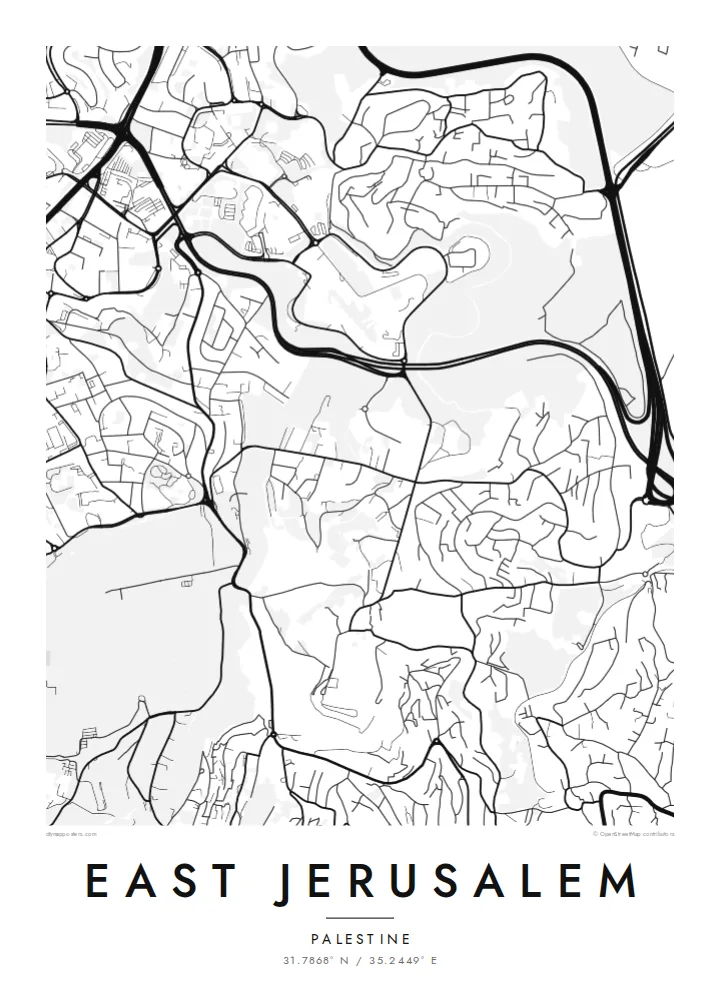
Walled Old City at the centre, the Kidron Valley and Mount of Olives to the east, neighbourhoods spreading north and south


Una ciudad, cinco ambientes
Toca un estilo para verlo en la pared. Todos los estilos cuestan lo mismo: impreso, enmarcado o en archivos HD.
 Píxeles reales · archivo de impresión de 24 × 36″
Nitidez de impresión
Este es un recorte al 100% del archivo de impresión real. Cada póster —impreso, enmarcado o descargado— se renderiza en nuestros servidores a 300 DPI, hasta 7,200 × 10,800 píxeles, para que hasta las calles más pequeñas se vean nítidas en una impresión de 24 × 36″.
En la pared


El mapa
From above, East Jerusalem arranges itself around the walled Old City. The walls form a clear, slightly skewed quadrilateral. Roads leave its gates and climb into the hills in every direction. To the east, the ground drops into the Kidron Valley and rises again to the Mount of Olives. Its slopes are marked by terraced cemeteries and a thin line of roads that follows the contours.
North of Damascus Gate, the street pattern becomes denser and more regular. Neighbourhoods such as Sheikh Jarrah spread along the road towards Ramallah. Further out, the map fragments into hilltop quarters separated by wadis and main roads. Because the terrain shapes almost every street, a East Jerusalem map poster reads as much like a relief study as a plan of a city.
The eastern side of the city has been contested since 1967, when Israel took control of the area. Its status remains central to Israeli–Palestinian negotiations. On paper, the lines are quieter. Gates, valleys, ridges and the long road descending towards Jericho are all shown with the same even weight. That lets the geography speak before the politics does.
The Ottoman walls, completed under Suleiman the Magnificent in the 1530s, enclose the Old City in an unmistakable outline. Gates such as Damascus Gate and Herod's Gate open onto the northern districts.
A deep, narrow valley runs north to south between the Old City and the Mount of Olives. On the map it shows as a clean gap between two dense areas of streets.
The ridge east of the Old City carries winding roads and large cemetery grounds. From above, its streets curve with the slope rather than following a grid.
Hazlo tuyo
Añade una fecha, un nombre o una frase propia, y cambia el estilo, el tamaño o la orientación.
La vista previa gratuita es de baja resolución y con marca de agua. Las impresiones y los archivos HD se renderizan a 300 DPI, hasta 7,200 × 10,800 px, sin marca de agua.
Por qué East Jerusalem
People who have lived in, studied in or prayed in this part of Jerusalem often want a map that is honest and restrained. A black-and-white plan of streets and slopes keeps the focus on the place itself, not on the headlines.
You can set your own title and add a subtitle with a date, a family name or a line of coordinates. Then choose from five styles: Classic black & white, Noir, Paper, Blueprint or Sand. The same composition can suit a study wall or a quiet hallway.
Pedir el póster East Jerusalem| Tamaño de impresión | Resolución | Archivos |
|---|---|---|
| 30 × 40 cm11.8 × 15.7″ | 3,543 × 4,724 px | PNG · PDF |
| 29.7 × 42 cm (A3)11.7 × 16.5″ | 3,508 × 4,961 px | PNG · PDF |
| 42 × 59.4 cm (A2)16.5 × 23.4″ | 4,961 × 7,016 px | PNG · PDF |
| 45.7 × 61 cm18 × 24″ | 5,400 × 7,200 px | PNG · PDF |
| 50 × 70 cm19.7 × 27.6″ | 5,906 × 8,268 px | PNG · PDF |
| 61 × 91.4 cm24 × 36″ | 7,200 × 10,800 px | PNG · PDF |
Como referencia, la vista previa gratuita mide 900 px de ancho, lleva marca de agua y está pensada para pantallas. Los archivos HD tienen hasta 8 veces más resolución en cada dirección y se imprimen con total nitidez a tamaño póster.
Elige un estilo arriba de la página y luego selecciona Póster Impreso —un tamaño y, si quieres, un marco— o Archivos Digitales HD. El pago se hace en un solo paso, y tu página de pedido se actualiza en cuanto se confirma el pago.
Se imprime en papel mate premium de 200 g/m² en uno de seis tamaños, desde 30 × 40 cm hasta 24 × 36″. Los pósters impresos cuestan desde $39, envío incluido.
Sí. Elige un marco de madera maciza en negro, blanco, roble natural o madera oscura. Incluye vidrio irrompible y llega listo para colgar. Los pósters enmarcados cuestan desde $99, envío incluido.
El envío es gratis a más de 60 países. Cada póster lo imprime el socio de impresión más cercano de nuestra red en más de 30 países y suele llegar en 3–7 días hábiles. Puedes seguir el estado y el seguimiento en Mis pedidos. Algunos países tardan de 2 a 5 semanas y, si aún no enviamos a tu país, la web te lo indica antes de pagar.
Envíanos una foto dentro de los 14 días posteriores a la entrega y te lo reimprimimos gratis o te devolvemos el dinero.
Sí. En el editor de esta página, cambia el título, el subtítulo y la línea de coordenadas por lo que quieras, y elige un estilo y un tamaño. Los pedidos impresos, enmarcados y digitales usan exactamente tu diseño.
Por $9 obtienes archivos PNG a 300 DPI y PDF listos para imprimir en los seis tamaños, sin marca de agua, para imprimir donde quieras. ¿Aún no estás seguro? Descarga primero una vista previa gratis con marca de agua.
Cerca
