Lake Cochituate
The lake forms a series of connected basins on the town's north-western edge. Their irregular shorelines give the map broad, open shapes that contrast with the fine lines of the surrounding streets.
Póster de mapa minimalista · Estados Unidos
42.2834° N / 71.3495° W
A wooded New England town of winding roads, framed by Lake Cochituate on one side and the Charles River on the other.



Una ciudad, cinco ambientes
Toca un estilo para verlo en la pared. Todos los estilos cuestan lo mismo: impreso, enmarcado o en archivos HD.
 Píxeles reales · archivo de impresión de 24 × 36″
Nitidez de impresión
Este es un recorte al 100% del archivo de impresión real. Cada póster —impreso, enmarcado o descargado— se renderiza en nuestros servidores a 300 DPI, hasta 7,200 × 10,800 píxeles, para que hasta las calles más pequeñas se vean nítidas en una impresión de 24 × 36″.
En la pared


El mapa
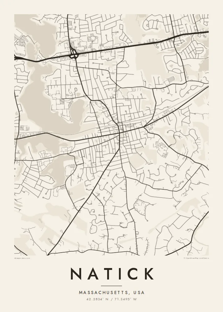
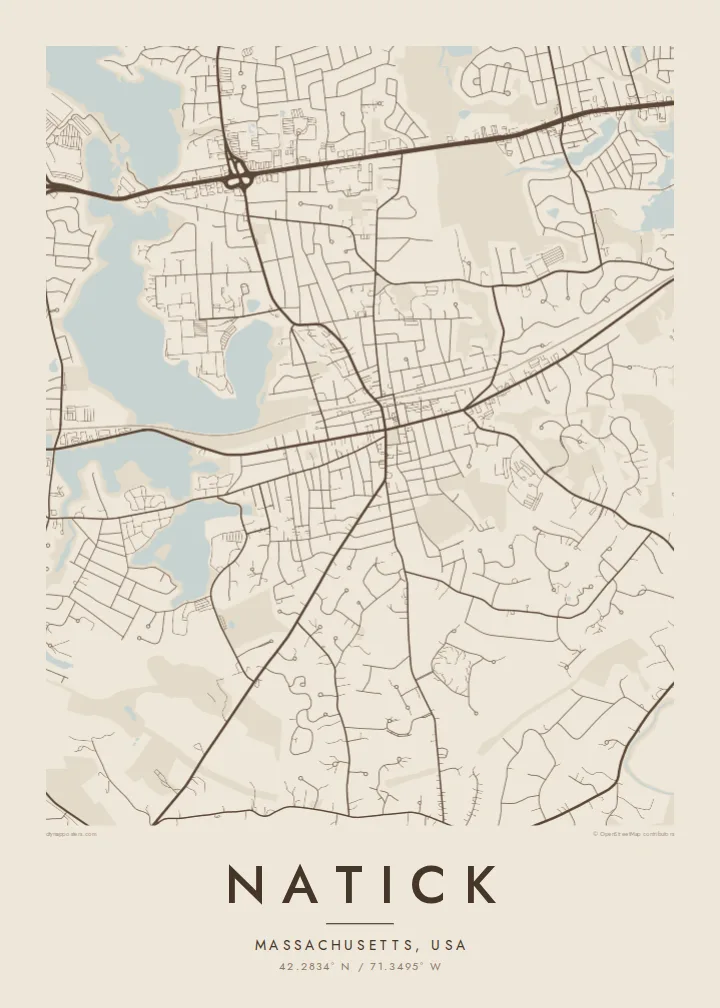
Natick lies in the MetroWest suburbs west of Boston, and its map is shaped more by water and woodland than by any grid. Curving residential streets fill the spaces between ponds and patches of forest, while a few long routes cross the town in straighter lines. The Massachusetts Turnpike runs along the northern side, and the commuter rail line cuts through toward the centre.
Natick was founded in 1651 by the missionary John Eliot as a settlement for Christian Native Americans, the first of the so-called praying towns in Massachusetts. Today it is also known as a stage on the Boston Marathon course, which follows Route 135 through the town centre. A Natick map poster brings these layers together on one sheet of carefully drawn lines.
Lake Cochituate stretches along the north-western side as a chain of long, lobed basins, and the Charles River winds past South Natick in the south. Between them, Route 9 draws a busy commercial corridor across the town. In monochrome, the two bodies of water work as natural borders and give the suburb a clear, recognisable outline.
The lake forms a series of connected basins on the town's north-western edge. Their irregular shorelines give the map broad, open shapes that contrast with the fine lines of the surrounding streets.
In South Natick the Charles River loops past the older village. It is a slow, winding line of water that marks the southern side of the town and softens the lower edge of the print.
The road that carries the Boston Marathon runs through the town centre. It is a straight thread linking Natick to its neighbours, and one many runners will recognise at once.
Hazlo tuyo
Añade una fecha, un nombre o una frase propia, y cambia el estilo, el tamaño o la orientación.
La vista previa gratuita es de baja resolución y con marca de agua. Las impresiones y los archivos HD se renderizan a 300 DPI, hasta 7,200 × 10,800 px, sin marca de agua.
Por qué Natick
Natick maps often end up with families who grew up near the lake, commuters who moved out from Boston, or runners who remember the marathon miles through town. The title, subtitle and coordinates line can all be edited, so a street, a race year or a moving date fits neatly beneath the map.
Five styles are available: Classic black & white, Noir, Paper, Blueprint and Sand. A free 900 px watermarked preview lets you check the framing first. For $9 you get six print sizes as 300 DPI PNG and print-ready PDF files, or you can order a matte poster, framed in wood if you like.
Pedir el póster Natick| Tamaño de impresión | Resolución | Archivos |
|---|---|---|
| 30 × 40 cm11.8 × 15.7″ | 3,543 × 4,724 px | PNG · PDF |
| 29.7 × 42 cm (A3)11.7 × 16.5″ | 3,508 × 4,961 px | PNG · PDF |
| 42 × 59.4 cm (A2)16.5 × 23.4″ | 4,961 × 7,016 px | PNG · PDF |
| 45.7 × 61 cm18 × 24″ | 5,400 × 7,200 px | PNG · PDF |
| 50 × 70 cm19.7 × 27.6″ | 5,906 × 8,268 px | PNG · PDF |
| 61 × 91.4 cm24 × 36″ | 7,200 × 10,800 px | PNG · PDF |
Como referencia, la vista previa gratuita mide 900 px de ancho, lleva marca de agua y está pensada para pantallas. Los archivos HD tienen hasta 8 veces más resolución en cada dirección y se imprimen con total nitidez a tamaño póster.
Elige un estilo arriba de la página y luego selecciona Póster Impreso —un tamaño y, si quieres, un marco— o Archivos Digitales HD. El pago se hace en un solo paso, y tu página de pedido se actualiza en cuanto se confirma el pago.
Se imprime en papel mate premium de 200 g/m² en uno de seis tamaños, desde 30 × 40 cm hasta 24 × 36″. Los pósters impresos cuestan desde $39, envío incluido.
Sí. Elige un marco de madera maciza en negro, blanco, roble natural o madera oscura. Incluye vidrio irrompible y llega listo para colgar. Los pósters enmarcados cuestan desde $99, envío incluido.
El envío es gratis a más de 60 países. Cada póster lo imprime el socio de impresión más cercano de nuestra red en más de 30 países y suele llegar en 3–7 días hábiles. Puedes seguir el estado y el seguimiento en Mis pedidos. Algunos países tardan de 2 a 5 semanas y, si aún no enviamos a tu país, la web te lo indica antes de pagar.
Envíanos una foto dentro de los 14 días posteriores a la entrega y te lo reimprimimos gratis o te devolvemos el dinero.
Sí. En el editor de esta página, cambia el título, el subtítulo y la línea de coordenadas por lo que quieras, y elige un estilo y un tamaño. Los pedidos impresos, enmarcados y digitales usan exactamente tu diseño.
Por $9 obtienes archivos PNG a 300 DPI y PDF listos para imprimir en los seis tamaños, sin marca de agua, para imprimir donde quieras. ¿Aún no estás seguro? Descarga primero una vista previa gratis con marca de agua.
Cerca
