The river confluence
The Saigon and Đồng Nai rivers merge here to form the Nhà Bè river. Two broad channels become one in a wide bend that dominates the upper part of the map.
Póster de mapa minimalista · Vietnam
10.6967° N / 106.7403° E
Low, water-laced ground on Ho Chi Minh City's southern edge, where great rivers meet and turn toward the sea


Una ciudad, cinco ambientes
Toca un estilo para verlo en la pared. Todos los estilos cuestan lo mismo: impreso, enmarcado o en archivos HD.
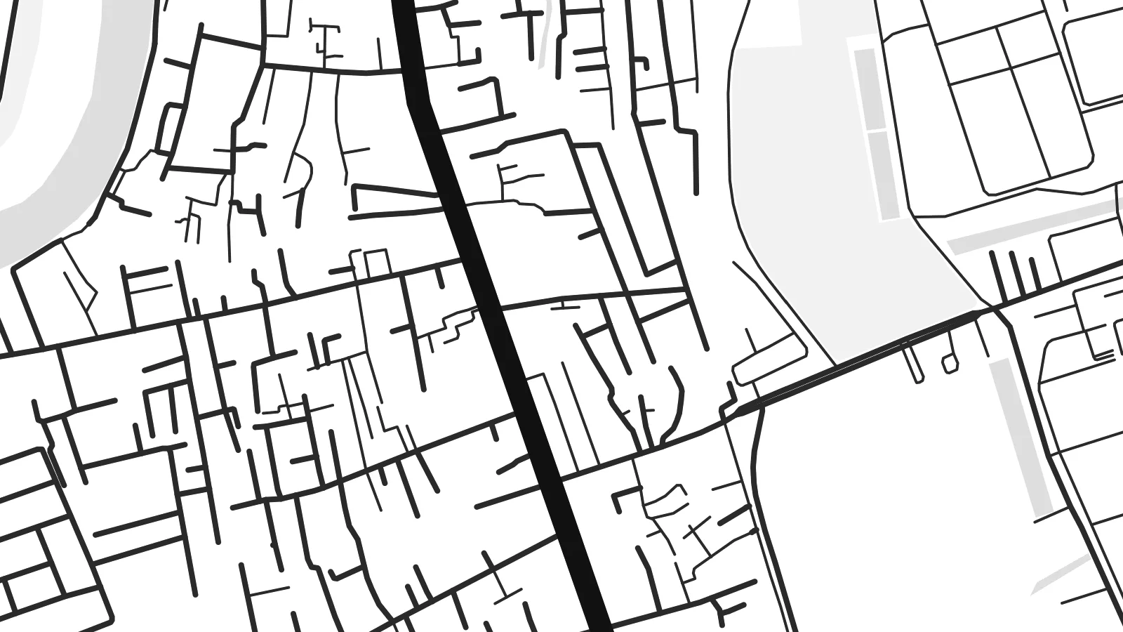 Píxeles reales · archivo de impresión de 24 × 36″
Nitidez de impresión
Este es un recorte al 100% del archivo de impresión real. Cada póster —impreso, enmarcado o descargado— se renderiza en nuestros servidores a 300 DPI, hasta 7,200 × 10,800 píxeles, para que hasta las calles más pequeñas se vean nítidas en una impresión de 24 × 36″.
En la pared


El mapa
Nhà Bè lies at the southern edge of Ho Chi Minh City, and from above it looks more like water than land. Here the Saigon and Đồng Nai rivers join to form the Nhà Bè river. Just south, the wide channels of the Soài Rạp and Lòng Tàu begin their run toward the coast. The settled areas follow the embankments and main roads, and between them lie fingers of low, flat ground cut by creeks.
The street pattern is loose and practical. There is no old grid or walled core. Instead you see long roads running parallel to the riverbanks, short lanes branching off toward the water, and blocks of warehouses and industrial land toward the south. Small canals and tidal creeks weave through everything. On a Nhà Bè map poster they appear as fine, irregular threads between the heavier outlines of the main rivers.
The river confluence has long made this a place of shipping and trade. Vessels bound for the city's ports pass through these channels, and the area's industry still leans toward the water. On a monochrome print, the district's fragmented land and broad river bends make an unusual composition. It feels closer to a delta chart than to a city plan, which is exactly its character.
The Saigon and Đồng Nai rivers merge here to form the Nhà Bè river. Two broad channels become one in a wide bend that dominates the upper part of the map.
A dense web of small creeks and canals crosses the low ground between the main rivers. It produces a fine, hand-drawn texture that sets Nhà Bè apart from the denser inner districts.
To the south, the waterways open toward the Soài Rạp and the coast. Their long, widening lines carry the eye out of the frame and hint at the delta beyond.
Hazlo tuyo
Añade una fecha, un nombre o una frase propia, y cambia el estilo, el tamaño o la orientación.
La vista previa gratuita es de baja resolución y con marca de agua. Las impresiones y los archivos HD se renderizan a 300 DPI, hasta 7,200 × 10,800 px, sin marca de agua.
Por qué Nhà Bè
This map suits anyone who has lived, worked or grown up along Saigon's southern rivers, or anyone who likes maps where water leads the composition. The irregular shapes feel calm on a wall and pair well with plain interiors and natural materials.
You can personalise the title and subtitle, including Vietnamese diacritics, and use the coordinates line for a date or a home address. Five styles are available: Classic black & white, Noir, Paper, Blueprint and Sand. Noir makes the channels glow, and Sand gives the delta a warmer tone.
Pedir el póster Nhà Bè| Tamaño de impresión | Resolución | Archivos |
|---|---|---|
| 30 × 40 cm11.8 × 15.7″ | 3,543 × 4,724 px | PNG · PDF |
| 29.7 × 42 cm (A3)11.7 × 16.5″ | 3,508 × 4,961 px | PNG · PDF |
| 42 × 59.4 cm (A2)16.5 × 23.4″ | 4,961 × 7,016 px | PNG · PDF |
| 45.7 × 61 cm18 × 24″ | 5,400 × 7,200 px | PNG · PDF |
| 50 × 70 cm19.7 × 27.6″ | 5,906 × 8,268 px | PNG · PDF |
| 61 × 91.4 cm24 × 36″ | 7,200 × 10,800 px | PNG · PDF |
Como referencia, la vista previa gratuita mide 900 px de ancho, lleva marca de agua y está pensada para pantallas. Los archivos HD tienen hasta 8 veces más resolución en cada dirección y se imprimen con total nitidez a tamaño póster.
Elige un estilo arriba de la página y luego selecciona Póster Impreso —un tamaño y, si quieres, un marco— o Archivos Digitales HD. El pago se hace en un solo paso, y tu página de pedido se actualiza en cuanto se confirma el pago.
Se imprime en papel mate premium de 200 g/m² en uno de seis tamaños, desde 30 × 40 cm hasta 24 × 36″. Los pósters impresos cuestan desde $39, envío incluido.
Sí. Elige un marco de madera maciza en negro, blanco, roble natural o madera oscura. Incluye vidrio irrompible y llega listo para colgar. Los pósters enmarcados cuestan desde $99, envío incluido.
El envío es gratis a más de 60 países. Cada póster lo imprime el socio de impresión más cercano de nuestra red en más de 30 países y suele llegar en 3–7 días hábiles. Puedes seguir el estado y el seguimiento en Mis pedidos. Algunos países tardan de 2 a 5 semanas y, si aún no enviamos a tu país, la web te lo indica antes de pagar.
Envíanos una foto dentro de los 14 días posteriores a la entrega y te lo reimprimimos gratis o te devolvemos el dinero.
Sí. En el editor de esta página, cambia el título, el subtítulo y la línea de coordenadas por lo que quieras, y elige un estilo y un tamaño. Los pedidos impresos, enmarcados y digitales usan exactamente tu diseño.
Por $9 obtienes archivos PNG a 300 DPI y PDF listos para imprimir en los seis tamaños, sin marca de agua, para imprimir donde quieras. ¿Aún no estás seguro? Descarga primero una vista previa gratis con marca de agua.
