Crater lake
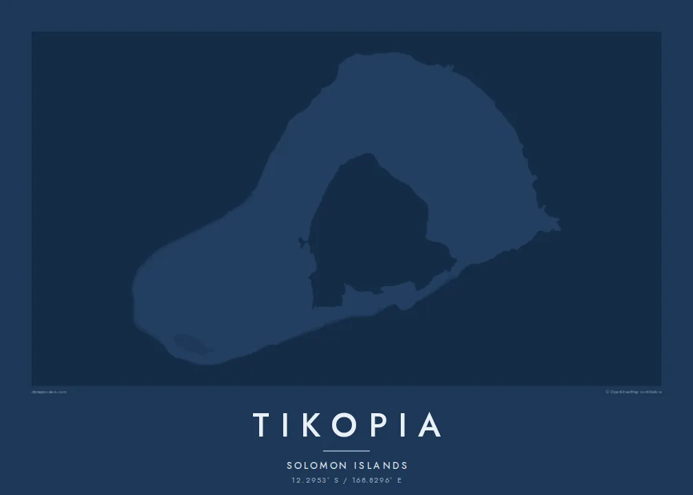
Te Roto fills the old volcanic crater, forming a pale inner shape that gives the island its unusual, almost ring-like appearance from above.
Póster de mapa minimalista · Islas Salomón
12.2953° S / 168.8296° E
A tiny volcanic island in the Solomon Islands, its old crater holding a lake beside steep hills and coastal villages.



Una ciudad, cinco ambientes
Toca un estilo para verlo en la pared. Todos los estilos cuestan lo mismo: impreso, enmarcado o en archivos HD.
 Píxeles reales · archivo de impresión de 24 × 36″
Nitidez de impresión
Este es un recorte al 100% del archivo de impresión real. Cada póster —impreso, enmarcado o descargado— se renderiza en nuestros servidores a 300 DPI, hasta 7,200 × 10,800 píxeles, para que hasta las calles más pequeñas se vean nítidas en una impresión de 24 × 36″.
En la pared


El mapa
Tikopia is a small, remote island in Temotu Province of the Solomon Islands, far to the southeast of the main chain. From above it is compact and roughly oval, the remnant of an extinct volcano whose crater now holds a lake, Te Roto. Steep hills rise around the crater, and the land falls toward the sea on the other sides.
The people of Tikopia are Polynesian, although the island lies within Melanesia, and their villages sit on the flatter land along the coast and near the lake. There are no roads for vehicles, so the map is shaped by paths, gardens and the edge of the reef that surrounds the island.
The island is widely known through the work of anthropologist Raymond Firth, whose studies of Tikopian society became classics of the field. In 2002 Cyclone Zoe struck the island, and the community's recovery drew wide attention. A Tikopia map poster shows a small, carefully used landscape in the open Pacific, with the lake at its heart.
Te Roto fills the old volcanic crater, forming a pale inner shape that gives the island its unusual, almost ring-like appearance from above.
The old crater rim rises into steep hills, the highest ground on the island, drawn as tight contours between the lake and the sea.
A narrow reef follows the coastline, framing the island with a second outline and separating the shallow shore from the open ocean beyond.
Hazlo tuyo
Añade una fecha, un nombre o una frase propia, y cambia el estilo, el tamaño o la orientación.
La vista previa gratuita es de baja resolución y con marca de agua. Las impresiones y los archivos HD se renderizan a 300 DPI, hasta 7,200 × 10,800 px, sin marca de agua.
Por qué Tikopia
Tikopia is a map for Solomon Islanders, for students and readers of Pacific anthropology and for anyone who values small, self-reliant communities. Its compact shape with a lake at its centre makes a gentle, balanced image on any wall.
Personalise the title, subtitle and coordinates line, and choose Classic black & white, Noir, Paper, Blueprint or Sand. Buy HD files for $9, each size a 300 DPI PNG and print-ready PDF, or order a printed poster from a partner near you.
Pedir el póster Tikopia| Tamaño de impresión | Resolución | Archivos |
|---|---|---|
| 30 × 40 cm (11.8 × 15.7″) | 3,543 × 4,724 px | PNG · PDF |
| 29.7 × 42 cm (A3, 11.7 × 16.5″) | 3,508 × 4,961 px | PNG · PDF |
| 42 × 59.4 cm (A2, 16.5 × 23.4″) | 4,961 × 7,016 px | PNG · PDF |
| 45.7 × 61 cm (18 × 24″) | 5,400 × 7,200 px | PNG · PDF |
| 50 × 70 cm (19.7 × 27.6″) | 5,906 × 8,268 px | PNG · PDF |
| 61 × 91.4 cm (24 × 36″) | 7,200 × 10,800 px | PNG · PDF |
Como referencia, la vista previa gratuita mide 900 px de ancho, lleva marca de agua y está pensada para pantallas. Los archivos HD tienen hasta 8 veces más resolución en cada dirección y se imprimen con total nitidez a tamaño póster.
Elige un estilo arriba de la página y luego selecciona Póster Impreso —un tamaño y, si quieres, un marco— o Archivos Digitales HD. El pago se hace en un solo paso, y tu página de pedido se actualiza en cuanto se confirma el pago.
Se imprime en papel mate premium de 200 g/m² en uno de seis tamaños, desde 30 × 40 cm hasta 24 × 36″. Los pósters impresos cuestan desde {printFrom}, envío incluido.
Sí. Elige un marco de madera maciza en negro, blanco, roble natural o madera oscura. Incluye vidrio irrompible y llega listo para colgar. Los pósters enmarcados cuestan desde {framedFrom}, envío incluido.
El envío es gratis en todo el mundo. Cada póster lo imprime el socio de impresión más cercano entre más de 30 países y suele llegar en 3 a 7 días hábiles. Puedes seguir el estado y el seguimiento en Mis Pedidos.
Envíanos una foto dentro de los 14 días posteriores a la entrega y te lo reimprimimos gratis o te devolvemos el dinero.
Sí. En el editor de esta página, cambia el título, el subtítulo y la línea de coordenadas por lo que quieras, y elige un estilo y un tamaño. Los pedidos impresos, enmarcados y digitales usan exactamente tu diseño.
Por $9 obtienes archivos PNG a 300 DPI y PDF listos para imprimir en los seis tamaños, sin marca de agua, para imprimir donde quieras. ¿Aún no estás seguro? Descarga primero una vista previa gratis con marca de agua.
