Hachiman-bori canal
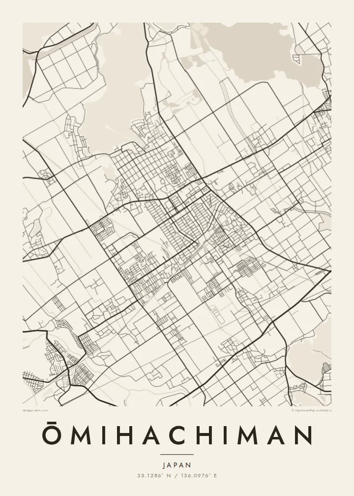
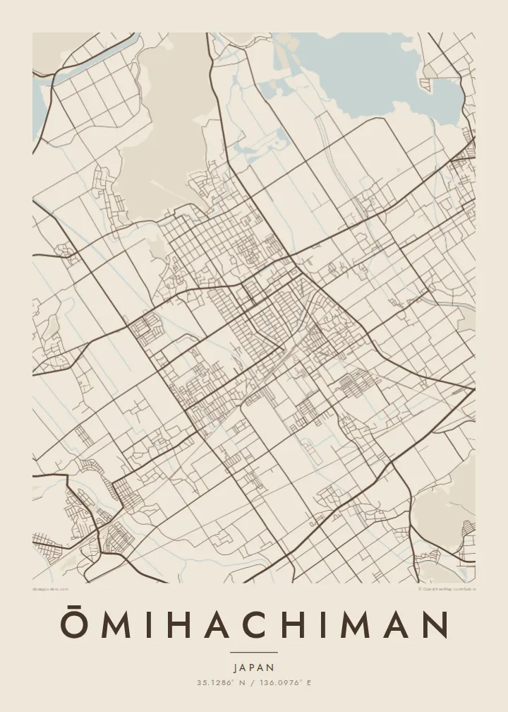
The old trade canal bends through the historic district below the mountain. On the poster it is a slim, deliberate line of water inside the orderly street grid.
Postè kat minimalis · Japan
35.1286° N / 136.0976° E
An old merchant town between Mount Hachiman and Lake Biwa, laced with a stone-lined canal and reed-filled lagoons.



Yon vil, senk atmosfè
Peze yon style pou wè li sou mi a. Chak style koute menm pri — enprime, ankadre oswa kòm fichye HD.
 Piksèl reyèl · fichye enpresyon 24 × 36″
Byen klè pou enprime
Sa a se yon zoom 100% sou vrè fichye enpresyon an. Chak afich — enprime, ankadre oswa telechaje — jenere sou sèvè nou yo nan 300 DPI, jiska 7,200 × 10,800 piksèl, konsa menm pi piti wout yo rete klè sou yon enpresyon 24 × 36″.
Sou mi a


Kat la
Ōmihachiman lies on the eastern shore of Lake Biwa, Japan's largest lake. The historic core sits at the foot of Mount Hachiman, a small forested peak that once held a castle built by Toyotomi Hidetsugu in the late sixteenth century. Below it, the old town's streets form a tidy grid that the castle-town planners laid out for trade.
Running through that grid is the Hachiman-bori, a canal that linked the town to the lake and carried goods for the Ōmi merchants. These traders were famous across Japan for their business ethics. To the north and west, the map dissolves into the Nishinoko lagoons and reed beds, then open water, with Okishima further out, one of the rare inhabited islands in a freshwater lake.
In the twentieth century the American architect William Merrell Vories settled here and designed many buildings still standing in the town. An Ōmihachiman map poster brings together a surprising amount on one sheet: a grid of merchant streets, a canal curve, a wooded hill and the soft edges of the lake.
The old trade canal bends through the historic district below the mountain. On the poster it is a slim, deliberate line of water inside the orderly street grid.
This small forested peak, once the site of Hidetsugu's castle, rises directly behind the old town. It shows as a dark, unbuilt mass at the top of the grid.
Lagoons and reed beds open into the lake, where Okishima island floats offshore. Together they turn the northern half of the map into shoreline and water.
Fè l pou ou
Ajoute yon dat, yon non oswa pwòp fraz pa w, chanje estil, gwosè oswa oryantasyon.
Apèsi gratis la se nan rezolisyon ba avèk yon watèrmak. Enpresyon ak fichye HD yo jenere nan 300 DPI, jiska 7,200 × 10,800 px, san watèrmak.
Poukisa Ōmihachiman
Ōmihachiman appeals to anyone who has walked its canal, studied the Ōmi merchants or admired Vories' buildings. Its mix of water and grid is also simply beautiful on paper. It makes a considered print for a reading room or a quiet corner.
Set the title in your own words, add a date or a line of text as the subtitle, and keep or edit the coordinates. Paper and Sand bring out the historic feel, while Noir makes the lake read as deep shadow. HD files are $9, and prints can be framed.
Kòmande afich Ōmihachiman a| Gwosè enpresyon | Rezolisyon | Fichye |
|---|---|---|
| 30 × 40 cm11.8 × 15.7″ | 3,543 × 4,724 px | PNG · PDF |
| 29.7 × 42 cm (A3)11.7 × 16.5″ | 3,508 × 4,961 px | PNG · PDF |
| 42 × 59.4 cm (A2)16.5 × 23.4″ | 4,961 × 7,016 px | PNG · PDF |
| 45.7 × 61 cm18 × 24″ | 5,400 × 7,200 px | PNG · PDF |
| 50 × 70 cm19.7 × 27.6″ | 5,906 × 8,268 px | PNG · PDF |
| 61 × 91.4 cm24 × 36″ | 7,200 × 10,800 px | PNG · PDF |
Pou konpare, apèsi gratis la gen 900 px lajè, li gen filigràn epi li fèt pou ekran. Fichye HD yo gen jiska 8 fwa plis rezolisyon nan chak direksyon epi yo enprime pwòp nan gwosè postè konplè.
Chwazi yon style anlè paj la, epi chwazi Afich Enprime — yon gwosè epi, si w vle, yon kad — oswa Fichye Dijital HD. Peman an fèt nan yon sèl etap, epi paj kòmand ou a mete ajou kou peman an konfime.
Li enprime sou papye mat premium 200 gsm nan youn nan sis gwosè, soti nan 30 × 40 cm rive nan 24 × 36″. Afich enprime yo kòmanse nan $39, livrezon enkli.
Wi. Chwazi yon kad an bwa solid nan koulè nwa, blan, chenn natirèl oswa bwa fonse. Li vin ak yon vit ki pa kase epi li pare pou pandye. Afich ankadre yo kòmanse nan $99, livrezon enkli.
Livrezon gratis nan plis pase 60 peyi. Chak afich enprime pa patnè enprimeri ki pi pre w la nan plis pase 30 peyi, e anjeneral li rive nan 3 a 7 jou ouvrab. Ou ka suiv estati a ak swivi kolis la nan Kòmand mwen yo. Kèk peyi pran 2 a 5 semèn, e kote nou poko livre, sit la di w sa anvan w peye.
Voye nou yon foto nan 14 jou apre livrezon an epi nou ap reenprime li gratis oswa remèt ou lajan w.
Wi. Nan editè a sou paj sa a, chanje tit la, soutit la ak liy kowòdone yo pou nenpòt sa w vle, epi chwazi yon style ak yon gwosè. Kòmand enprime, ankadre ak dijital yo tout itilize egzakteman desen w lan.
Pou $9 ou jwenn fichye PNG 300 DPI ak PDF pare-pou-enprime nan tout sis gwosè yo, san watèrmak, pou enprime kote w vle. Pa sèten toujou? Telechaje yon apèsi gratis ak watèrmak anvan.
