Indented coastline
The shore breaks into a series of bays and headlands. On the poster, it gives the map a long, intricate edge against the lagoon.
Poster peta minimalis · Kaledonia Baru
22.2626° S / 166.5662° E
A commune on New Caledonia's southern coast, where bays, headlands and lagoon waters wrap around the flanks of its namesake mountain.

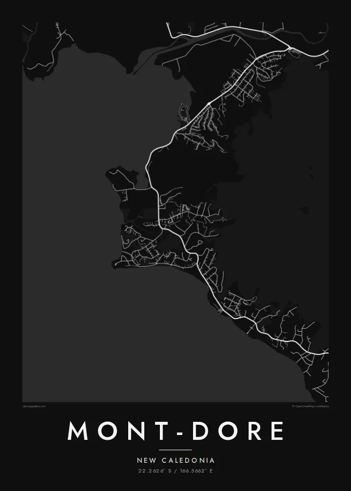
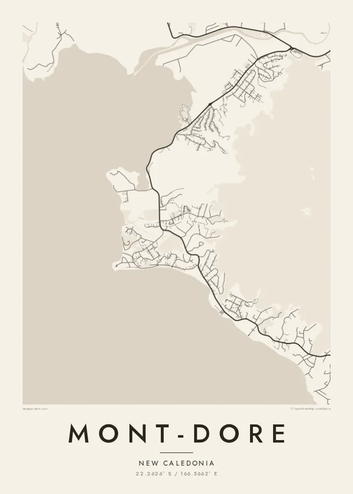


Satu kota, lima nuansa
Ketuk salah satu gaya untuk melihatnya di dinding. Semua gaya harganya sama — baik cetak, berbingkai, maupun file HD.
 Piksel asli · file cetak 24 × 36″
Tajam saat dicetak
Ini adalah crop 100% dari file cetak asli. Setiap poster — dicetak, berbingkai, atau diunduh — dirender di server kami dengan 300 DPI, hingga 7,200 × 10,800 piksel, sehingga jalan sekecil apa pun tetap tajam pada cetakan 24 × 36″.
Di dinding


Peta
Mont-Dore is a commune in New Caledonia's South Province, on Grande Terre next to Nouméa. It's named after the mountain that rises within its boundaries, a steep peak whose reddish, mineral-rich soils are typical of southern Grande Terre. The commune has a long coastline on the lagoon, and much of its population lives near the shore.
On the map, Mont-Dore is shaped by coast and slope. The shoreline breaks into bays and headlands, and residential areas follow the coast road around them. Inland, the ground rises quickly toward the mountain, where the street pattern stops and the terrain takes over. Small islands and reefs lie offshore in the lagoon.
A Mont-Dore map poster shows the interplay between the indented coastline, the ribbon of settlement and the mountain behind it. The bays make the composition dynamic and varied. It's a considered choice for residents, for people who have lived in New Caledonia and for anyone attached to the lagoon coast.
The shore breaks into a series of bays and headlands. On the poster, it gives the map a long, intricate edge against the lagoon.
Homes and streets follow the coast road around the bays, forming a ribbon of development between the water and the rising ground.
The steep slopes of Mont Dore rise behind the coast. Where the streets end, the mountain appears as a broad open area on the map.
Jadikan milik Anda
Tambahkan tanggal, nama, atau kalimat Anda sendiri, lalu ganti gaya, ukuran, atau orientasi.
Pratinjau gratis beresolusi rendah dan berwatermark. Cetakan dan file HD dirender dengan 300 DPI, hingga 7,200 × 10,800 px, tanpa watermark.
Mengapa Mont-Dore
Mont-Dore is home to many families and a place people remember long after leaving New Caledonia. A map of its bays and mountain is a calm, personal way to keep that connection.
The title, subtitle and coordinates line can be personalised, perhaps with the name of a bay or a date. Choose from Classic black & white, Noir, Paper, Blueprint or Sand. Blueprint suits the lagoon coast.
Pesan poster Mont-Dore| Ukuran cetak | Resolusi | File |
|---|---|---|
| 30 × 40 cm11.8 × 15.7″ | 3,543 × 4,724 px | PNG · PDF |
| 29.7 × 42 cm (A3)11.7 × 16.5″ | 3,508 × 4,961 px | PNG · PDF |
| 42 × 59.4 cm (A2)16.5 × 23.4″ | 4,961 × 7,016 px | PNG · PDF |
| 45.7 × 61 cm18 × 24″ | 5,400 × 7,200 px | PNG · PDF |
| 50 × 70 cm19.7 × 27.6″ | 5,906 × 8,268 px | PNG · PDF |
| 61 × 91.4 cm24 × 36″ | 7,200 × 10,800 px | PNG · PDF |
Sebagai perbandingan, pratinjau gratis lebarnya 900 px, bertanda watermark, dan ditujukan untuk layar. File HD memiliki resolusi hingga 8× lebih besar di setiap sisi dan tercetak jernih dalam ukuran poster penuh.
Pilih gaya di bagian atas halaman, lalu pilih Poster Cetak — beserta ukuran dan, jika suka, bingkai — atau File Digital HD. Checkout hanya satu langkah, dan halaman pesanan Anda langsung diperbarui begitu pembayaran berhasil.
Dicetak di atas kertas doff premium 200 gsm dalam salah satu dari enam ukuran, mulai dari 30 × 40 cm hingga 24 × 36″. Poster cetak mulai dari $39, sudah termasuk ongkos kirim.
Tentu. Pilih bingkai kayu solid berwarna hitam, putih, oak natural, atau kayu gelap. Dilengkapi kaca anti pecah dan siap digantung. Poster berbingkai mulai dari $99, sudah termasuk ongkos kirim.
Gratis ongkir ke 60+ negara. Setiap poster dicetak oleh mitra cetak terdekat kami di 30+ negara dan biasanya tiba dalam 3–7 hari kerja. Anda bisa memantau status dan pelacakan di Pesanan Saya. Beberapa negara membutuhkan waktu 2–5 minggu, dan jika kami belum mengirim ke negara Anda, situs akan memberi tahu sebelum Anda membayar.
Kirimkan foto kepada kami dalam 14 hari sejak pengiriman diterima, dan kami akan mencetak ulang secara gratis atau mengembalikan uang Anda.
Tentu. Di editor pada halaman ini, ubah judul, subjudul, dan baris koordinat sesuai keinginan Anda, lalu pilih gaya dan ukuran. Pesanan cetak, berbingkai, maupun digital semuanya menggunakan desain Anda persis.
Dengan $9 Anda mendapatkan file PNG 300 DPI dan PDF siap cetak dalam keenam ukuran, tanpa watermark, untuk dicetak di mana saja. Belum yakin? Unduh dulu pratinjau gratis berwatermark.
