Highway crossroads
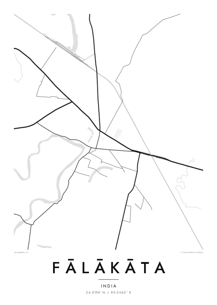
The main road through town carries long-distance traffic across north Bengal. On the map it is a bold horizontal stroke, and the market district gathers around it.
Minimalist map poster · India
26.5196° N / 89.2042° E
A market town on the flat Dooars plain, where a highway crossroads meets tea-garden blocks and braided rivers.


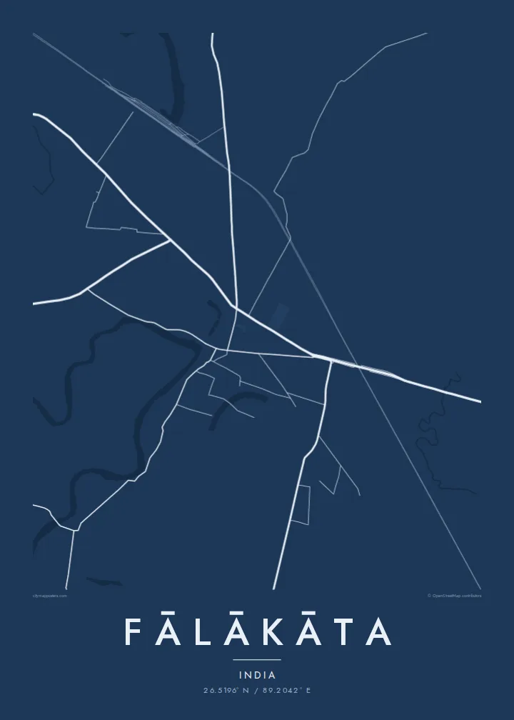

One city, five moods
Ekamowa emwit style ouga bwe ouga ekamowa e dedaña ñan bwega. Style otata a kor eangan — eprint, eframe ke HD files.
 Pixel ekwan · 24 × 36″ print file
Print-sharp
Enin 100% crop eo mai print file eo elango. Poster otata — eprint, eframe ke edownload — erender iaan server bwir e 300 DPI, dedaña ñan 7,200 × 10,800 pixels, bwe lane ekekedik ekwan ebwe crisp iaan print 24 × 36″.
Ituro


The map
Fālākāta is a town in the Alipurduar district of northern West Bengal, in the Dooars. This belt of low plain runs along the foot of the Himalayan foothills, below Bhutan. The land is almost perfectly flat, so on a map the town reads as roads and rivers rather than contours.
The centre grew around a crossroads on the national highway that links northeast India with the rest of the country. Market streets branch off it, and residential lanes thin out quickly into paddy fields and plantation land. Rivers coming down from the hills cross the region in wide channels that divide and rejoin across gravel beds.
A Fālākāta map poster shows that setting. There is a compact town grid, long straight transport lines running east and west, and wide open land around it. Tea estates and forest reserves lie close by, and Jaldapara National Park is within reach to the north. The lines on the map point toward the hills in every direction.
The main road through town carries long-distance traffic across north Bengal. On the map it is a bold horizontal stroke, and the market district gathers around it.
Rivers descending from the foothills spread into several channels across the plain. They give the map loose, branching shapes that differ from the straight roads.
Beyond the town, tea gardens and fields form broad blocks with few streets. This leaves generous white space around the dense centre.
Make it yours
Add a date, a name or a line of your own, switch style, size or orientation.
Preview ededa low-resolution im watermark. Print im HD files erender iaan 300 DPI, dedaña ñan 7,200 × 10,800 px, ededa watermark.
Why Fālākāta
Fālākāta is a meeting point for families across the Dooars, and many who move to Kolkata, Siliguri or abroad keep a close tie to it. A clean map of the town is an understated way to keep that connection on the wall.
The title, subtitle and coordinates line can be personalised. You might add a family name, a wedding date or a line in your own words. Five styles are available, from Classic black & white to Blueprint and Noir.
Oder poster Fālākāta| Print size | Resolution | Files |
|---|---|---|
| 30 × 40 cm11.8 × 15.7″ | 3,543 × 4,724 px | PNG · PDF |
| 29.7 × 42 cm (A3)11.7 × 16.5″ | 3,508 × 4,961 px | PNG · PDF |
| 42 × 59.4 cm (A2)16.5 × 23.4″ | 4,961 × 7,016 px | PNG · PDF |
| 45.7 × 61 cm18 × 24″ | 5,400 × 7,200 px | PNG · PDF |
| 50 × 70 cm19.7 × 27.6″ | 5,906 × 8,268 px | PNG · PDF |
| 61 × 91.4 cm24 × 36″ | 7,200 × 10,800 px | PNG · PDF |
For comparison, the free preview is 900 px wide, watermarked and meant for screens. The HD files have up to 8× the resolution in each direction and print cleanly at full poster size.
Emwit style iaan capña page, im dogen Printed Poster — size eo, im framme ouga tomwin — ke Digital HD Files. Checkout eaer sit step, im order page bwira eupdate iaan payment eo emej.
Eprint iaan matte paper 200 gsm, iaan size eo eo, mai 30 × 40 cm ñan 24 × 36″. Poster eprint eo emeja iaan $39, shipping ededo.
Eko. Emwit frame wood solid iaan black, white, oak natural ke wood dark. Etaña shatterproof glazing im ready ñan hang. Poster eframe emeja iaan $99, shipping ededo.
Shipping ma free ägen 60+ country. Poster ngaga eo e print ägen print partner nearest ibiema 30+ country, ae e tep ägen 3–7 business day. Ngaga kor status ae tracking ibe My Orders. Country ibiema e tep 2–5 week, ae country ngaga ibe shipping e bwaren, website e ibin oen bwa ngaga pay.
Kabun photo bwira iaan 14 aean mai delivery, im bwira ereprint ededo ke erefund.
Eko. Iaan editor page eanin, ouga change title, subtitle, im coordinates line ñan tomwin ouga koda, im emwit style im size. Order eprint, eframe im digital otata ekamowa design ouga tomwin.
Iaan $9 ouga ereub 300 DPI PNG im PDF print-ready iaan size otata eo, ededa watermark, ñan print ekamowa tomwin. Ouga aewedik? Download preview ededa watermarked kabun.
