Vila Bay waterfront
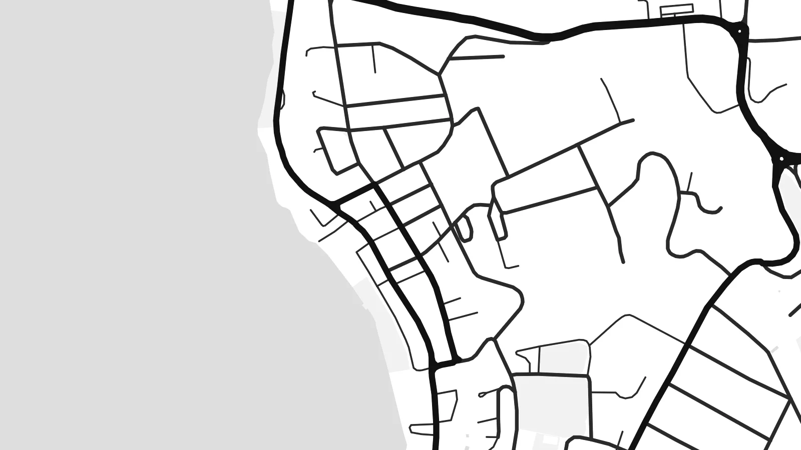
The curve of the harbour anchors the whole composition. The main streets trace the shoreline and quays, then the grid loosens and climbs the hillsides behind the town.
Minimalist map poster · Vanuatu
17.7365° S / 168.3137° E
A harbour town wrapped around Vila Bay, with Iririki Island just offshore and lagoons reaching inland from the south.


One city, five moods
Ekamowa emwit style ouga bwe ouga ekamowa e dedaña ñan bwega. Style otata a kor eangan — eprint, eframe ke HD files.
 Pixel ekwan · 24 × 36″ print file
Print-sharp
Enin 100% crop eo mai print file eo elango. Poster otata — eprint, eframe ke edownload — erender iaan server bwir e 300 DPI, dedaña ñan 7,200 × 10,800 pixels, bwe lane ekekedik ekwan ebwe crisp iaan print 24 × 36″.
Ituro


The map
Port-Vila sits on the southwest coast of Efate, the island that holds the capital of Vanuatu. From above, water shapes the town on almost every side. The deep curve of Vila Bay lies in front, small islands sit just offshore, and the long arms of Erakor Lagoon push in from the south. Streets follow the shoreline first, then climb in loops toward the ridges behind.
The central waterfront is compact. A short run of commercial streets follows the harbour, and residential roads spread across the slopes above it. Iririki Island is a short crossing from town and shows on paper as a small rounded shape in the bay. Further west, Mele Bay opens to the sea. The coastline breaks into headlands, inlets and reef edges that give the map real texture at its edges.
The town grew as the administrative centre of the New Hebrides, which Britain and France governed jointly until independence in 1980. Both languages still appear in its place names. A Port-Vila map poster keeps that story in line form: an irregular street network bounded by water, a sheltered harbour and a scatter of islands, printed in quiet black and white.
The curve of the harbour anchors the whole composition. The main streets trace the shoreline and quays, then the grid loosens and climbs the hillsides behind the town.
A small island set just off the centre. It sits close enough to read as part of the town but stays clearly separate, and it gives the bay a focal point on the printed sheet.
South of the centre, a winding lagoon cuts deep into the land. It leaves narrow peninsulas and soft, irregular shorelines that contrast with the straighter lines of the streets.
Make it yours
Add a date, a name or a line of your own, switch style, size or orientation.
Preview ededa low-resolution im watermark. Print im HD files erender iaan 300 DPI, dedaña ñan 7,200 × 10,800 px, ededa watermark.
Why Port-Vila
If you have lived, worked or sailed in Vanuatu, this map is a daily reminder of warm water and a small capital built around its harbour. The mix of open sea, lagoon and looping roads also works simply as a graphic piece, calm enough for a hallway or a study.
You can set your own title and subtitle, add a date such as an arrival or a wedding, and adjust the coordinates line. Choose from five styles: Classic black & white, Noir, Paper, Blueprint or Sand. Then download the $9 HD files or order a printed poster.
Oder poster Port-Vila| Print size | Resolution | Files |
|---|---|---|
| 30 × 40 cm11.8 × 15.7″ | 3,543 × 4,724 px | PNG · PDF |
| 29.7 × 42 cm (A3)11.7 × 16.5″ | 3,508 × 4,961 px | PNG · PDF |
| 42 × 59.4 cm (A2)16.5 × 23.4″ | 4,961 × 7,016 px | PNG · PDF |
| 45.7 × 61 cm18 × 24″ | 5,400 × 7,200 px | PNG · PDF |
| 50 × 70 cm19.7 × 27.6″ | 5,906 × 8,268 px | PNG · PDF |
| 61 × 91.4 cm24 × 36″ | 7,200 × 10,800 px | PNG · PDF |
For comparison, the free preview is 900 px wide, watermarked and meant for screens. The HD files have up to 8× the resolution in each direction and print cleanly at full poster size.
Emwit style iaan capña page, im dogen Printed Poster — size eo, im framme ouga tomwin — ke Digital HD Files. Checkout eaer sit step, im order page bwira eupdate iaan payment eo emej.
Eprint iaan matte paper 200 gsm, iaan size eo eo, mai 30 × 40 cm ñan 24 × 36″. Poster eprint eo emeja iaan $39, shipping ededo.
Eko. Emwit frame wood solid iaan black, white, oak natural ke wood dark. Etaña shatterproof glazing im ready ñan hang. Poster eframe emeja iaan $99, shipping ededo.
Shipping ma free ägen 60+ country. Poster ngaga eo e print ägen print partner nearest ibiema 30+ country, ae e tep ägen 3–7 business day. Ngaga kor status ae tracking ibe My Orders. Country ibiema e tep 2–5 week, ae country ngaga ibe shipping e bwaren, website e ibin oen bwa ngaga pay.
Kabun photo bwira iaan 14 aean mai delivery, im bwira ereprint ededo ke erefund.
Eko. Iaan editor page eanin, ouga change title, subtitle, im coordinates line ñan tomwin ouga koda, im emwit style im size. Order eprint, eframe im digital otata ekamowa design ouga tomwin.
Iaan $9 ouga ereub 300 DPI PNG im PDF print-ready iaan size otata eo, ededa watermark, ñan print ekamowa tomwin. Ouga aewedik? Download preview ededa watermarked kabun.
