Charlotte Amalie
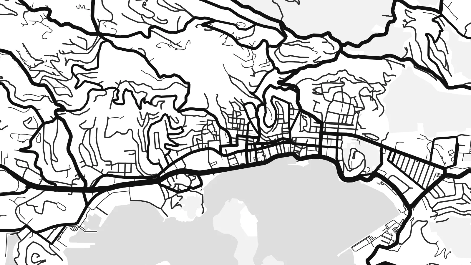
The capital wraps around a broad harbour, and its historic centre climbs in steep, stepped lanes above the waterfront. It is the densest part of the map.
Minimalist map poster · United States
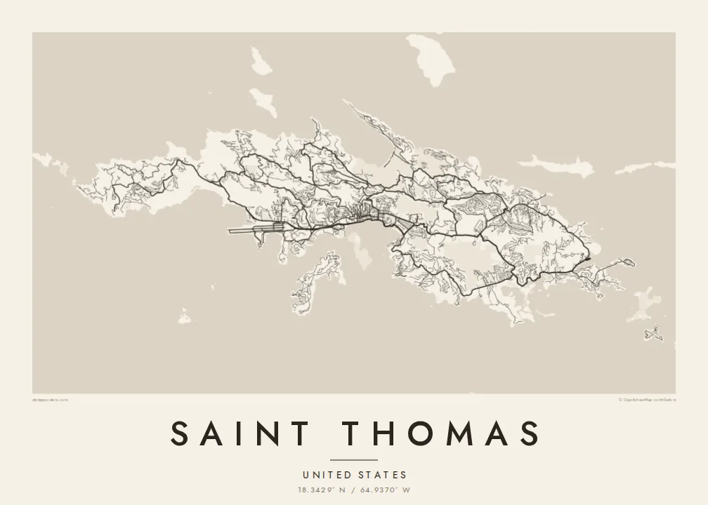
18.3429° N / 64.9370° W
A steep, ridged Caribbean island with a harbour capital on its south coast and a deep, rounded bay on the north.




One city, five moods
Ekamowa emwit style ouga bwe ouga ekamowa e dedaña ñan bwega. Style otata a kor eangan — eprint, eframe ke HD files.
 Pixel ekwan · 24 × 36″ print file
Print-sharp
Enin 100% crop eo mai print file eo elango. Poster otata — eprint, eframe ke edownload — erender iaan server bwir e 300 DPI, dedaña ñan 7,200 × 10,800 pixels, bwe lane ekekedik ekwan ebwe crisp iaan print 24 × 36″.
Ituro


The map
Saint Thomas is one of the three main United States Virgin Islands, a narrow island with a high ridge along its length. From above, the coast is intricate, with headlands, coves and small offshore islands on every side. The land rises steeply almost everywhere, so roads follow the contours in long switchbacks. Most building is spread along the southern shore.
Charlotte Amalie, the territorial capital, lines a wide harbour on the south coast. Cruise piers and a waterfront road front a historic core of narrow lanes and stepped streets that climb the hill. On the north side, Magens Bay forms a deep, rounded bite into the coast, sheltered by long headlands. A Saint Thomas map poster brings out both shapes clearly.
The island was a Danish colony for more than two centuries, until the United States bought the Danish West Indies in 1917. Danish street names and buildings still mark Charlotte Amalie. Cars still drive on the left, a long-standing local convention, even though most vehicles on the island are built for driving on the right.
The capital wraps around a broad harbour, and its historic centre climbs in steep, stepped lanes above the waterfront. It is the densest part of the map.
A deep, sheltered bay on the north shore, almost enclosed by two long headlands. Its rounded shape is one of the most recognisable features on the island.
A mountainous spine runs east to west through the island. The roads that climb it twist into tight curves before dropping down to either coast.
Make it yours
Add a date, a name or a line of your own, switch style, size or orientation.
Preview ededa low-resolution im watermark. Print im HD files erender iaan 300 DPI, dedaña ñan 7,200 × 10,800 px, ededa watermark.
Why Saint Thomas
Saint Thomas is a landmark for cruise passengers, sailors and people who have made a life in the Virgin Islands. The map is a lasting keepsake of a harbour arrival, a wedding on the beach or years spent living on the hillside.
You can personalise the title and subtitle, add the coordinates of a favourite bay, and pick one of five styles. Download the HD files for $9 in any of six sizes, or order a matte print with an optional wooden frame.
Oder poster Saint Thomas| Print size | Resolution | Files |
|---|---|---|
| 30 × 40 cm11.8 × 15.7″ | 3,543 × 4,724 px | PNG · PDF |
| 29.7 × 42 cm (A3)11.7 × 16.5″ | 3,508 × 4,961 px | PNG · PDF |
| 42 × 59.4 cm (A2)16.5 × 23.4″ | 4,961 × 7,016 px | PNG · PDF |
| 45.7 × 61 cm18 × 24″ | 5,400 × 7,200 px | PNG · PDF |
| 50 × 70 cm19.7 × 27.6″ | 5,906 × 8,268 px | PNG · PDF |
| 61 × 91.4 cm24 × 36″ | 7,200 × 10,800 px | PNG · PDF |
For comparison, the free preview is 900 px wide, watermarked and meant for screens. The HD files have up to 8× the resolution in each direction and print cleanly at full poster size.
Emwit style iaan capña page, im dogen Printed Poster — size eo, im framme ouga tomwin — ke Digital HD Files. Checkout eaer sit step, im order page bwira eupdate iaan payment eo emej.
Eprint iaan matte paper 200 gsm, iaan size eo eo, mai 30 × 40 cm ñan 24 × 36″. Poster eprint eo emeja iaan $39, shipping ededo.
Eko. Emwit frame wood solid iaan black, white, oak natural ke wood dark. Etaña shatterproof glazing im ready ñan hang. Poster eframe emeja iaan $99, shipping ededo.
Shipping ma free ägen 60+ country. Poster ngaga eo e print ägen print partner nearest ibiema 30+ country, ae e tep ägen 3–7 business day. Ngaga kor status ae tracking ibe My Orders. Country ibiema e tep 2–5 week, ae country ngaga ibe shipping e bwaren, website e ibin oen bwa ngaga pay.
Kabun photo bwira iaan 14 aean mai delivery, im bwira ereprint ededo ke erefund.
Eko. Iaan editor page eanin, ouga change title, subtitle, im coordinates line ñan tomwin ouga koda, im emwit style im size. Order eprint, eframe im digital otata ekamowa design ouga tomwin.
Iaan $9 ouga ereub 300 DPI PNG im PDF print-ready iaan size otata eo, ededa watermark, ñan print ekamowa tomwin. Ouga aewedik? Download preview ededa watermarked kabun.
