Sanmachi Suji
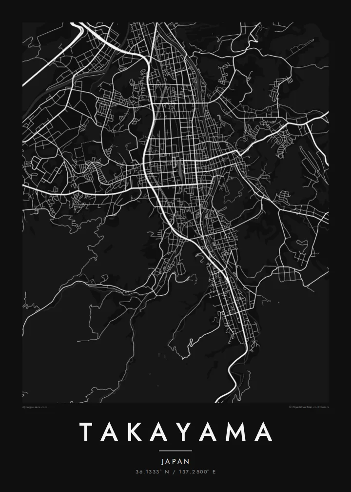
Parallel lanes of preserved merchant houses form the heart of the old town, a fine, regular grid that stands out clearly against the newer streets around it.
Minimalist map poster · Japan
36.1333° N / 137.2500° E
A mountain town in the Hida highlands, its preserved merchant lanes laid in a tight grid beside the Miyagawa River.



One city, five moods
Ekamowa emwit style ouga bwe ouga ekamowa e dedaña ñan bwega. Style otata a kor eangan — eprint, eframe ke HD files.
 Pixel ekwan · 24 × 36″ print file
Print-sharp
Enin 100% crop eo mai print file eo elango. Poster otata — eprint, eframe ke edownload — erender iaan server bwir e 300 DPI, dedaña ñan 7,200 × 10,800 pixels, bwe lane ekekedik ekwan ebwe crisp iaan print 24 × 36″.
Ituro


The map
Takayama lies in a basin of the Hida highlands in Gifu Prefecture, surrounded by the peaks of the Japanese Alps. The Miyagawa River runs north through the town, and the old centre sits on its east bank. From above, the historic streets form a compact grid of narrow lanes, bordered by forested hills rising toward the old castle site.
The Sanmachi Suji district preserves rows of Edo-period merchant houses, sake breweries and shops along a few parallel streets. Nearby, the Takayama Jinya, a former government office of the shogunate, occupies a large walled compound. Morning markets are held along the Miyagawa and in front of the Jinya. A Takayama map poster places all of these within a few blocks of each other.
The town is famous for the Takayama Festival, held in spring and autumn, when elaborately decorated floats are drawn through the streets. Since municipal mergers in 2005, Takayama has been Japan's largest municipality by area, stretching deep into the mountains. The town itself remains small, walkable and closely bound to its river and hills.
Parallel lanes of preserved merchant houses form the heart of the old town, a fine, regular grid that stands out clearly against the newer streets around it.
The river runs north through the centre, crossed by a series of short bridges. Its banks host one of the town's morning markets, and it divides old and new Takayama.
East of the old town, the wooded hill where Takayama Castle once stood is now Shiroyama Park, a soft green mass that frames the tight streets below.
Make it yours
Add a date, a name or a line of your own, switch style, size or orientation.
Preview ededa low-resolution im watermark. Print im HD files erender iaan 300 DPI, dedaña ñan 7,200 × 10,800 px, ededa watermark.
Why Takayama
Takayama is a place people remember precisely: the lanes of Sanmachi, the red bridges, the festival floats. A map of the old town makes a calm, detailed print for anyone who has walked there, and it sits well alongside prints of Kyoto or Kanazawa.
Personalise the title and subtitle, perhaps in Japanese or with the date of your visit, and adjust the coordinates line. Choose from Classic black and white, Noir, Paper, Blueprint and Sand. Paper suits the historic streets especially well.
Oder poster Takayama| Print size | Resolution | Files |
|---|---|---|
| 30 × 40 cm11.8 × 15.7″ | 3,543 × 4,724 px | PNG · PDF |
| 29.7 × 42 cm (A3)11.7 × 16.5″ | 3,508 × 4,961 px | PNG · PDF |
| 42 × 59.4 cm (A2)16.5 × 23.4″ | 4,961 × 7,016 px | PNG · PDF |
| 45.7 × 61 cm18 × 24″ | 5,400 × 7,200 px | PNG · PDF |
| 50 × 70 cm19.7 × 27.6″ | 5,906 × 8,268 px | PNG · PDF |
| 61 × 91.4 cm24 × 36″ | 7,200 × 10,800 px | PNG · PDF |
For comparison, the free preview is 900 px wide, watermarked and meant for screens. The HD files have up to 8× the resolution in each direction and print cleanly at full poster size.
Emwit style iaan capña page, im dogen Printed Poster — size eo, im framme ouga tomwin — ke Digital HD Files. Checkout eaer sit step, im order page bwira eupdate iaan payment eo emej.
Eprint iaan matte paper 200 gsm, iaan size eo eo, mai 30 × 40 cm ñan 24 × 36″. Poster eprint eo emeja iaan $39, shipping ededo.
Eko. Emwit frame wood solid iaan black, white, oak natural ke wood dark. Etaña shatterproof glazing im ready ñan hang. Poster eframe emeja iaan $99, shipping ededo.
Shipping ma free ägen 60+ country. Poster ngaga eo e print ägen print partner nearest ibiema 30+ country, ae e tep ägen 3–7 business day. Ngaga kor status ae tracking ibe My Orders. Country ibiema e tep 2–5 week, ae country ngaga ibe shipping e bwaren, website e ibin oen bwa ngaga pay.
Kabun photo bwira iaan 14 aean mai delivery, im bwira ereprint ededo ke erefund.
Eko. Iaan editor page eanin, ouga change title, subtitle, im coordinates line ñan tomwin ouga koda, im emwit style im size. Order eprint, eframe im digital otata ekamowa design ouga tomwin.
Iaan $9 ouga ereub 300 DPI PNG im PDF print-ready iaan size otata eo, ededa watermark, ñan print ekamowa tomwin. Ouga aewedik? Download preview ededa watermarked kabun.
