Regular grid
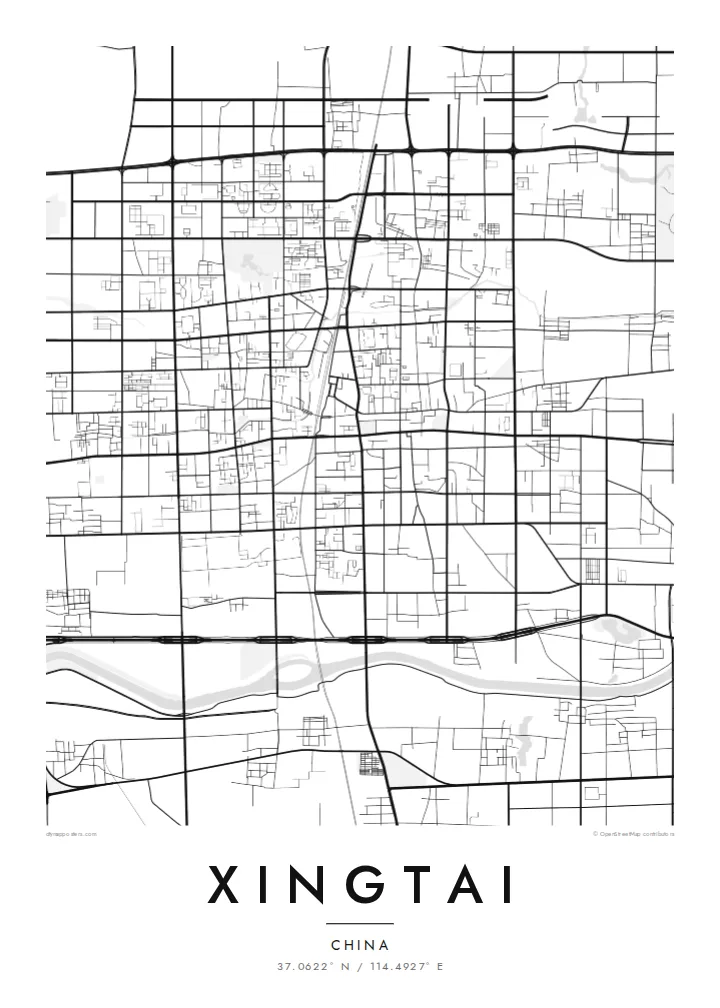
Wide avenues cross at right angles on the flat ground, dividing the city into large blocks that give the poster a steady, orderly rhythm.
Minimalist map poster · China
37.0622° N / 114.4927° E
A long-settled city on the flat North China Plain, laid out in broad blocks with the Taihang Mountains to the west


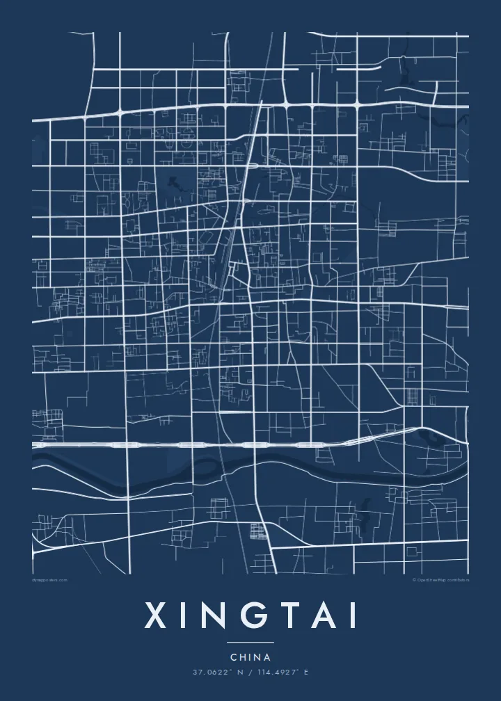

One city, five moods
Ekamowa emwit style ouga bwe ouga ekamowa e dedaña ñan bwega. Style otata a kor eangan — eprint, eframe ke HD files.
 Pixel ekwan · 24 × 36″ print file
Print-sharp
Enin 100% crop eo mai print file eo elango. Poster otata — eprint, eframe ke edownload — erender iaan server bwir e 300 DPI, dedaña ñan 7,200 × 10,800 pixels, bwe lane ekekedik ekwan ebwe crisp iaan print 24 × 36″.
Ituro


The map
Xingtai lies in southern Hebei, on the North China Plain, with the Taihang Mountains rising some distance to the west. It is one of the older cities in northern China, with a history reaching back to early dynasties. The land around it is flat and intensively farmed, so the city spreads evenly in a wide grid of avenues and large blocks.
The older centre keeps a denser pattern of streets. Newer districts extend outward with broad, straight roads and planned residential compounds. Rivers and canals cross the area, and parks with lakes break the grid in places. Railways and expressways crossing the plain add long diagonal and straight lines to the map.
In 1966 a major earthquake struck the Xingtai region, an event that became important in the development of earthquake research in China. A Xingtai map poster shows a typical plains city. Its street pattern is generous and regular, and a few water features soften its otherwise geometric outline.
Wide avenues cross at right angles on the flat ground, dividing the city into large blocks that give the poster a steady, orderly rhythm.
Green spaces and water break up the grid in several places, forming open shapes that give relief from the dense urban blocks.
Rail lines and expressways cut across the plain around the city, drawn as long, confident lines that tie Xingtai to the wider region.
Make it yours
Add a date, a name or a line of your own, switch style, size or orientation.
Preview ededa low-resolution im watermark. Print im HD files erender iaan 300 DPI, dedaña ñan 7,200 × 10,800 px, ededa watermark.
Why Xingtai
Xingtai's map has a calm, measured quality that suits minimalist interiors. It is a fitting keepsake for people born in southern Hebei who now live elsewhere, or for anyone marking years spent in the city.
You can personalise the title, subtitle and coordinates, and choose Classic black & white, Noir, Paper, Blueprint or Sand. Printed posters come on matte paper, framed or unframed, and digital files in six sizes cost $9.
Oder poster Xingtai| Print size | Resolution | Files |
|---|---|---|
| 30 × 40 cm11.8 × 15.7″ | 3,543 × 4,724 px | PNG · PDF |
| 29.7 × 42 cm (A3)11.7 × 16.5″ | 3,508 × 4,961 px | PNG · PDF |
| 42 × 59.4 cm (A2)16.5 × 23.4″ | 4,961 × 7,016 px | PNG · PDF |
| 45.7 × 61 cm18 × 24″ | 5,400 × 7,200 px | PNG · PDF |
| 50 × 70 cm19.7 × 27.6″ | 5,906 × 8,268 px | PNG · PDF |
| 61 × 91.4 cm24 × 36″ | 7,200 × 10,800 px | PNG · PDF |
For comparison, the free preview is 900 px wide, watermarked and meant for screens. The HD files have up to 8× the resolution in each direction and print cleanly at full poster size.
Emwit style iaan capña page, im dogen Printed Poster — size eo, im framme ouga tomwin — ke Digital HD Files. Checkout eaer sit step, im order page bwira eupdate iaan payment eo emej.
Eprint iaan matte paper 200 gsm, iaan size eo eo, mai 30 × 40 cm ñan 24 × 36″. Poster eprint eo emeja iaan $39, shipping ededo.
Eko. Emwit frame wood solid iaan black, white, oak natural ke wood dark. Etaña shatterproof glazing im ready ñan hang. Poster eframe emeja iaan $99, shipping ededo.
Shipping ma free ägen 60+ country. Poster ngaga eo e print ägen print partner nearest ibiema 30+ country, ae e tep ägen 3–7 business day. Ngaga kor status ae tracking ibe My Orders. Country ibiema e tep 2–5 week, ae country ngaga ibe shipping e bwaren, website e ibin oen bwa ngaga pay.
Kabun photo bwira iaan 14 aean mai delivery, im bwira ereprint ededo ke erefund.
Eko. Iaan editor page eanin, ouga change title, subtitle, im coordinates line ñan tomwin ouga koda, im emwit style im size. Order eprint, eframe im digital otata ekamowa design ouga tomwin.
Iaan $9 ouga ereub 300 DPI PNG im PDF print-ready iaan size otata eo, ededa watermark, ñan print ekamowa tomwin. Ouga aewedik? Download preview ededa watermarked kabun.
